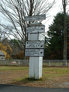
Warwick, Massachusetts facts for kids
Quick facts for kids
Warwick, Massachusetts
|
||
|---|---|---|
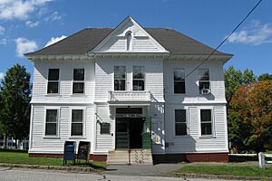
Warwick Town Hall
|
||
|
||
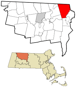
Location in Franklin County in Massachusetts
|
||
| Country | United States | |
| State | Massachusetts | |
| County | Franklin | |
| Settled | 1739 | |
| Incorporated | 1763 | |
| Government | ||
| • Type | Open town meeting | |
| Area | ||
| • Total | 37.6 sq mi (97.5 km2) | |
| • Land | 37.3 sq mi (96.7 km2) | |
| • Water | 0.3 sq mi (0.8 km2) | |
| Elevation | 922 ft (281 m) | |
| Population
(2020)
|
||
| • Total | 780 | |
| • Density | 20.72/sq mi (8.00/km2) | |
| ZIP code |
01378
|
|
| Area code(s) | 351 / 978 | |
| FIPS code | 25-73265 | |
| GNIS feature ID | 0618177 | |
Warwick is a small town in Franklin County, Massachusetts, in the United States. In 2020, about 780 people lived here. It is part of the larger Springfield area. Warwick is known for its beautiful natural areas and quiet community life.
Contents
Discover Warwick's Past: A Look at Its History
Warwick was first settled by people in 1739. It officially became a town in 1763.
Early Beginnings and Town Formation
The land for Warwick was given out in 1735. This was to thank the families of soldiers who fought in a battle in Canada in 1690. The area was first called Gardner's Canada. It took about 25 years to get enough people to live there.
By 1760, more settlers arrived. The town then hired a young minister named Lemuel Hedge. Warwick officially became a town on February 17, 1763. Its first leaders included James Ball, Moses Evans, and Jeduthan Morse.
Warwick During the Revolutionary War
As the American Revolutionary War got closer, the people of Warwick voted for independence. This was even though their minister, Rev. Lemuel Hedge, spoke against it. He was not allowed to leave town in July 1775. He passed away on October 15, 1777. This was the same day a British general surrendered to the American colonists. In 1776, Lieutenant Thomas Rich represented Warwick in the Massachusetts government.
Moving West and New Communities
Around the early 1800s, many families from Franklin County started moving. They went to places like Windham County, Vermont. They were looking for cheaper land and new places to settle. The Nathan Hastings family from Warwick moved to Windham, Vermont, in 1806. Other families from nearby towns also joined them.
The Brotherhood of the Spirit Commune
In the 1960s and 1970s, a group called the Brotherhood of the Spirit Commune came to Warwick. The town's population was only about 450 people then. Hundreds of young people joined the commune. At first, there were some disagreements. But over time, the townspeople and commune members learned to work together. The commune left Warwick in the 1980s.
Geography and Outdoor Fun in Warwick
Warwick covers about 97.5 square kilometers (37.6 square miles). Most of this is land, with a small part being water.
Mount Grace: A Natural Landmark
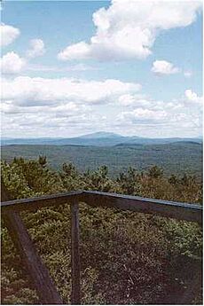
The town's landscape is mostly shaped by Mount Grace. This mountain is right in the middle of Warwick. It has many trails for hiking and cross-country skiing. Most of the mountain is part of Mount Grace State Forest. This means it is open for everyone to enjoy. The Metacomet-Monadnock Trail goes over the mountain's top, which is 1,617 feet (493 meters) high.
Protected Lands and Waterways
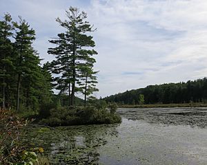
About one-third of Warwick's land is protected. This includes parts of the Warwick State Forest. These areas offer many outdoor activities. There are several ponds in Warwick. Some were made by dams on brooks. These include Moores Pond, Sheomet Lake, and Laurel Lake. You can also find Wheeler Reservoir, Richards Reservoir, and Hastings Pond. Stevens Swamp is a large area of wetlands.
The Mount Grace Land Conservation Trust helps protect land in Warwick and nearby towns. It was started by a Warwick resident in 1986.
Getting Around Warwick: Transportation
Warwick is in the northeastern part of Franklin County. It is close to the borders of Worcester County and Cheshire County, New Hampshire.
Roads and Travel Distances
The town center is about 10 miles northwest of Athol. It is 20 miles northeast of Greenfield, the county seat. Warwick is a bit isolated. It is 13 miles east of the closest exit on Interstate 91. It is also 8 miles north of Massachusetts Route 2, a main road in northern Massachusetts.
The only state highway that goes through Warwick is Route 78. This road connects to Route 2A in Orange and goes into New Hampshire.
Public Transport and Airports
There are no train or bus services directly in Warwick. The closest train service is in Brattleboro, Vermont. This is where the Amtrak Vermonter train stops.
The nearest small airport is the Orange Municipal Airport. For bigger flights, you can go to Logan Airport in Boston. Or you can use Manchester-Boston Regional Airport in New Hampshire. Bradley International Airport in Connecticut is also an option. All these airports are about 90 minutes away from Warwick.
Warwick's Economy and Local Businesses
Warwick has many small businesses run from people's homes.
Local Products and Services
There are farms that produce organic dairy products from grass-fed animals. Other farms grow herbal products, flowers, and vegetables. The town also has logging businesses and a few wood shops.
Farmer's Market
You can find a farmer's market on the town common. It is open on Saturday mornings. This is a great place to buy fresh, local products.
| Historical population | ||
|---|---|---|
| Year | Pop. | ±% |
| 1790 | 1,246 | — |
| 1800 | 1,233 | −1.0% |
| 1810 | 1,277 | +3.6% |
| 1820 | 1,256 | −1.6% |
| 1830 | 1,150 | −8.4% |
| 1840 | 1,071 | −6.9% |
| 1850 | 1,021 | −4.7% |
| 1860 | 932 | −8.7% |
| 1870 | 769 | −17.5% |
| 1880 | 713 | −7.3% |
| 1890 | 565 | −20.8% |
| 1900 | 619 | +9.6% |
| 1910 | 477 | −22.9% |
| 1920 | 327 | −31.4% |
| 1930 | 367 | +12.2% |
| 1940 | 444 | +21.0% |
| 1950 | 429 | −3.4% |
| 1960 | 426 | −0.7% |
| 1970 | 492 | +15.5% |
| 1980 | 603 | +22.6% |
| 1990 | 740 | +22.7% |
| 2000 | 750 | +1.4% |
| 2010 | 780 | +4.0% |
| 2020 | 780 | +0.0% |
| 2022 | 780 | +0.0% |
Source: United States Census records and Population Estimates Program data. |
||
See also
 In Spanish: Warwick (Massachusetts) para niños
 | Valerie Thomas |
 | Frederick McKinley Jones |
 | George Edward Alcorn Jr. |
 | Thomas Mensah |


