1790 United States Census facts for kids
Quick facts for kids 1790 United States Census |
|
|---|---|

Seal of the United States Census Bureau
|
|

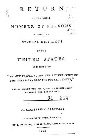
Title page of 1790 United States Census
|
|
| General information | |
| Country | United States |
| Date taken | August 2, 1790 |
| Total population | 3,893,635 |
| Most populous state | Virginia 747,610 |
| Least populous state | Delaware 59,094 |
The United States Census of 1790 was the very first time the United States counted all its people. This important count happened on August 2, 1790. It showed that 3,929,214 people lived in the U.S. at that time.
Information was gathered from all 13 original states. These included Connecticut, Delaware, Georgia, Maryland, Massachusetts, New Hampshire, New Jersey, New York, North Carolina, Pennsylvania, Rhode Island, South Carolina, and Virginia. Data was also collected from areas that later became Vermont, Kentucky, Tennessee, and Maine.
Contents
Why the First Census Was Important
The U.S. Constitution said that a census must happen every ten years. This was to make sure that each state had the right number of representatives in Congress. It also helped the government decide how to collect taxes fairly.
Leaders' Thoughts on the Census
Both Thomas Jefferson, who was the Secretary of State, and President George Washington had doubts about the census results. They thought the actual number of people in the United States was higher than what the census reported.
There were several reasons why the count might have been low. People lived far apart, and roads were often bad. Technology was very limited, making it hard to reach everyone. Also, some people might not have wanted to share their information.
Lost Census Records
Sadly, many of the original census records from 1790 have been lost. About one-third of the information was destroyed between 1790 and 1830.
This includes data from states like Connecticut, Maine, Maryland, Massachusetts, New Hampshire, New York, North Carolina, Pennsylvania, Rhode Island, South Carolina, and Vermont. Even though some original records are gone, historians can still find information about the first census in other old documents.
What Information Was Collected
The census collected specific details about each household. It mainly focused on the name of the head of the family.
People were placed into different groups:
- Free white males aged 16 and older (to understand the country's workforce and military strength).
- Free white males under 16 years old.
- Free white females.
- All other free persons (their gender and skin color were noted).
- Enslaved people.
Secretary of State Thomas Jefferson told officials to collect data from all thirteen states. They also gathered information from the Southwest Territory.
Enslaved People in the Census
The 1790 census showed that 17.8% of the total population were enslaved people. This was the highest percentage of enslaved people recorded in any U.S. census.
| State | Free white males of 16 years and upward, including heads of families | Free white males under 16 years | Free white females, including heads of families | All other free persons | Slaves | Enslaved % of state population | Total | % of US population |
|---|---|---|---|---|---|---|---|---|
| Vermont | 22,435 | 22,328 | 40,505 | 255 | 16 | 0.02% | 85,539 | 2.2% |
| New Hampshire | 36,086 | 34,851 | 70,160 | 630 | 158 | 0.1% | 141,885 | 3.6% |
| Maine | 24,384 | 24,748 | 46,870 | 538 | 0 | 0.0% | 96,540 | 2.5% |
| Massachusetts | 95,453 | 87,289 | 190,582 | 5,463 | 0 | 0.0% | 378,787 | 9.7% |
| Rhode Island | 16,019 | 15,799 | 32,652 | 3,407 | 948 | 1.4% | 68,825 | 1.5% |
| Connecticut | 60,523 | 54,403 | 117,448 | 2,808 | 2,764 | 1.2% | 237,946 | 6.1% |
| New York | 83,700 | 78,122 | 152,320 | 4,654 | 21,324 | 6.3% | 340,120 | 8.7% |
| New Jersey | 45,251 | 41,416 | 83,287 | 2,762 | 11,423 | 6.2% | 184,139 | 4.7% |
| Pennsylvania | 110,788 | 106,948 | 206,363 | 6,537 | 3,737 | 0.9% | 434,373 | 11.2% |
| Delaware | 11,783 | 12,143 | 22,384 | 3,899 | 8,887 | 15.0% | 59,094 | 1.5% |
| Maryland | 55,915 | 51,339 | 101,395 | 8,043 | 103,036 | 32.2% | 319,728 | 8.2% |
| Virginia | 110,936 | 116,135 | 215,046 | 12,866 | 292,627 | 39.1% | 747,610 | 19.2% |
| Kentucky | 15,154 | 17,057 | 28,922 | 114 | 12,430 | 16.9% | 73,677 | 1.9% |
| North Carolina | 69,988 | 77,506 | 140,710 | 4,975 | 100,572 | 25.5% | 393,751 | 10.1% |
| South Carolina | 35,576 | 37,722 | 66,880 | 1,801 | 107,094 | 43.0% | 249,073 | 6.4% |
| Georgia | 13,103 | 14,044 | 25,739 | 398 | 29,264 | 35.5% | 82,548 | 2.1% |
| Total | 807,094 | 791,850 | 1,541,263 | 59,150 | 694,280 | 17.8% | 3,893,635 | 99.9% |
Top Cities by Population
The census also ranked the largest cities in the United States at that time.
See also
 In Spanish: Censo de los Estados Unidos de 1790 para niños
 | Shirley Ann Jackson |
 | Garett Morgan |
 | J. Ernest Wilkins Jr. |
 | Elijah McCoy |


