Brattleboro, Vermont facts for kids
Quick facts for kids
Brattleboro, Vermont
|
|
|---|---|
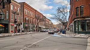
Main Street
|
|
| Motto(s):
The One and Only Brattleboro
|
|
| Country | United States |
| State | Vermont |
| County | Windham |
| Chartered | 1753 |
| Communities | |
| Government | |
| • Type | Representative town meeting |
| Area | |
| • Total | 32.4 sq mi (84.0 km2) |
| • Land | 32.0 sq mi (82.9 km2) |
| • Water | 0.5 sq mi (1.2 km2) |
| Elevation | c. 200-1,768 ft (c. 61-539 m) |
| Population
(2020)
|
|
| • Total | 12,184 |
| • Density | 376.0/sq mi (145.05/km2) |
| Time zone | UTC−5 (Eastern (EST)) |
| • Summer (DST) | UTC−4 (EDT) |
| ZIP Codes |
05301–05304
|
| Area code(s) | 802 |
| FIPS code | 50-07900 |
| GNIS feature ID | 1462049 |
| Website | www.brattleboro.org |
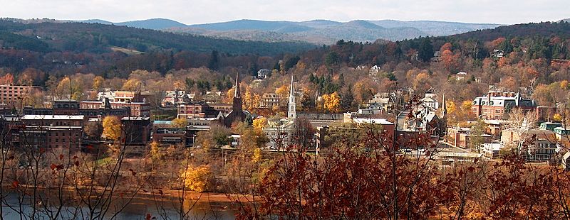
Brattleboro (/ˈbrætəlbʌroʊ/), which used to be called Brattleborough, is a town in Windham County, Vermont, United States. It's located about 10 miles (16 km) north of the Massachusetts state line. The town sits where Vermont's West River meets the Connecticut River.
In 2022, Brattleboro had about 12,106 people living there. This makes it the busiest town along Vermont's eastern border, which is the Connecticut River. Brattleboro has been very important in Vermont's history. It was a key spot for trade because of the Connecticut River and later, roads and trains. The Whetstone Brook also helped many factories grow, as they used water power.
In the 1800s, Brattleboro became famous for its industries. These included companies that bound books, like Brattleboro Typographic Company, which made Bibles. Also, Estey Organ was one of the biggest makers of pipe organs in the world. These industries became smaller in the early 1900s. After that, Brattleboro became more of a center for nearby rural towns and for Vermont's tourism.
Today, Brattleboro has parts of two colleges: Community College of Vermont and Vermont Technical College. You can also find the New England Center for Circus Arts, the Vermont Jazz Center, and the Brattleboro Retreat, a hospital that helps people with their mental well-being. Some fun yearly events include Strolling of the Heifers and the Brattleboro Literary Festival.
Contents
- Brattleboro's Story: A Look at Its Past
- Brattleboro's Location and Weather
- Who Lives in Brattleboro?
- Brattleboro's Economy and Growth
- Arts and Fun in Brattleboro
- Parks and Outdoor Activities
- Learning in Brattleboro
- News and Entertainment
- Getting Around Brattleboro
- Famous People From Brattleboro
- See also
Brattleboro's Story: A Look at Its Past
Native American Roots: The Abenaki People
Long ago, Native American groups often named places after rivers. The area where Brattleboro is now, where the West River and Connecticut River meet, was called 'Wantastiquet' by the Abenaki people. This name can mean "lost river" or "river that leads to the west."
Today, the West River still flows, and nearby is New Hampshire's tall Mount Wantastiquet. The Abenaki people, specifically a group called Sokoki, traveled through this area every year. They moved between their summer hunting grounds near Swanton and their winter camps near Northfield, Massachusetts.
The Abenaki called what is now Vermont "Ndakinna" ("our land"). In the 1600s and 1700s, more Europeans came to the region. This led to conflicts like Dummer's War. Most Abenaki sided with the French during these times. After the French and Indian War (1754–1763), many Abenaki moved north to Quebec. This opened the way for English settlers to move into the area.
Building a Frontier Fort
To protect the Massachusetts Bay Colony during Dummer's War, a fort was built. On December 27, 1723, leaders decided to build a blockhouse and stockade on the Connecticut River. This was near where Brattleboro is now. Construction of Fort Dummer started on February 3, 1724, and was finished by summer. On October 11 of that year, the French attacked the fort.
After the war ended in 1725, the fort became a trading post. It was a place for settlers and Indians to trade goods. However, there were still times of fighting in the early 1700s. For example, King George's War happened from 1744 to 1748. British troops were at the fort during this time, but after 1750, they were no longer needed.
The area became part of the New Hampshire Grants. On December 26, 1753, Governor Benning Wentworth officially founded the town. It was named Brattleborough after Colonel William Brattle, Jr. of Boston. He was an important owner of land there. It's interesting that there's no record of him ever visiting the town. People didn't really settle there until after the Treaty of Paris in 1763. In this treaty, France gave up its claims to Vermont.
Once the fighting stopped, Brattleboro grew quickly. It soon became one of the richest and busiest towns in Vermont. In 1771, Stephen Greenleaf opened Vermont's first store. A post office was set up in 1784. A bridge was built across the Connecticut River to Hinsdale, New Hampshire in 1804.
In 1834, the Brattleboro Retreat was started. It was first called the Vermont Asylum for the Insane. This was made possible by a generous gift from Anna Marsh of Hinsdale, NH. In 1844, a "water cure" center opened, using water from a spring. Brattleboro was known as a health resort until this center closed in 1871.
A Town of Mills and Industry
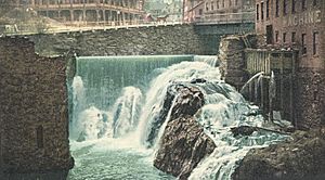
The Whetstone Falls, where Brattleboro's Whetstone Brook flows into the Connecticut River, was perfect for water power. This power ran watermills, like sawmills and gristmills. By 1859, Brattleboro had a population of 3,816. It had a mill for wool, a paper mill, and a factory that made paper machines. There was also a factory making melodeons (a type of organ), machine shops, a flour mill, and a carriage factory. Four printing businesses also operated there.
The town was connected by the Vermont and Massachusetts Railroad and the Vermont Valley Railroad. This helped Brattleboro become a busy center for trading goods like grain, lumber, and pork. In 1888, the town's name was shortened to Brattleboro.
The Estey Organ company was the biggest organ maker in the United States. It operated in Brattleboro for about 100 years, starting in 1852. Their main factory was southwest of downtown Brattleboro. At its busiest, the factory had over 20 buildings. One of these buildings now holds the Estey Organ Museum. The remaining factory buildings are important for their history and architecture.
The famous British author Rudyard Kipling lived near Brattleboro. He married Carrie Balestier, a young woman from Brattleboro, in 1892. They built a home called Naulakha (Rudyard Kipling House) in nearby Dummerston. Kipling wrote The Jungle Book and other stories there. He also wrote about life in the area in the early 1890s. He described heavy snow, oxen pulling sleds, and how people in small towns knew a lot about each other's lives.
Ida May Fuller from Brattleboro was the first person to receive a Social Security benefit check. This happened on January 31, 1940.
Brattleboro's Location and Weather
According to the United States Census Bureau, Brattleboro covers about 32.5 square miles (84.0 km2). Most of this is land, with a small part being water. The town gets its water from the West River, Ames Hill Brook, and Whetstone Brook. Brattleboro is in the Connecticut River Valley. Its eastern edge is the western bank of the Connecticut River, which is also the border with New Hampshire. Hills and mountains surround the town.
Understanding Brattleboro's Climate
Brattleboro has a humid continental climate. This means it has cold, snowy winters and hot, humid summers. Snow can fall as early as November and as late as April. In the mountains nearby, it can even snow in May. Big snowstorms, called Nor'easters, can bring a foot or more of snow in winter.
Summers are warm to hot and usually humid. There's plenty of sunshine, but also heavy rain and thunderstorms when cold fronts pass through. Tornadoes are rare here.
The hottest temperature ever recorded was 100 °F (38 °C) in 1955. The coldest was −33 °F (−36 °C) in 1958. May is usually the wettest month, and February is the driest. Brattleboro gets about 92.58 inches (235 cm) of snow each year.
| Climate data for Brattleboro, Vermont | |||||||||||||
|---|---|---|---|---|---|---|---|---|---|---|---|---|---|
| Month | Jan | Feb | Mar | Apr | May | Jun | Jul | Aug | Sep | Oct | Nov | Dec | Year |
| Record high °F (°C) | 62 (17) |
65 (18) |
83 (28) |
97 (36) |
95 (35) |
100 (38) |
99 (37) |
100 (38) |
100 (38) |
91 (33) |
78 (26) |
68 (20) |
100 (38) |
| Mean daily maximum °F (°C) | 32 (0) |
36 (2) |
45 (7) |
57 (14) |
70 (21) |
79 (26) |
84 (29) |
82 (28) |
73 (23) |
62 (17) |
49 (9) |
36 (2) |
59 (15) |
| Mean daily minimum °F (°C) | 11 (−12) |
13 (−11) |
24 (−4) |
34 (1) |
45 (7) |
54 (12) |
59 (15) |
57 (14) |
49 (9) |
37 (3) |
29 (−2) |
18 (−8) |
36 (2) |
| Record low °F (°C) | −30 (−34) |
−33 (−36) |
−19 (−28) |
5 (−15) |
22 (−6) |
31 (−1) |
39 (4) |
36 (2) |
24 (−4) |
10 (−12) |
−16 (−27) |
−24 (−31) |
−33 (−36) |
| Average precipitation inches (mm) | 3.92 (100) |
3.15 (80) |
3.94 (100) |
3.97 (101) |
4.32 (110) |
4.07 (103) |
3.87 (98) |
4.20 (107) |
3.78 (96) |
4.03 (102) |
4.13 (105) |
3.69 (94) |
47.07 (1,196) |
| Source: The Weather Channel | |||||||||||||
Who Lives in Brattleboro?
| Historical population | |||
|---|---|---|---|
| Census | Pop. | %± | |
| 1790 | 1,589 | — | |
| 1800 | 1,867 | 17.5% | |
| 1810 | 1,891 | 1.3% | |
| 1820 | 2,017 | 6.7% | |
| 1830 | 2,141 | 6.1% | |
| 1840 | 2,623 | 22.5% | |
| 1850 | 3,816 | 45.5% | |
| 1860 | 3,855 | 1.0% | |
| 1870 | 4,933 | 28.0% | |
| 1880 | 5,880 | 19.2% | |
| 1890 | 6,862 | 16.7% | |
| 1900 | 6,640 | −3.2% | |
| 1910 | 7,541 | 13.6% | |
| 1920 | 8,332 | 10.5% | |
| 1930 | 9,816 | 17.8% | |
| 1940 | 10,983 | 11.9% | |
| 1950 | 11,522 | 4.9% | |
| 1960 | 11,734 | 1.8% | |
| 1970 | 12,239 | 4.3% | |
| 1980 | 11,886 | −2.9% | |
| 1990 | 12,241 | 3.0% | |
| 2000 | 12,005 | −1.9% | |
| 2010 | 12,046 | 0.3% | |
| 2020 | 12,184 | 1.1% | |
| U.S. Decennial Census | |||
In 2010, there were 12,046 people living in Brattleboro. They lived in 5,364 households, with 2,880 being families. Most of the people live in two main areas: Brattleboro and West Brattleboro. The number of people living in the town hasn't changed much recently. Even so, Brattleboro is still the most populated town along Vermont's eastern border.
The town had about 375 people per square mile (144.9/km2). Most people (92.1%) were White. Other groups included 1.9% Black, 0.3% Native American, and 2.2% Asian. About 2.7% of the population was Hispanic or Latino.
In 2010, about 27.2% of households had children under 18. About 37.8% were married couples. The average household had 2.15 people, and the average family had 2.84 people.
The population included 22.3% under 18, 29.2% between 25 and 44, and 16.6% who were 65 or older. The average age was 40 years. For every 100 females, there were about 84 males.
The average income for a household in the town was $31,997. For families, it was $44,267. About 13.1% of the population lived below the poverty line. This included 18.0% of those under 18.
Brattleboro's Economy and Growth

Brattleboro is a key place for business and tourism in Vermont. If you drive north from Massachusetts on Interstate 91, Brattleboro is the first big town you reach. It has a mix of country feel and city services, including many places to stay. Downtown Brattleboro also has art galleries, shops, and places for performances.
Most jobs in Brattleboro are in healthcare and social help. After that, manufacturing, government, and retail trade are the biggest job areas.
In 2007, Brattleboro became a Fair Trade Town. This means it supports fair prices and good working conditions for producers, especially in developing countries. It was the second town in the nation to get this special status.
C&S Wholesale Grocers, a large food distributor, used to have its main office here. They moved to Keene, New Hampshire, in 2005. But they still have a big shipping and warehouse building in Brattleboro.
Ehrmann Commonwealth Dairy has its main office in Brattleboro. They opened a dairy processing plant here in 2011. New Chapter, a company that makes organic vitamins and supplements, is also based in Brattleboro.
| Employer | Employees | Industry |
|---|---|---|
| C&S Wholesale Grocers | 1,200 | Grocery wholesale, distribution |
| Brattleboro Memorial Hospital | 400 | Healthcare |
| Brattleboro Retreat | 400 | Healthcare |
| Retreat Healthcare | 400 | Healthcare |
How Brattleboro Has Grown
The busiest part of Brattleboro is downtown, located near Vermont's lowest point in the Connecticut River valley. Because of the steep hills around it, there isn't much flat land. Many buildings and houses are built close together on these hills. This closeness has created a lively, city-like feel downtown.
Since the 1950s, Brattleboro has grown beyond its downtown area. New buildings and homes have spread to the west, south, and north. The southeast part of town, near the river, has always had the most people. It has many one- or two-family houses and some apartment buildings. Businesses and factories are mostly along Canal Street (Route 5). The town's high school and the Regional Career Center are also in this area. Fort Dummer State Park is here too. The original Fort Dummer site is now underwater because of a dam built in the early 1900s. A historical marker shows where it used to be.
The western part of town, built around Route 9, became an official village in 2005. It has more spread-out homes, including the state's largest mobile home park. Some areas in western Brattleboro and north of the West River feel very rural. They have dirt roads, few houses, and wooded hills. Only a few farms are left in town after the dairy industry declined in the 1970s.
The area north of the West River used to be farmland. It was developed in the 1960s and 1970s after Interstate 91 was built. This area has fewer homes and more large businesses and shopping centers along Putney Road. You can find seven hotels and motels close to each other here.
Brattleboro is also the main office for the Holstein/Friesian Cattle Association. This group keeps records for these two types of cattle worldwide.
Arts and Fun in Brattleboro
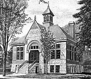
The Brooks Memorial Library has a town history collection, paintings, and sculptures. Brattleboro has a lively arts community. It was even listed as one of the "100 Best Small Art Towns in America."
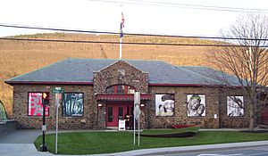
On the first Friday of every month, there's an event called "Gallery Walk." During this event, art galleries, artists, and stores show new art or hold performances. Places like the Brattleboro Museum and Art Center and the River Gallery School take part.
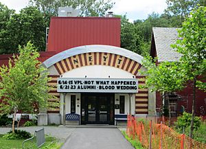
Other art groups in Brattleboro include the Brattleboro Music Center, the New England Youth Theater, and the New England Center for Circus Arts (NECCA). The Vermont Jazz Center is also here.
Fun Annual Events
- January: The annual Northern Roots Festival at the Brattleboro Music Center.
- February: The annual Winter Carnival.
- February: Alpine Ski Jumping's Fred Harris Memorial Tournament at the Harris Hill Ski Jump.
- March: Brattleboro Women's Film Festival.
- March: Maple Open House Weekend.
- May or June: Annual Slow Living Summit.
- June and July: Vermont Theatre Company's Shakespeare-in-the-Park.
- October: Brattleboro Literary Festival.
- November: Brattleboro Film Festival.
Parks and Outdoor Activities
The town runs the Gibson-Aiken Center, a big place for recreation and community activities downtown. It also has many parks and outdoor areas. One is Living Memorial Park, which has an outdoor swimming pool and a town skiing area.
There are bike lanes on Putney Road in the north, on Guilford Street near Living Memorial Park, and on a short part of Western Avenue in West Brattleboro. Fort Dummer State Park is open in the summer. It's named after the old fort and is located near its original site. The state park has 218 acres of protected forest, with hiking trails and a campground.
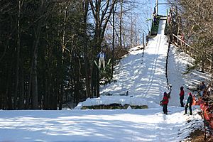
Brattleboro gets many skiers and snowboarders in winter. Many are heading to nearby resorts like Mount Snow and Stratton. But Brattleboro is also a winter sports spot itself. The town played a big role in making skiing popular. Fred Harris, who was from Brattleboro, started the Brattleboro Outing Club in 1922. He helped create the first motor-driven ski lifts in North America. He also built the Harris Hill Ski Jump, where international ski jumping competitions are held every February.
Learning in Brattleboro
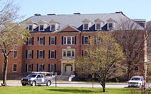
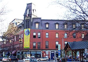
Brattleboro has many different schools, including public and private ones. It also has colleges and career centers. Parts of the Community College of Vermont and Vermont Technical College are in Brattleboro, located in the newly fixed Brooks House downtown.
SIT Graduate Institute, also known as the School for International Training, is a private college in northern Brattleboro. It grew from The Experiment in International Living, started in 1932. The Graduate Institute offers master's degrees in topics related to international studies. Students and teachers come from all over the world, giving Brattleboro an international feel. A famous graduate is Jody Williams, who won the Nobel Peace Prize in 1997.
Brattleboro has three public elementary schools for grades K–6:
- Green Street School
- Oak Grove School
- Academy School
There is one public middle school, the Brattleboro Area Middle School (BAMS). There is also one public high school, the Brattleboro Union High School (BUHS). The Windham Southeast Supervisory Union manages the public schools in this area. It also runs the Windham Regional Career Center, which teaches job skills. Oak Meadow, a company that provides homeschool curriculum, is also based downtown.
News and Entertainment
Reading the News
Brattleboro has the Brattleboro Reformer, a daily newspaper started in 1876. It prints over 10,000 copies on weekdays. The Commons is a non-profit weekly community newspaper. The Parent Express is another community paper that circulates in Brattleboro and nearby areas. You can also find local news in the Keene Sentinel and Rutland Herald.
Listening to the Radio
Several radio stations broadcast from Brattleboro:
FM Stations
- WVBA 88.9 FM, a Vermont Public Radio station
- WKVT-FM 92.7 (plays classic hits)
- WTSA-FM 96.7 (plays hot adult contemporary music)
- WVEW-LP 107.7 (a community-supported low power station)
AM Stations
- WINQ 1490
- WTSA 1450
Watching TV
Because of the mountains around Brattleboro, you can't get regular broadcast TV channels. However, Brattleboro is part of the Burlington / Plattsburgh TV market. Comcast and Consolidated Communications are the main companies that provide cable TV in Brattleboro. They offer channels from the Burlington area, as well as WMUR-TV (ABC) and WEKW-TV (NHPTV) from New Hampshire.
Getting Around Brattleboro
Roads and Highways
Brattleboro has six main highways, including one Interstate highway:
 Interstate 91
 U.S. Route 5 ("Connecticut River Byway")
 Vermont Route 9 ("Molly Stark Trail")
 Vermont Route 30
 Vermont Route 119
 Vermont Route 142
Vermont Route 9 starts in New York and goes through the southern Green Mountains. It enters downtown Brattleboro as High Street. It also has names like The Molly Stark Trail, Marlboro Road, Western Avenue, Main Street, and Putney Road. It meets I-91 at Exit 2. Then, it joins U.S. Route 5 downtown. After that, it goes north with Main Street and Putney Road to Exit 3 of I-91. From there, it goes east into New Hampshire, becoming New Hampshire Route 9.
U.S. Route 5 enters Brattleboro from Guilford in the south and goes north through downtown. It leaves Brattleboro at the northern border with Dummerston. Route 5 is also called Canal Street, Main Street, and Putney Road. It's known as the Connecticut River Byway throughout Vermont.
Vermont Route 30 starts in Brattleboro. It follows the West River for about 12 miles, offering great views. This road is popular for cycling. Route 30 leaves Brattleboro at the border with Dummerston. Its local names are Linden Street and West River Road.
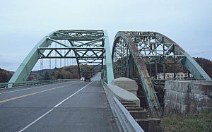
Interstate 91 goes north-south through Brattleboro, curving around the town center. Its first three Vermont exits are in Brattleboro. Exit 1 serves the south, Exit 2 serves the west (connecting to ski areas), and Exit 3 serves the north and nearby New Hampshire. The large West River Bridge on I-91 is being rebuilt.
Vermont Route 119 starts where U.S. Route 5 and VT Route 142 meet. It's called Bridge Street in Brattleboro. It crosses into New Hampshire over the Connecticut River.
Vermont Route 142 also starts at the same intersection. It goes south, following the New England Central Railroad. Its local names are Vernon Street and Vernon Road. It continues south into Vernon and then into Massachusetts.
Trains in Brattleboro
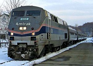
Amtrak, the national passenger train system, has its Vermonter service go through Brattleboro every day. This train connects Brattleboro with Washington, D.C., and St. Albans, Vermont. Recent improvements to the train tracks have made travel times to New York and other southern cities much faster.
Bus Services
Southeast Vermont Transit, also known as the MOOver, runs three local bus routes around Brattleboro. These buses also serve Guilford and Hinsdale, New Hampshire on weekdays and Saturdays. They also have bus routes for commuters between Brattleboro, Bellows Falls, and Wilmington.
Greyhound buses also stop in Brattleboro.
Airports Near Brattleboro
The closest small airports for private planes are Deerfield Valley Regional Airport in West Dover and Dillant-Hopkins Airport in Keene, New Hampshire.
For regular commercial flights, the closest airports are Lebanon Municipal Airport in West Lebanon, New Hampshire, and the Rutland – Southern Vermont Regional Airport. Both are within 70 miles (110 km) north of Brattleboro. They offer daily Cape Air flights to and from Boston and White Plains, New York.
For major domestic and international flights, the closest airports are Bradley International Airport (south), Manchester-Boston Regional Airport (east), and Albany International Airport (west). All of these are less than two hours' drive from Brattleboro.
Emergency Services and Utilities
Fire Department
The Brattleboro Fire Department protects the town. It was started in 1831 and is located on Elliot Street downtown. There is also a smaller fire station in West Brattleboro.
Police Department
The Brattleboro Police Department serves Brattleboro and West Brattleboro. The Windham County Sheriff's Department also helps with transporting prisoners and serving legal documents. The Vermont State Police have a station nearby and also serve the town.
Electricity and Water
Green Mountain Power supplies electricity to Brattleboro. The town gets its water from the Pleasant Valley Reservoir. The Pleasant Valley Water Plant pumps about 1.0 to 1.5 million gallons of water per day to Brattleboro. There are also backup water pumps near West River Road.
Comcast provides cable television in Brattleboro. Both Comcast and Consolidated Communications offer landline phone and high-speed Internet service to the town.
Famous People From Brattleboro
See also
 In Spanish: Brattleboro para niños
 | Laphonza Butler |
 | Daisy Bates |
 | Elizabeth Piper Ensley |


