
Windham County, Vermont facts for kids
Quick facts for kids
Windham County
|
|
|---|---|

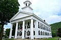
Windham County courthouse in Newfane
|
|

Location within the U.S. state of Vermont
|
|
 Vermont's location within the U.S. |
|
| Country | |
| State | |
| Founded | 1781 |
| Named for | Windham, Vermont, which was named for Windham, Connecticut |
| Shire Town | Newfane |
| Largest town | Brattleboro |
| Area | |
| • Total | 798 sq mi (2,070 km2) |
| • Land | 785 sq mi (2,030 km2) |
| • Water | 13 sq mi (30 km2) 1.6%% |
| Population
(2020)
|
|
| • Total | 45,905 |
| • Density | 57.53/sq mi (22.211/km2) |
| Time zone | UTC−5 (Eastern) |
| • Summer (DST) | UTC−4 (EDT) |
| Congressional district | At-large |
Windham County is a county located in the state of Vermont in the United States. In 2020, about 45,905 people lived here. The main town for the county government, called the shire town, is Newfane. The biggest town in Windham County is Brattleboro.
Contents
History of Windham County
During the French and Indian War in 1755, a place called Fort Bridgman in Vernon was burned down. This was a tough time for the area.
Before Vermont became its own state, it was part of the Province of New York. In 1768, a court was set up for Cumberland County, New York. This court moved to Westminster in 1772.
On January 15, 1777, Vermont decided to become independent from New York. It acted like its own country until 1791, when it joined the United States. When Vermont became independent, the old counties from New York were no longer used.
A new county called Unity County was created in Vermont on March 17, 1778. A few days later, it was renamed Cumberland County. This new Cumberland County and Bennington County traded some land to fix their borders. Later, on February 16, 1781, several new counties were made from Cumberland County. These included Rutland County, Orange County, Windsor County, and Windham County.
Some people think Cumberland County was just renamed Windham County. However, it seems Cumberland County was actually ended, and Windham County was created. This helped Vermont break away from its past ties to New York. The records from the old Cumberland County in Vermont were kept in Windham County. Newfane became the main government town for Windham County before 1812.
Geography of Windham County
Windham County covers a total area of about 798 square miles. Most of this, 785 square miles, is land. The remaining 13 square miles, which is about 1.6%, is water. It is the third-largest county in Vermont based on its land area.
Neighboring Counties
Windham County shares its borders with several other counties:
- Windsor County to the north
- Sullivan County, New Hampshire to the northeast
- Cheshire County, New Hampshire to the east
- Franklin County, Massachusetts to the south
- Bennington County to the west
Lakes and Reservoirs
The county has a few important bodies of water:
- Ball Mountain Lake
- Harriman Reservoir (also known as Lake Whitingham)
- Townshend Lake
Protected Natural Areas
Parts of these national protected areas are found in Windham County:
- Green Mountain National Forest
- Silvio O. Conte National Fish and Wildlife Refuge
People of Windham County
The population of Windham County has changed a lot over the years. Here's how it has grown since 1790:
| Historical population | |||
|---|---|---|---|
| Census | Pop. | %± | |
| 1790 | 17,572 | — | |
| 1800 | 23,581 | 34.2% | |
| 1810 | 26,760 | 13.5% | |
| 1820 | 28,457 | 6.3% | |
| 1830 | 28,748 | 1.0% | |
| 1840 | 27,442 | −4.5% | |
| 1850 | 29,062 | 5.9% | |
| 1860 | 26,982 | −7.2% | |
| 1870 | 26,036 | −3.5% | |
| 1880 | 26,763 | 2.8% | |
| 1890 | 26,547 | −0.8% | |
| 1900 | 26,660 | 0.4% | |
| 1910 | 26,932 | 1.0% | |
| 1920 | 26,373 | −2.1% | |
| 1930 | 26,015 | −1.4% | |
| 1940 | 27,850 | 7.1% | |
| 1950 | 28,749 | 3.2% | |
| 1960 | 29,776 | 3.6% | |
| 1970 | 33,074 | 11.1% | |
| 1980 | 36,933 | 11.7% | |
| 1990 | 41,588 | 12.6% | |
| 2000 | 44,216 | 6.3% | |
| 2010 | 44,513 | 0.7% | |
| 2020 | 45,905 | 3.1% | |
| U.S. Decennial Census 1790–1960 1900–1990 1990–2000 2010–2018 |
|||
What the 2010 Census Showed
In 2010, there were 44,513 people living in Windham County. Most people (95.3%) were white. About 1.8% of the population was of Hispanic or Latino background.
Many people in the county have Irish (21.8%) or English (21.7%) family backgrounds. Other large groups include French (12.3%), German (11.7%), and Italian (8.6%).
The average age of people in the county was about 44.9 years old. The average income for a household was $46,714. About 11.1% of all people in the county lived below the poverty line.
Law Enforcement in Windham County
The Windham County Sheriff's Department helps keep the peace in the county. They are especially important in areas that do not have their own local police. If there is no local police or sheriff's coverage, the Vermont State Police step in to help.
Many towns in Windham County have an agreement with the Sheriff's Department for patrol services. These towns include Athens, Dummerston, Grafton, Halifax, Jamaica, Londonderry, Marlboro, Newfane, Putney, Rockingham, Vernon, Westminster, and Windham. The current Sheriff is Mark Anderson, who started in 2019.
Getting Around Windham County
Roads and Highways
Several important roads cross through Windham County, helping people travel around.
|
Bus Services
Local bus services help people get around, especially in towns like Brattleboro and Bellows Falls. This service is called "The Current" and is run by Connecticut River Transit. It includes the Brattleboro BeeLine bus system, which has Red, Blue, and White Lines. These lines also go to West Brattleboro and Hinsdale, New Hampshire.
Another bus service, the MOOver, is free to ride. It mostly serves the southwestern part of the county, especially Wilmington and nearby ski areas. The MOOver also connects to Bennington and Brattleboro, where you can find other bus connections.
For longer trips, the national bus service Greyhound has stops in Brattleboro and Bellows Falls every day.
Train Services
Amtrak, the national passenger train network, runs its Vermonter train through Windham County. This train travels daily from St. Albans, Vermont all the way to Washington, DC. It stops at Bellows Falls and Brattleboro once a day in each direction.
Communities in Windham County
Towns
In Vermont, towns are specific areas within counties where people live all year round. They usually have their own local government and hold open town meetings. The elected leaders are called a selectboard. Even though Brattleboro is the largest town, Newfane is the historic "shire town" or county seat. This means the Windham County Superior Court and the offices for the County Sheriff and County Clerk are still there.
Villages
Villages are smaller named places. Some are officially separate within a town, while others are just recognized areas.
Incorporated Villages
These villages have their own official local governments:
- Bellows Falls
- Jacksonville
- Newfane
- Saxtons River
- Westminster
Census-Designated Places
These are areas identified by the U.S. Census Bureau for collecting population data, but they might not have their own separate local government:
- Algiers
- Brattleboro
- Chimney Hill
- Grafton
- Harmonyville
- Jamaica
- Londonderry
- North Westminster
- Putney
- South Londonderry
- Stratton Mountain (also partly in Winhall in Bennington County)
- Townshend
- Wardsboro
- West Brattleboro
- West Dummerston
- Whitingham
- Wilmington
Unincorporated Villages
These are smaller communities that are part of a larger town and do not have their own separate government:
- Cambridgeport
- Dover
- Dummerston Center
- East Dover
- East Dummerston
- East Jamaica
- Halifax Center
- Houghtonville
- Rawsonville
- South Newfane
- South Wardsboro
- South Windham
- Wardsboro Center
- West Dover
- West Halifax
- West Townshend
- West Wardsboro
- Westminster Station
- Westminster West
- Williamsville
Images for kids
-
Windham County courthouse in Newfane
See also
 In Spanish: Condado de Windham (Vermont) para niños
