Cheshire County, New Hampshire facts for kids
Quick facts for kids
Cheshire County
|
||
|---|---|---|

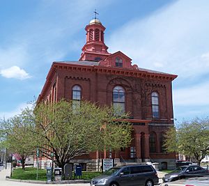
Cheshire County Courthouse in Keene
|
||
|
||

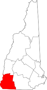
Location within the U.S. state of New Hampshire
|
||
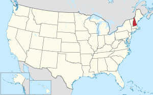
 New Hampshire's location within the U.S. |
||
| Country | ||
| State | ||
| Founded | 1769 | |
| Named for | Cheshire, England | |
| Seat | Keene | |
| Largest city | Keene | |
| Area | ||
| • Total | 728.9 sq mi (1,888 km2) | |
| • Land | 706.7 sq mi (1,830 km2) | |
| • Water | 22.2 sq mi (57 km2) 3.1% | |
| Population
(2020)
|
||
| • Total | 76,458 |
|
| • Density | 108.2/sq mi (41.8/km2) | |
| Time zone | UTC−5 (Eastern) | |
| • Summer (DST) | UTC−4 (EDT) | |
| Congressional district | 2nd | |
Cheshire County is a special area called a county in the southwestern part of New Hampshire. New Hampshire is one of the U.S. states.
In 2020, about 76,458 people lived here. The main city and government center is Keene. Cheshire County was one of the first five counties in New Hampshire. It was named after a county called Cheshire in England. The county was officially set up in Keene in 1771. Later, in 1827, Sullivan County was made from the northern part of Cheshire County. Keene and the surrounding area are known as the Keene, NH micropolitan area. This means it's a smaller city area that's important for jobs and life nearby.
Contents
Exploring Cheshire County's Geography
Cheshire County covers about 729 square miles. Most of this area, about 707 square miles, is land. The rest, about 22 square miles, is water. This means about 3.1% of the county is water.
The highest point in Cheshire County is Mount Monadnock. It's a famous mountain located in the northwestern part of Jaffrey. Mount Monadnock stands tall at 3,165 feet.
Neighboring Counties Around Cheshire
Cheshire County shares its borders with several other counties.
- To the north, it touches Sullivan County.
- To the east, you'll find Hillsborough County.
- To the southeast, it borders Worcester County, Massachusetts.
- To the southwest, it's next to Franklin County, Massachusetts.
- And to the west, it meets Windham County, Vermont.
Special Natural Spots in Cheshire County
- Mount Monadnock: A very popular mountain for hiking.
- Pisgah State Park: A large state park with lots of trails and nature to explore.
People and Life in Cheshire County
The number of people living in Cheshire County has changed a lot over the years. In 1790, there were about 28,753 people. By 2020, the population had grown to 76,458.
A Look at the 2010 Population
In 2010, there were 77,117 people living in Cheshire County. There were 30,204 households, which are like homes or families living together. The average age of people in the county was about 40.7 years old.
Many different groups of people make up the population. Most people were white (96.3%). Other groups included Asian (1.2%), Black or African American (0.5%), and American Indian (0.3%). About 1.4% of the people were from two or more races. Also, about 1.4% of the population was of Hispanic or Latino background.
The average household had about 2.40 people. For families, the average size was about 2.88 people.
Towns and Cities in Cheshire County
Cheshire County has one main city and many smaller towns and villages.
The Main City
- Keene (This is where the county government is located)
Towns in Cheshire County
Special Census-Designated Places
These are areas that are like towns but are counted separately for census data.
Small Villages in the County
See also
 In Spanish: Condado de Cheshire para niños
 | Chris Smalls |
 | Fred Hampton |
 | Ralph Abernathy |


