
Sullivan, New Hampshire facts for kids
Quick facts for kids
Sullivan, New Hampshire
|
||
|---|---|---|
|
Town
|
||

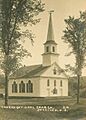
Congregational Church c. 1915
|
||
|
||

Location in Cheshire County, New Hampshire
|
||
| Country | United States | |
| State | New Hampshire | |
| County | Cheshire | |
| Incorporated | 1787 | |
| Villages |
|
|
| Area | ||
| • Total | 18.7 sq mi (48.5 km2) | |
| • Land | 18.5 sq mi (48.0 km2) | |
| • Water | 0.2 sq mi (0.5 km2) 1.01% | |
| Elevation | 1,421 ft (433 m) | |
| Population
(2020)
|
||
| • Total | 658 | |
| • Density | 35/sq mi (13.7/km2) | |
| Time zone | UTC-5 (Eastern) | |
| • Summer (DST) | UTC-4 (Eastern) | |
| ZIP code |
03445
|
|
| Area code(s) | 603 | |
| FIPS code | 33-74900 | |
| GNIS feature ID | 0873731 | |

Sullivan is a town in Cheshire County, New Hampshire, United States. In 2020, about 658 people lived there. It includes smaller areas called East Sullivan and Ellisville.
Contents
History of Sullivan
Sullivan got its name from General John Sullivan. The town was officially formed on September 27, 1787. It was created from parts of nearby towns like Gilsum, Keene, Nelson, and Stoddard.
In the early days, farming was the main job for people living in Sullivan. By 1859, the town had a population of 468. In 1867, Sullivan became the first town in New Hampshire to build a monument. This monument honors soldiers who were lost during the Civil War. You can find it across from the Sullivan Congregational Church.
Geography and Location
Sullivan covers a total area of about 48.5 square kilometers (18.7 square miles). Most of this area is land, with only a small part being water. About 0.5 square kilometers (0.2 square miles) is water, which is about 1% of the town's total area.
Waterways in Sullivan
Several brooks flow through Sullivan. These include Ferry Brook, Meetinghouse Brook, and Spaulding Brook. Otter Brook also runs through the town. All these brooks are part of the Ashuelot River system, which eventually flows into the Connecticut River.
Highest Point and Roads
The highest point in Sullivan is the top of Boynton Hill. It stands at about 1,739 feet (530 meters) high. This hill is located in the northern part of the town. New Hampshire Route 9 is the main road that serves the town.
Neighboring Towns
Sullivan shares its borders with several other towns:
- Gilsum (to the northwest)
- Stoddard (to the northeast)
- Nelson (to the east)
- Roxbury (to the south)
- Keene (to the southwest)
Population Changes Over Time
| Historical population | |||
|---|---|---|---|
| Census | Pop. | %± | |
| 1790 | 220 | — | |
| 1800 | 488 | 121.8% | |
| 1810 | 516 | 5.7% | |
| 1820 | 582 | 12.8% | |
| 1830 | 555 | −4.6% | |
| 1840 | 496 | −10.6% | |
| 1850 | 468 | −5.6% | |
| 1860 | 376 | −19.7% | |
| 1870 | 347 | −7.7% | |
| 1880 | 382 | 10.1% | |
| 1890 | 337 | −11.8% | |
| 1900 | 287 | −14.8% | |
| 1910 | 266 | −7.3% | |
| 1920 | 206 | −22.6% | |
| 1930 | 192 | −6.8% | |
| 1940 | 255 | 32.8% | |
| 1950 | 272 | 6.7% | |
| 1960 | 261 | −4.0% | |
| 1970 | 376 | 44.1% | |
| 1980 | 585 | 55.6% | |
| 1990 | 706 | 20.7% | |
| 2000 | 746 | 5.7% | |
| 2010 | 677 | −9.2% | |
| 2020 | 658 | −2.8% | |
| U.S. Decennial Census | |||
The population of Sullivan has changed quite a bit over the years. In 1790, there were 220 people. The population grew to 746 people by the year 2000. However, by the 2020 census, the population had decreased slightly to 658 people.
Community Life
In 2000, there were 282 households in Sullivan. About 30.9% of these households had children under 18 living there. Most households, 59.2%, were married couples living together.
The average household size was about 2.65 people. The average family size was 3.00 people. The median age in town was 38 years old. This means half the people were younger than 38, and half were older.
Education in Sullivan
The town of Sullivan has its own school district. It is managed by an elected school board with five members.
Where Students Attend School
Students in Sullivan go to different schools depending on their age:
- Kindergarten through sixth grade students attend Nelson Elementary School.
- Seventh and eighth graders go to Keene Middle School.
- High school students attend Keene High School.
Changes in School Districts
From 1960 to 2013, Sullivan was part of the Monadnock Regional School District. During this time, elementary students went to Sullivan Central School or Gilsum Elementary School. Middle and high school students attended Monadnock Regional High School in Swanzey.
In 2012, residents of Sullivan voted to leave the Monadnock Regional School District. They wanted to have their own independent school district. This change officially happened on July 1, 2013. The old Sullivan Central School building is now owned by the new district, but it is not planned to reopen as a school.
Notable People from Sullivan
Many interesting people have connections to Sullivan, New Hampshire:
- Charles C. Comstock (1818–1900) – A successful businessman and a US congressman from Michigan.
- David H. Mason (1818–1873) – A US congressman from Massachusetts and a US Attorney.
- Rufus Osgood Mason (1830–1903) – A doctor, surgeon, and teacher. He was also an early researcher in parapsychology (the study of psychic phenomena) and hypnotherapy.
- John Morressy (1930–2006) – A writer of science fiction and fantasy books. He was also an English professor at Franklin Pierce College.
Images for kids
-
Congregational Church in Sullivan, New Hampshire
See also
 In Spanish: Sullivan (Nuevo Hampshire) para niños
