List of counties in New Hampshire facts for kids
Quick facts for kids Counties of New Hampshire |
|
|---|---|
| Location | State of New Hampshire |
| Number | 10 |
| Populations | 31,372 (Coös) – 427,354 (Hillsborough) |
| Areas | 369 square miles (960 km2) (Strafford) – 1,801 square miles (4,660 km2) (Coös) |
| Government | County government |
| Subdivisions | cities, towns, townships, villages, unincorporated territories, census designated place |
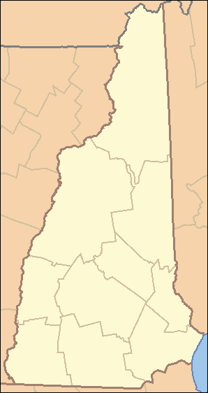
New Hampshire, a state in the United States, is divided into ten main areas called counties. Think of a county as a smaller part of a state, like a district. Each county has its own local government that helps manage things for the people living there.
Five of these counties were created way back in 1769. At that time, New Hampshire was still an English colony, not yet a state. The newest counties, Belknap County and Carroll County, were formed much later in 1840.
Most of New Hampshire's counties are named after important British or American people. Some are also named after places or natural features. Only one county, Coös County, has a name from a Native American language. "Coös" comes from an Algonquian word that means "small pines."
The counties in the southern part of New Hampshire are usually smaller in size. This is because more people live in the south. The counties in the less populated northern part of the state tend to be much larger.
Understanding County Codes
Every county in the United States has a special number called a FIPS code. FIPS stands for Federal Information Processing Standard. This code is a unique five-digit number that helps identify each county.
The first two digits of the FIPS code show the state. For New Hampshire, the state code is 33. The last three digits identify the specific county within that state. For example, Belknap County has the code 001. So, its full FIPS code is 33001. This unique code helps make sure that every county in the entire country can be easily identified.
New Hampshire Counties List
Here is a list of all ten counties in New Hampshire. It includes details like when they were created, who or what they were named after, and their population and size.
| County | FIPS code |
County seat |
Est. |
Formed from |
Named after |
Population |
Area |
Map |
|---|---|---|---|---|---|---|---|---|
| Belknap County | 001 | Laconia | 1840 | Parts of Merrimack County and Strafford County. | Jeremy Belknap (1744–1798), an early historian from New Hampshire. | 65,027 | 401 sq mi (1,039 km2) |
 |
| Carroll County | 003 | Ossipee | 1840 | Part of Strafford County. | Charles Carroll of Carrollton (1737–1832), the last person to sign the United States Declaration of Independence. | 52,448 | 934 sq mi (2,419 km2) |
 |
| Cheshire County | 005 | Keene | 1769 | One of five original counties. | The English county of Cheshire. | 77,703 | 708 sq mi (1,834 km2) |
 |
| Coös County | 007 | Lancaster | 1803 | Part of Grafton County. | An Algonquian word meaning "small pines". | 31,372 | 1,801 sq mi (4,665 km2) |
 |
| Grafton County | 009 | Haverhill | 1769 | One of five original counties. | Augustus Henry Fitzroy, 3rd Duke of Grafton (1735–1811), who was a Prime Minister of Great Britain. | 93,146 | 1,714 sq mi (4,439 km2) |
 |
| Hillsborough County | 011 | Manchester and Nashua |
1769 | One of five original counties. | Wills Hill, 1st Marquess of Downshire (1718–1793), also known as the Earl of Hillsborough, who was an important British official for the colonies. | 427,354 | 876 sq mi (2,269 km2) |
 |
| Merrimack County | 013 | Concord | 1823 | Parts of Hillsborough County and Rockingham County. | The Merrimack River, a major river in New Hampshire. | 157,103 | 934 sq mi (2,419 km2) |
 |
| Rockingham County | 015 | Brentwood | 1769 | One of five original counties. | Charles Watson-Wentworth, 2nd Marquess of Rockingham (1730–1782), who served as a Prime Minister of Great Britain twice. | 320,689 | 695 sq mi (1,800 km2) |
 |
| Strafford County | 017 | Dover | 1769 | One of five original counties. | William Wentworth, 2nd Earl of Strafford (1626–1695), an English noble who owned land in the colonies. | 133,243 | 369 sq mi (956 km2) |
 |
| Sullivan County | 019 | Newport | 1827 | Part of Cheshire County. | John Sullivan (1740–1795), who was the third and fifth governor of New Hampshire. | 43,969 | 537 sq mi (1,391 km2) |
 |
See also
 In Spanish: Anexo:Condados de Nuevo Hampshire para niños
 | Georgia Louise Harris Brown |
 | Julian Abele |
 | Norma Merrick Sklarek |
 | William Sidney Pittman |


