Belknap County, New Hampshire facts for kids
Quick facts for kids
Belknap County
|
||
|---|---|---|

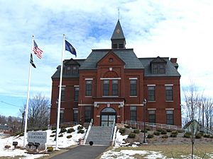
Laconia District Court on Academy Square in Laconia
|
||
|
||

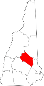
Location within the U.S. state of New Hampshire
|
||
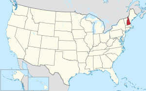
 New Hampshire's location within the U.S. |
||
| Country | ||
| State | ||
| Founded | 1840 | |
| Named for | Jeremy Belknap | |
| Seat | Laconia | |
| Largest city | Laconia | |
| Area | ||
| • Total | 470.0 sq mi (1,217 km2) | |
| • Land | 401.8 sq mi (1,041 km2) | |
| • Water | 68.2 sq mi (177 km2) 14.5% | |
| Population
(2020)
|
||
| • Total | 63,705 |
|
| • Density | 158.5/sq mi (61.2/km2) | |
| Time zone | UTC−5 (Eastern) | |
| • Summer (DST) | UTC−4 (EDT) | |
| Congressional districts | 1st, 2nd | |
Belknap County is a county in the state of New Hampshire. In 2020, about 63,705 people lived there. The main city and county seat is Laconia.
This county is in New Hampshire's beautiful Lakes Region. It is a bit southeast of the state's center. Belknap County is part of a larger area that includes Boston and other big cities.
Many lakes are found here. The southwestern part of Lake Winnipesaukee is in Belknap County. Other large lakes like Squam Lake and Lake Winnisquam are also here. The Belknap Mountains are near Lake Winnipesaukee. You can find Mount Major there, which is great for hiking. Gunstock Mountain is a popular place for skiing.
Belknap County also has fun attractions. The Bank of New Hampshire Pavilion in Gilford hosts many concerts. Every June, the Laconia Motorcycle Week brings many visitors. Funspot Family Fun Center in Weirs Beach is known as the world's largest video game arcade!
Contents
History of Belknap County
Belknap County was created in 1840. It was formed from parts of Merrimack County and Strafford County. The county is named after Dr. Jeremy Belknap. He was a famous preacher and historian. He wrote a book called The History of New Hampshire.
The first county court was held in the town of Meredith. This was in a village called Meredith Bridge. Later, in 1855, the city of Laconia became its own separate town.
Geography of Belknap County
Belknap County covers about 469 square miles. Most of this area, about 400 square miles, is land. The remaining 68 square miles (15%) is water. This makes it the second-smallest county in New Hampshire by land area. A big part of the water area is Lake Winnipesaukee.
Neighboring Counties
Belknap County shares borders with these other counties:
- Carroll County (to the north)
- Strafford County (to the east)
- Merrimack County (to the southwest)
- Grafton County (to the northwest)
Population Information
| Historical population | |||
|---|---|---|---|
| Census | Pop. | %± | |
| 1850 | 17,721 | — | |
| 1860 | 18,549 | 4.7% | |
| 1870 | 17,681 | −4.7% | |
| 1880 | 17,948 | 1.5% | |
| 1890 | 20,321 | 13.2% | |
| 1900 | 19,526 | −3.9% | |
| 1910 | 21,309 | 9.1% | |
| 1920 | 21,178 | −0.6% | |
| 1930 | 22,623 | 6.8% | |
| 1940 | 24,328 | 7.5% | |
| 1950 | 26,632 | 9.5% | |
| 1960 | 28,912 | 8.6% | |
| 1970 | 32,367 | 12.0% | |
| 1980 | 42,884 | 32.5% | |
| 1990 | 49,216 | 14.8% | |
| 2000 | 56,325 | 14.4% | |
| 2010 | 60,088 | 6.7% | |
| 2020 | 63,705 | 6.0% | |
| U.S. Decennial Census 1790-1960 1900-1990 1990-2000 |
|||
In 2010, there were 60,088 people living in Belknap County. The population density was about 150 people per square mile. Most people (96.6%) were white. About 1.2% were Asian, and 0.5% were Black or African American.
The average age in the county was 44.7 years old. Many families lived in the county. About 28.5% of households had children under 18.
Cities and Towns
Belknap County has one city and ten towns.
City
- Laconia (This is the county seat, where the main government offices are.)
Towns
Census-Designated Places
These are areas that the Census Bureau defines for statistics.
Villages
These are smaller communities within towns.
See also

- In Spanish: Condado de Belknap para niños
 | James Van Der Zee |
 | Alma Thomas |
 | Ellis Wilson |
 | Margaret Taylor-Burroughs |


