Strafford County, New Hampshire facts for kids
Quick facts for kids
Strafford County
|
||
|---|---|---|

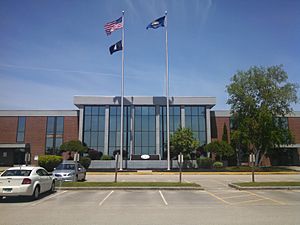
Strafford County Courthouse
|
||
|
||

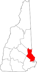
Location within the U.S. state of New Hampshire
|
||
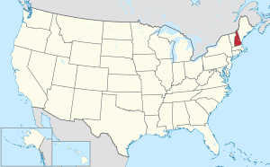
 New Hampshire's location within the U.S. |
||
| Country | ||
| State | ||
| Founded | 1771 | |
| Named for | William Wentworth, 2nd Earl of Strafford | |
| Seat | Dover | |
| Largest city | Dover | |
| Area | ||
| • Total | 382.6 sq mi (991 km2) | |
| • Land | 367.6 sq mi (952 km2) | |
| • Water | 15.0 sq mi (39 km2) 3.9% | |
| Population
(2020)
|
||
| • Total | 130,889 | |
| • Estimate
(2022)
|
132,275 |
|
| • Density | 356.1/sq mi (137.5/km2) | |
| Time zone | UTC−5 (Eastern) | |
| • Summer (DST) | UTC−4 (EDT) | |
| Congressional district | 1st | |
Strafford County is a place in New Hampshire, a state in the United States. In 2020, about 130,889 people lived there. Its main town, called the county seat, is Dover.
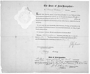
Strafford County was one of the first five counties created in New Hampshire back in 1769. It was officially set up in Dover in 1771. The county was named after William Wentworth, 2nd Earl of Strafford. People at the time thought he was an ancestor of Governor John Wentworth, but they were only distantly related. In 1840, part of Strafford County became a new county called Belknap County.
Strafford County is part of the larger Boston area, which includes cities like Cambridge and Newton in Massachusetts. It is also part of an even bigger area that stretches into Rhode Island and Connecticut. Between 2010 and 2019, Strafford County was the fastest-growing county in New Hampshire.
Contents
County Geography
Strafford County is located in the southeastern part of New Hampshire. The Salmon Falls River separates it from York County, Maine in the state of Maine. The southern part of this river is a tidal river, meaning its water levels change with the ocean tides. It flows into the Piscataqua River.
The United States Census Bureau says that Strafford County covers about 384 square miles. Most of this area, about 369 square miles, is land. The remaining 15 square miles (about 3.9%) is water. Strafford County is the smallest county in New Hampshire by total area.
Neighboring Counties
Strafford County shares borders with several other counties:
- Carroll County to the north
- York County, Maine to the east
- Rockingham County to the south
- Merrimack County to the west
- Belknap County to the northwest
Population Information
| Historical population | |||
|---|---|---|---|
| Census | Pop. | %± | |
| 1790 | 23,611 | — | |
| 1800 | 32,614 | 38.1% | |
| 1810 | 41,595 | 27.5% | |
| 1820 | 51,117 | 22.9% | |
| 1830 | 58,910 | 15.2% | |
| 1840 | 61,127 | 3.8% | |
| 1850 | 29,374 | −51.9% | |
| 1860 | 31,493 | 7.2% | |
| 1870 | 30,243 | −4.0% | |
| 1880 | 35,558 | 17.6% | |
| 1890 | 38,442 | 8.1% | |
| 1900 | 39,337 | 2.3% | |
| 1910 | 38,951 | −1.0% | |
| 1920 | 38,546 | −1.0% | |
| 1930 | 38,580 | 0.1% | |
| 1940 | 43,553 | 12.9% | |
| 1950 | 51,567 | 18.4% | |
| 1960 | 59,799 | 16.0% | |
| 1970 | 70,431 | 17.8% | |
| 1980 | 85,408 | 21.3% | |
| 1990 | 104,233 | 22.0% | |
| 2000 | 112,233 | 7.7% | |
| 2010 | 123,143 | 9.7% | |
| 2020 | 130,889 | 6.3% | |
| 2022 (est.) | 132,275 | 7.4% | |
| U.S. Decennial Census 1790–1960 1900–1990 1990–2000 2010–2020 |
|||
2010 Census Details
In 2010, there were 123,143 people living in Strafford County. There were about 47,100 households, and 29,862 of these were families. The county had about 333 people per square mile.
Most people in the county (about 93.8%) were white. Other groups included Asian (2.6%), Black or African American (1.0%), and American Indian (0.2%). About 1.8% of the population was of Hispanic or Latino origin. Many people had ancestors from places like France or French Canada (24.4%), Ireland (19.7%), and England (17.4%).
About 30.6% of households had children under 18 living with them. The average age of people in the county was 36.9 years old.
Towns and Cities

Cities in Strafford County
- Dover (This is the county seat)
- Rochester
- Somersworth
Towns in Strafford County
Special Places (CDPs)
These are areas that the Census Bureau defines for gathering data, but they are not always separate towns.
Villages in Strafford County
See also
 In Spanish: Condado de Strafford para niños
 | Victor J. Glover |
 | Yvonne Cagle |
 | Jeanette Epps |
 | Bernard A. Harris Jr. |


