
York County, Maine facts for kids
Quick facts for kids
York County
|
|||
|---|---|---|---|

York County Courthouse in Alfred
|
|||
|
|||

Location within the U.S. state of Maine
|
|||
 Maine's location within the U.S. |
|||
| Country | |||
| State | |||
| Founded | 1639 | ||
| Named for | York, England | ||
| Seat | Alfred | ||
| Largest city | Biddeford | ||
| Area | |||
| • Total | 1,270 sq mi (3,300 km2) | ||
| • Land | 991 sq mi (2,570 km2) | ||
| • Water | 279 sq mi (720 km2) 22%% | ||
| Population
(2020)
|
|||
| • Total | 211,972 | ||
| • Estimate
(2021)
|
214,591 |
||
| • Density | 166.9/sq mi (64.44/km2) | ||
| Time zone | UTC−5 (Eastern) | ||
| • Summer (DST) | UTC−4 (EDT) | ||
| Congressional district | 1st | ||


York County is a special place in Maine. It's the southernmost and westernmost county in the state. It sits right on the border with New Hampshire. Two rivers, the Salmon Falls River and the Piscataqua River, separate it from Strafford County, New Hampshire.
York County was officially started in 1639. This makes it the oldest county in Maine and one of the oldest in the entire United States. Many of Maine's first settlements by European colonists were here. In 2020, about 211,972 people lived in York County. This makes it the second-most populated county in Maine. The main town where the county government is located, called the county seat, is Alfred. York County is also part of the larger Portland-South Portland Metropolitan Area.
Contents
History of York County
Early Beginnings: Land Grants and Names
The story of York County began with special land grants from England. On August 10, 1622, two men named Ferdinando Gorges and John Mason received the first grant for a large area. This land was along the coast of North America. It stretched between the Merrimack River and Kennebec River in what is now Maine.
In 1629, Gorges and Mason decided to split their land. Mason took the land south of the Piscataqua River, which became New Hampshire. Gorges kept the northern part, which he called New Somersetshire. This first attempt to create a colony didn't work out well. There wasn't enough money or enough people to settle there.
How York County Got Its Name
Another attempt to start a colony was made by Captain Christopher Levett. He was given 6,000 acres of land where Portland is today. Levett wanted to name his new settlement "York" after his hometown in England. Sadly, his project failed. The men he left behind disappeared, and Levett himself died in 1630. Even though his colony didn't last, the name "York" did. It's now the name of the county!
A place called Fort Levett on Cushing Island is named after Captain Levett.
A New Start and Growth
In 1639, Ferdinando Gorges got a new land grant from King Charles I of England. This grant covered the same area between the Piscataqua and Kennebec Rivers. This second colony also struggled, but it kept going even after Gorges died in 1647.
Joining Massachusetts
In the 1650s, the powerful Massachusetts Bay Colony began to claim land in southern Maine. By 1658, Massachusetts had taken over what is now southwestern Maine. This area became known as York County, Massachusetts.
A Famous Land Deal
One interesting story from this time is about Francis Small. In 1668, he traded goods with the Newichewannock tribe. Their chief, Wesumbe (also called Captain Sandy), warned Small about a plan to harm him. Some tribe members wanted to kill Small instead of paying him with furs. Small escaped, but his house in what is now Cornish burned down.
Chief Wesumbe helped Small make up for his loss. He sold Small a huge area of land. This land was bordered by the Great and Little Ossipee Rivers, the Saco River, and the New Hampshire border. Today, this area includes the towns of Limington, Limerick, Cornish, Newfield, and Parsonsfield.
Dividing the County
York County was very large. Because of its size, it was divided in 1760. Cumberland and Lincoln counties were created from its eastern parts. When Massachusetts formed its own state government in 1780, it created the District of Maine to manage its eastern lands.
In 1805, the northern part of York County was separated to form part of Oxford County. Finally, in 1820, Maine became its own state. All the areas that were part of the District of Maine became the counties of Maine, including York County.
Geography of York County
York County covers a total area of 1,270 square miles. About 991 square miles of this is land, and 279 square miles (22%) is water.
| Mountain Name | Elevation (feet) | Community |
|---|---|---|
| Clark Mountain | 1,320 | Cornish |
| Wiggin Mountain | 1,300 | Parsonsfield |
| Sawyer Mountain, main summit | 1,200 | Limington |
| Sawyer Mountain, north summit | 1,200 | Limerick |
| Province Mountain | 1,176 | Newfield |
| Fort Ridge, main summit | 1,114 | Shapleigh |
| Ossipee Hill | 1,058 | Waterboro |
| Hussey Hill | 1,051 | Acton |
| Fort Ridge, south slope | 1,000 | Alfred |
| Prospect Hill | 880 | Lebanon |
| Bauneg Beg Hill | 866 | North Berwick |
| Mount Agamenticus | 692 | York |
| Mount Hope | 680 | Sanford |
| Whitehouse Hill | 581 | Hollis |
| Grant Hill | 502 | Lyman |
| No name (hill) | 385 | Buxton |
| Welch Hill | 370 | South Berwick |
| No name (hill) | 360 | Wells |
| Clark Hill | 360 | Dayton |
| Third Hill | 360 | Eliot |
| No name (hill) | 300 | Biddeford |
| No name (hill) | 240 | Arundel |
| No name (hill) | 230 | Saco |
| No name (hill) | 223 | Kennebunk |
| 6 unnamed locations | 200 | Kennebunkport |
| 5 unnamed locations | 160 | Ogunquit |
| Cutts Ridge | 140 | Kittery |
| No name (hill) | 138 | Old Orchard Beach |
Neighboring Counties
York County shares borders with several other counties:
- Oxford County – to the north
- Cumberland County – to the northeast
- Rockingham County, New Hampshire – to the southwest
- Strafford County, New Hampshire – to the west
- Carroll County, New Hampshire – to the northwest
Protected Natural Areas
Part of the Rachel Carson National Wildlife Refuge is located in York County. This refuge helps protect important wildlife and their habitats.
People of York County
| Historical population | |||
|---|---|---|---|
| Census | Pop. | %± | |
| 1790 | 29,078 | — | |
| 1800 | 37,896 | 30.3% | |
| 1810 | 41,877 | 10.5% | |
| 1820 | 46,283 | 10.5% | |
| 1830 | 51,722 | 11.8% | |
| 1840 | 54,034 | 4.5% | |
| 1850 | 60,098 | 11.2% | |
| 1860 | 62,107 | 3.3% | |
| 1870 | 60,174 | −3.1% | |
| 1880 | 62,257 | 3.5% | |
| 1890 | 62,829 | 0.9% | |
| 1900 | 64,885 | 3.3% | |
| 1910 | 68,526 | 5.6% | |
| 1920 | 70,696 | 3.2% | |
| 1930 | 72,934 | 3.2% | |
| 1940 | 82,550 | 13.2% | |
| 1950 | 93,541 | 13.3% | |
| 1960 | 99,402 | 6.3% | |
| 1970 | 111,576 | 12.2% | |
| 1980 | 139,666 | 25.2% | |
| 1990 | 164,587 | 17.8% | |
| 2000 | 186,742 | 13.5% | |
| 2010 | 197,131 | 5.6% | |
| 2020 | 211,972 | 7.5% | |
| 2023 (est.) | 218,586 | 10.9% | |
| U.S. Decennial Census 1790–1960 1900–1990 1990–2000 2010–2019 |
|||
Population Facts from 2010
In 2010, there were 197,131 people living in York County. Most people (96.4%) were white. Other groups included Asian (1.1%), Black or African American (0.6%), and American Indian (0.3%). About 1.3% of the population was of Hispanic or Latino background.
Many people in York County have roots from different countries. The largest groups were English (22.3%), Irish (19.3%), French Canadian (9.8%), German (8.1%), Italian (7.9%), American (5.8%), and Scottish (5.6%).
The average age of people in York County in 2010 was 43 years old. About 29.3% of households had children under 18 living with them. The average household had 2.40 people.
Cities and Towns in York County
Cities
Towns
Smaller Communities (Census-Designated Places)
These are smaller areas that are recognized for census purposes:
Unincorporated Villages or Neighborhoods
These are smaller communities that are not officially separate towns or cities:
- Bald Head
- Bar Mills
- Bedell Crossing
- Cape Porpoise
- East Parsonsfield
- East Waterboro
- Felch Corner
- Ocean Park
- Springvale
- York Beach
- York Cliffs
| Biddeford (21,277) |
Sanford (20,798) |
Saco (18,482) |
York (12,529) |
Kennebunk (10,798) |
Wells (9,589) |
Kittery (9,490) |
| Old Orchard Beach (8,624) |
Buxton (8,034) |
Waterboro (7,693) |
Berwick (7,246) |
South Berwick (7,220) |
Eliot (6,204) |
Lebanon (6,031) |
| North Berwick (4,576) |
Lyman (4,344) |
Hollis (4,281) |
Arundel (4,022) |
Limington (3,713) |
Kennebunkport (3,474) |
Alfred (3,019) |
| Limerick (2,892) |
Shapleigh (2,668) |
Acton (2,447) |
Dayton (1,965) |
Parsonsfield (1,898) |
Newfield (1,522) |
Cornish (1,403) |
| Ogunquit (892) |
Images for kids
-
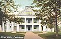
The York County Courthouse in Alfred, Maine.
See also
 In Spanish: Condado de York (Maine) para niños
