Wells, Maine facts for kids
Quick facts for kids
Wells, Maine
|
|||
|---|---|---|---|
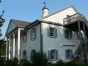
Town Hall
|
|||
|
|||
| Motto(s):
The Friendliest Town in Maine
|
|||
| Country | United States | ||
| State | Maine | ||
| County | York | ||
| Founded | 1643 | ||
| Incorporated | 1653 | ||
| Government | |||
| • Type | Town Meeting, Board of Selectmen, Town Manager | ||
| Area | |||
| • Total | 73.61 sq mi (190.6 km2) | ||
| • Land | 57.55 sq mi (149.1 km2) | ||
| • Water | 16.06 sq mi (41.6 km2) | ||
| Elevation | 177 ft (54 m) | ||
| Population
(2020)
|
|||
| • Total | 11,314 | ||
| • Density | 153.702/sq mi (59.345/km2) | ||
| Time zone | UTC−05:00 (EST) | ||
| • Summer (DST) | UTC−04:00 (EDT) | ||
| ZIP Codes |
04054 (Moody)
04090 (Wells) |
||
| Area code(s) | 207 | ||
| FIPS code | 23-81475 | ||
| GNIS feature ID | 0582799 | ||
Wells is a charming town located in York County, Maine, United States. It was founded in 1643, making it the third-oldest town in Maine. In 2020, the population was 11,314 people. Wells Beach is a very popular spot, especially during the summer months.
Contents
Discover Wells, Maine
Wells is a historic and beautiful town on the southern coast of Maine. It's known for its lovely beaches and rich history. Many people visit Wells to enjoy its natural beauty and friendly atmosphere.
A Glimpse into Wells' Past
Wells has a long and interesting history, dating back to the early days of colonial America. It played an important role in the development of Maine.
Early Beginnings and Growth
An immigrant named Edmund Littlefield came from England. He built the first gristmill and later a woolen mill on the Webhannet River. People called him "The Father of Wells" because of his important contributions. A monument in town remembers his work.
In 1622, a company in England gave land to Sir Ferdinando Gorges, who was the Lord Proprietor of Maine. This land included the area that would become Wells. In 1641, his cousin, Thomas Gorges, allowed Rev. John Wheelwright and other settlers to live on the land. This area stretched from the Ogunquit River to the Kennebunk River.
After Sir Gorges passed away in 1647, the Massachusetts Bay Colony claimed Maine. On July 5, 1653, Wells officially became a town. It was the third town in Maine to be incorporated. The town was named after Wells, England, a small city with a cathedral.
Wells' Role in History
Wells was an important frontier settlement for the English colonists. Other attempts to settle further north in Maine were often stopped. This was due to conflicts with Native American communities. These groups were protecting their lands. Wells faced three major challenges, including a famous event in 1692. The area became safer after a battle in Louisburg in 1745.
Many early settlers from Wells joined the Continental Army. Some became heroes in the American Revolutionary War. These included Captains Samuel Gooch, Nathanial Littlefield, and Jeremiah Storer. Ocean View Cemetery has a Civil War monument. It honors those who served. You can also visit Founder's Park. It has a walking trail, picnic area, and the site of the first settlement home. Monuments there list the names of Wells' founding families.
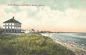
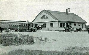
The town started as a farming community. Farmers grew hay and vegetables. Other important jobs included shipbuilding and fishing. In the 1800s, the railroad arrived. This brought many tourists to the town's sandy beaches. Many inns and hotels were built along the coast. Today, tourism is still a big part of Wells' economy.
Modern Wells: A Community Celebrates
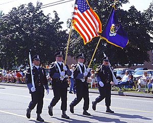
In 2003, Wells celebrated its 350th anniversary. It was a year-long party! Events included a New Year's Eve celebration with fireworks. There was also a parade and a visit from a Russian circus. Concerts and historical reenactments also took place. The town asked Kristi Borst to design a town flag. Her design shows Wells' history, farming, and focus on tourism. It also includes the motto: "Proud of our Past, Ready for our Future."
Exploring Wells' Natural Beauty
Wells is located on the beautiful southern coast of Maine. It offers stunning views and natural areas to explore.
Where is Wells Located?
Wells is surrounded by other towns. To the northeast is Kennebunk. To the northwest is Sanford. North Berwick is to the west. South Berwick and York are to the southwest. Ogunquit is to the south.
The town covers about 73.61 square miles (190.65 km2) in total. About 57.55 square miles (149.05 km2) is land, and 16.06 square miles (41.60 km2) is water. The Webhannet River flows through Wells. The highest point is Pine Hill, which is 360 feet (110 m) above sea level. The lowest point is sea level along the Atlantic Ocean. Wells is part of the larger Portland-South Portland-Biddeford Metropolitan Statistical Area.
People of Wells: Community Life
Wells is home to a vibrant community. According to the 2020 United States census, 11,314 people live here. The town has grown quite a bit over the years, welcoming new families and visitors.
| Historical population | |||
|---|---|---|---|
| Census | Pop. | %± | |
| 1790 | 3,070 | — | |
| 1800 | 3,692 | 20.3% | |
| 1810 | 4,489 | 21.6% | |
| 1820 | 2,660 | −40.7% | |
| 1830 | 2,978 | 12.0% | |
| 1840 | 2,978 | 0.0% | |
| 1850 | 2,945 | −1.1% | |
| 1860 | 2,878 | −2.3% | |
| 1870 | 2,773 | −3.6% | |
| 1880 | 2,450 | −11.6% | |
| 1890 | 2,029 | −17.2% | |
| 1900 | 2,007 | −1.1% | |
| 1910 | 1,908 | −4.9% | |
| 1920 | 1,943 | 1.8% | |
| 1930 | 2,047 | 5.4% | |
| 1940 | 2,144 | 4.7% | |
| 1950 | 2,321 | 8.3% | |
| 1960 | 3,528 | 52.0% | |
| 1970 | 4,448 | 26.1% | |
| 1980 | 8,211 | 84.6% | |
| 1990 | 7,778 | −5.3% | |
| 2000 | 9,400 | 20.9% | |
| 2010 | 9,589 | 2.0% | |
| 2020 | 11,314 | 18.0% | |
Fun Things to Do in Wells
Wells offers many exciting places to visit and activities to enjoy. From sandy beaches to interesting museums, there's something for everyone.
Beaches and Outdoor Adventures
Wells has several beautiful beaches. These include Drakes Island Beach, East Shore Beach, Wells Beach, and Moody Beach. They are perfect for swimming, sunbathing, and playing in the sand.
You can also explore the Rachel Carson National Wildlife Refuge. Or visit the Wells National Estuarine Research Reserve and Laudholm Farm. These places are great for learning about nature and seeing local wildlife. The Eastern Trail is a multi-use path. It's part of the East Coast Greenway and great for walking or biking.
Museums and Learning Spots
For history buffs, there's the Division 9 Schoolhouse Museum. The Meetinghouse Museum and Library is also interesting. It's located where the First Congregational Church of Wells once stood. Don't forget to check out the famous Maine Diner for a tasty meal!
Learning and Growing in Wells
Wells has a strong focus on education, with schools for all ages.
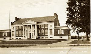
The Wells-Ogunquit Community School District serves students from kindergarten through high school. This includes Wells Elementary School (K-4), Wells Junior High School (5-8), and Wells High School (9-12). The Wells High School Football team has won seven state championships!
York County Community College is also in Wells. It's a public college that opened in 1995. It helps students learn skills for many different careers.
Getting Around Wells
Wells has good transportation options, making it easy to travel in and out of town.
Highways
Major roads include Interstate 95 (Exit 19 on the Maine Turnpike). Also, U.S. Route 1, Maine State Route 9, Maine State Route 9A, and Maine State Route 109 pass through Wells.
Railways
The Pan Am Railways mainline runs through town. You can also catch an Amtrak train at the Wells Regional Transportation Center. The Downeaster train stops here.
Famous Faces from Wells
Many notable people have connections to Wells.
- George Burroughs, a clergyman involved in the Salem witch trials
- Kathleen Chase, a Maine state representative
- Ronald F. Collins, a Maine state senator
- Jonathan Courtney, a Maine state senator
- Nate Dingle, an NFL football player
- Daniel W. Gooch, a US congressman
- Ivory Kimball, a judge
- Steve Lavigne, a comic book illustrator
- Nathaniel Littlefield, a U.S. congressman and Revolutionary War captain
- Ryan Peters (stage name Spose), a rapper
- John Fairfield Scamman, a US congressman
- John Storer, who founded Storer College
- Bob Tewksbury, a former MLB pitcher
- Luis Tiant, a famous Boston Red Sox player
- Guy Tripp, a business executive and U.S. Army brigadier general
- Esther Wheelwright, Mother Superior of the Ursuline order in Quebec City
- John Wheelwright, a clergyman and original settler of Wells
- Bob Winn, a distance runner and local politician
See also
 In Spanish: Wells (Maine) para niños
 | Madam C. J. Walker |
 | Janet Emerson Bashen |
 | Annie Turnbo Malone |
 | Maggie L. Walker |


