Waterboro, Maine facts for kids
Quick facts for kids
Waterboro
|
|
|---|---|

Little Ossipee Lake
|
|
| Country | United States |
| State | Maine |
| County | York |
| Incorporated | 1787 |
| Government | |
| • Type | Board Of Selectmen - Town Meeting |
| Area | |
| • Total | 57.16 sq mi (148.04 km2) |
| • Land | 55.33 sq mi (143.30 km2) |
| • Water | 1.83 sq mi (4.74 km2) |
| Elevation | 797 ft (243 m) |
| Population
(2020)
|
|
| • Total | 7,936 |
| • Density | 143/sq mi (55.4/km2) |
| Time zone | UTC-5 (Eastern (EST)) |
| • Summer (DST) | UTC-4 (EDT) |
| ZIP code |
04087,04061,04030
|
| Area code(s) | 207 |
| FIPS code | 23-80530 |
| GNIS feature ID | 0582793 |
Waterboro is a town located in York County, Maine, in the United States. In 2020, about 7,936 people lived there. It is part of the larger Portland metropolitan area.
The town has different areas like North, South, and East Waterboro. It is also home to the Lake Arrowhead Community. This community is one of the biggest developments in southern Maine. Its creation led to new rules for how towns plan their growth in Maine.
Contents
History of Waterboro
Early Beginnings and Naming
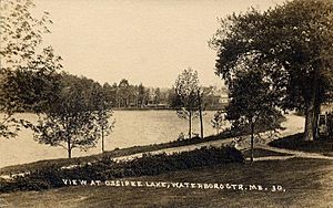
The Abenaki Indians first lived in this area. They called it Massabesic, which means "the place of much water." This name referred to the many lakes in the region.
In 1661, Major William Phillips from Saco bought a large piece of land from Chief Fluellin. This land was known as Massabesic Plantation. It included most of what is now Waterboro, Alfred, and Sanford. After Phillips died, the land was passed down to 10 owners. One of these owners was Colonel Joshua Waters, and the town was later named after him.
Growth and Changes
Lumbering (cutting down trees for wood) became important around 1764. Captain John Smith was the first person to settle there permanently in 1768. On March 6, 1787, the area officially became a town called Waterborough.
In 1790, a court was set up in Old Corners, a part of Waterboro. However, in 1805, the main county court moved to Alfred. In 1895, the town's name was made shorter to Waterboro.
Industries and Development
The land in Waterboro was good for raising livestock, so agriculture became a main industry. Many farms raised cattle and produced milk. The Portland and Rochester Railroad came through Waterboro in 1871. This helped the town grow and develop.
The local rivers and brooks provided water power for mills. Many sawmills were built to cut wood. By 1886, the town produced a lot of lumber each year. Other businesses included the Ossipee Manufacturing Company, which made blankets, and the Steam Mill Company, which made wooden boxes. Later, a spinning mill was built in 1922.
Fires and Nature
Waterboro was hit by big fires twice. In 1911, a large part of South Waterboro burned down. Then, during the Great Fires of 1947, three-quarters of Waterboro's land burned. This included the town center and most of the small houses around Little Ossipee Lake.
Today, Waterboro's lakes are still popular for fun activities. The town is also home to the Waterboro Barrens. This is a large area of pitch pine trees, and it's one of the best-preserved in Maine.
On October 16, 2012, a moderate earthquake shook Waterboro and other parts of Maine. It was also felt in nearby states like New Hampshire and Massachusetts.
Geography and Location
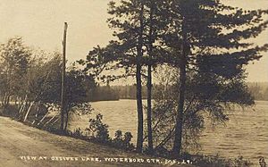
Waterboro covers about 57.16 square miles (148.04 km2). Most of this area is land, with about 1.83 square miles (4.74 km2) being water. Lake Arrowhead is on the northern edge of the town. The Little Ossipee River flows through Waterboro.
Little Ossipee Lake is the biggest body of water in the town. Ossipee Mountain is the highest point, reaching 1058 feet (322 meters) above sea level.
Waterboro is connected by U.S. Route 202 and state routes 4 and 5. It shares borders with several other towns. These include Alfred, Lyman, Hollis, Limerick, Limington, Newfield, and Shapleigh.
Population Data
| Historical population | |||
|---|---|---|---|
| Census | Pop. | %± | |
| 1790 | 971 | — | |
| 1800 | 1,253 | 29.0% | |
| 1810 | 1,395 | 11.3% | |
| 1820 | 1,762 | 26.3% | |
| 1830 | 1,814 | 3.0% | |
| 1840 | 1,944 | 7.2% | |
| 1850 | 1,989 | 2.3% | |
| 1860 | 1,824 | −8.3% | |
| 1870 | 1,548 | −15.1% | |
| 1880 | 1,482 | −4.3% | |
| 1890 | 1,357 | −8.4% | |
| 1900 | 1,169 | −13.9% | |
| 1910 | 997 | −14.7% | |
| 1920 | 942 | −5.5% | |
| 1930 | 914 | −3.0% | |
| 1940 | 947 | 3.6% | |
| 1950 | 1,071 | 13.1% | |
| 1960 | 1,059 | −1.1% | |
| 1970 | 1,208 | 14.1% | |
| 1980 | 2,943 | 143.6% | |
| 1990 | 4,510 | 53.2% | |
| 2000 | 6,214 | 37.8% | |
| 2010 | 7,693 | 23.8% | |
| 2020 | 7,936 | 3.2% | |
How Many People Live Here?
In 2010, there were 7,693 people living in Waterboro. There were 2,775 households, and 2,095 families. The town had about 139 people per square mile.
Most of the people living in Waterboro were White (97.3%). A small number were African American, Native American, or Asian. About 0.9% of the population was Hispanic or Latino.
Age and Households
The average age of people in Waterboro was 36.6 years old.
- About 27.7% of residents were under 18.
- About 29.5% were between 25 and 44 years old.
- About 8.2% were 65 years or older.
Most households (60.8%) were married couples living together. About 41.1% of households had children under 18 living with them.
Education in Waterboro
Waterboro is home to several schools. These include Massabesic High School, Massabesic Middle School, and Waterboro Elementary School. The town is part of a school district called Regional School Unit 57 (RSU 57). This district also includes five other towns: Alfred, Limerick, Lyman, Newfield, and Shapleigh.
In 2007, Massabesic Junior High became Massabesic High School's Freshmen Academy. This happened after the new Massabesic Middle School was built. The middle school also has a section for sixth graders from Waterboro Elementary School. The mascot for the school district is the "Mustangs."
Places to Visit
Notable People
- Amos L. Allen, a US congressman
See also
 In Spanish: Waterboro (Maine) para niños
 | Toni Morrison |
 | Barack Obama |
 | Martin Luther King Jr. |
 | Ralph Bunche |


