
Kennebunkport, Maine facts for kids
Quick facts for kids
Kennebunkport, Maine
|
|||
|---|---|---|---|

Downtown during the Christmas season, looking towards Dock Square
|
|||
|
|||

Kennebunkport, Maine
Location in Maine
|
|||
| Country | United States | ||
| State | Maine | ||
| County | York | ||
| Incorporated | July 5, 1653 | ||
| Government | |||
| • Type | Town Meeting | ||
| Area | |||
| • Land | 18.6 sq mi (48 km2) | ||
| Elevation | 26 ft (8 m) | ||
| Population | |||
| • Total | 3,629 | ||
| • Density | 195.1/sq mi (75.3/km2) | ||
| Time zone | UTC-5 (Eastern (EST)) | ||
| • Summer (DST) | UTC-4 (EDT) | ||
| ZIP code |
04046
|
||
| Area code(s) | 207 | ||
| FIPS code | 23-36745 | ||
| GNIS feature ID | 0582540 | ||


Kennebunkport is a popular resort town in York County, Maine, United States. In 2020, about 3,629 people lived there. It is part of the larger Portland area.
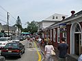
The town center, called Dock Square, is located along the Kennebunk River. It is about 1 mile (1.6 km) from where the river meets the Atlantic Ocean. Kennebunkport was once known for shipbuilding and fishing. For over 100 years, it has been a favorite summer spot and tourist destination by the sea.
Dock Square has many shops, art galleries, and seafood restaurants. You can also find places to stay, like bed and breakfasts. Cape Porpoise is another village in Kennebunkport. It is still a working fishing harbor. It also has a small village area with restaurants, a church, and a library. Kennebunkport is known as a summer getaway for wealthy people. It is one of the richest communities in Maine.
The town of Kennebunkport includes several smaller villages. These include Kennebunkport Village, Cape Arundel, Goose Rocks Beach, and Cape Porpoise Village. The town is also home to Walker's Point. This is a summer home for the Bush family.
Kennebunkport shares a school district (RSU 21) with the nearby towns of Kennebunk and Arundel.
Every year, the town hosts the Kennebunkport Christmas Prelude. This special event starts in late November or early December.
Contents
History of Kennebunkport
Kennebunkport was first set up as a town in 1653. It was called Cape Porpus back then. It was part of the Massachusetts Bay Colony. Maine became a state in 1820.
Native American groups, like the Abenaki Indians, resisted the settlers. European settlers left the town around 1689. They did not return for at least ten years. The Wabanaki Confederacy also forced the English out from 1703 to 1717. They continued to fight until 1748.
The town was later renamed Arundel. The town center moved inland to Burbank Hill. On August 8, 1782, Arundel was attacked by two ships. These ships were loyal to the British during the American Revolution. A battle happened between the ships and the local militia.
In 1821, the town was renamed again to Kennebunkport. This new name showed that the town's economy was now focused on shipbuilding and trade along the Kennebunk River.
By the 1870s, Kennebunkport became a popular place for summer vacations. Many hotels and homes were built along the coast. Cape Arundel and Goose Rocks were some of the first summer communities. Cape Porpoise remained a working fishing harbor. Since 1939, Kennebunkport has been home to the Seashore Trolley Museum.
The Great Fires of 1947 caused a lot of damage in York County. Kennebunkport was also affected, especially the area near Goose Rocks Beach. Many homes there were destroyed. However, the area has since been rebuilt.
Land and Landscape
The way the coast of southern Maine looks was shaped by a giant ice sheet. This ice sheet, called the Laurentide ice cap, melted about 23,000 years ago. The coast has many rocks that were formed when the Appalachian mountains were created. The uneven shape of the coast is due to different types of rock wearing away at different speeds.
Kennebunkport's coast is different from the coast north of Portland, Maine. Here, the coast has a mix of igneous rock. It also has bays with softer sedimentary and metamorphic rock that have worn away more. These bays create the sandy beaches found in southern Maine. Examples include Goose Rocks Beach and Colony Beach. These sandy beaches are not common north of Portland.
Geography of Kennebunkport
Kennebunkport covers about 49.35 square miles (127.8 km²). About 20.52 square miles (53.1 km²) is land, and 28.83 square miles (74.7 km²) is water.
The town has several unique areas. Each area developed at a different time in the town's history.
- Cape Porpoise: This was the original town center. Today, it is a small village. It is both a summer spot and a year-round community. It also has a working fishing harbor.
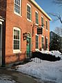
- Burbank Hill: Inland from Cape Porpoise, this area has forests and farms. It also has a historic town center with old buildings like a schoolhouse and a jail.
- Dock Square: This is the current town center. It is located west, near the mouth of the Kennebunk River.
- Cape Arundel: In the late 1800s and early 1900s, this area became a summer colony for wealthy people. The Cape Arundel Summer Colony Historic District has many well-preserved old homes. These homes are built in a style called "shingle-style cottages." This district runs along Ocean Avenue, from Chick's Creek to Walker's Point.
Neighboring Towns
Kennebunkport is next to these towns:
Rachel Carson National Wildlife Refuge
A large part of the Rachel Carson National Wildlife Refuge is in Kennebunkport. This protected land is northeast of Cape Porpoise and goes through Goose Rocks. Much of this area in Kennebunkport is a salt-water marsh.
Climate
Kennebunkport has a climate with big changes in temperature throughout the year. Summers are warm to hot and often humid. Winters are cold, sometimes very cold. This type of climate is called a humid continental climate.
| Climate data for Kennebunkport, Maine (1991–2020 normals, extremes 1989–present) | |||||||||||||
|---|---|---|---|---|---|---|---|---|---|---|---|---|---|
| Month | Jan | Feb | Mar | Apr | May | Jun | Jul | Aug | Sep | Oct | Nov | Dec | Year |
| Record high °F (°C) | 63 (17) |
68 (20) |
77 (25) |
91 (33) |
92 (33) |
97 (36) |
99 (37) |
96 (36) |
93 (34) |
84 (29) |
75 (24) |
75 (24) |
99 (37) |
| Mean maximum °F (°C) | 51 (11) |
52 (11) |
60 (16) |
73 (23) |
82 (28) |
88 (31) |
91 (33) |
88 (31) |
83 (28) |
74 (23) |
64 (18) |
56 (13) |
93 (34) |
| Mean daily maximum °F (°C) | 32.7 (0.4) |
34.9 (1.6) |
41.2 (5.1) |
52.0 (11.1) |
61.6 (16.4) |
70.8 (21.6) |
76.9 (24.9) |
76.0 (24.4) |
69.3 (20.7) |
58.6 (14.8) |
48.3 (9.1) |
38.8 (3.8) |
55.1 (12.8) |
| Daily mean °F (°C) | 22.9 (−5.1) |
24.7 (−4.1) |
32.0 (0.0) |
42.1 (5.6) |
52.1 (11.2) |
61.5 (16.4) |
67.3 (19.6) |
66.2 (19.0) |
59.1 (15.1) |
48.1 (8.9) |
38.7 (3.7) |
29.4 (−1.4) |
45.3 (7.4) |
| Mean daily minimum °F (°C) | 13.1 (−10.5) |
14.4 (−9.8) |
22.7 (−5.2) |
32.3 (0.2) |
42.7 (5.9) |
52.3 (11.3) |
57.8 (14.3) |
56.5 (13.6) |
48.9 (9.4) |
37.5 (3.1) |
29.2 (−1.6) |
20.0 (−6.7) |
35.6 (2.0) |
| Mean minimum °F (°C) | −6 (−21) |
−4 (−20) |
4 (−16) |
21 (−6) |
29 (−2) |
40 (4) |
46 (8) |
44 (7) |
33 (1) |
24 (−4) |
14 (−10) |
3 (−16) |
−9 (−23) |
| Record low °F (°C) | −20 (−29) |
−19 (−28) |
−10 (−23) |
13 (−11) |
16 (−9) |
34 (1) |
35 (2) |
29 (−2) |
19 (−7) |
12 (−11) |
−3 (−19) |
−15 (−26) |
−20 (−29) |
| Average precipitation inches (mm) | 3.65 (93) |
3.71 (94) |
4.68 (119) |
4.73 (120) |
4.21 (107) |
4.69 (119) |
3.90 (99) |
3.88 (99) |
3.93 (100) |
5.63 (143) |
4.17 (106) |
4.82 (122) |
52 (1,321) |
| Average snowfall inches (cm) | 13.3 (34) |
13.3 (34) |
9.8 (25) |
1.3 (3.3) |
0 (0) |
0 (0) |
0 (0) |
0 (0) |
0 (0) |
0.1 (0.25) |
0.7 (1.8) |
10.4 (26) |
48.9 (124.35) |
| Average extreme snow depth inches (cm) | 12 (30) |
13 (33) |
12 (30) |
2 (5.1) |
0 (0) |
0 (0) |
0 (0) |
0 (0) |
0 (0) |
0 (0) |
1 (2.5) |
7 (18) |
18 (46) |
| Average precipitation days (≥ 0.01 in) | 11 | 9 | 11 | 12 | 13 | 13 | 11 | 10 | 10 | 12 | 11 | 12 | 135 |
| Average snowy days (≥ 0.1 in) | 6 | 5 | 3 | 1 | 0 | 0 | 0 | 0 | 0 | 0 | 1 | 4 | 18 |
| Source: NOAA | |||||||||||||
Summer Home of the Bush Family
Kennebunkport is famous for being the summer home of former U.S. President George H. W. Bush. He was the father of another former U.S. President, George W. Bush. The home was first built by George H. W. Bush's grandfather, George Herbert Walker. It has been a family home ever since. The Bush family has owned it since the early 1980s.
During his time as president, George H. W. Bush often invited important world leaders to Kennebunkport. Leaders like Margaret Thatcher and Mikhail Gorbachev visited him there. In 2007, his son, George W. Bush, invited Vladimir Putin and Nicolas Sarkozy to the compound. The Bush compound is on Walkers Point. This area was called Point Vesuvius before the Walker family bought it.
Population and People
| Historical population | |||
|---|---|---|---|
| Census | Pop. | %± | |
| 1830 | 2,763 | — | |
| 1840 | 2,768 | 0.2% | |
| 1850 | 2,706 | −2.2% | |
| 1860 | 2,668 | −1.4% | |
| 1870 | 2,372 | −11.1% | |
| 1880 | 2,405 | 1.4% | |
| 1890 | 2,196 | −8.7% | |
| 1900 | 2,123 | −3.3% | |
| 1910 | 2,130 | 0.3% | |
| 1920 | 1,431 | −32.8% | |
| 1930 | 1,284 | −10.3% | |
| 1940 | 1,448 | 12.8% | |
| 1950 | 1,522 | 5.1% | |
| 1960 | 1,851 | 21.6% | |
| 1970 | 2,160 | 16.7% | |
| 1980 | 2,952 | 36.7% | |
| 1990 | 3,356 | 13.7% | |
| 2000 | 3,720 | 10.8% | |
| 2010 | 3,474 | −6.6% | |
| 2020 | 3,629 | 4.5% | |
| U.S. Decennial Census | |||
In 2000, the average income for a household in Kennebunkport was about $54,219 per year. For families, the average income was about $66,505. About 4.4% of the people in Kennebunkport lived below the poverty line. This included 4.4% of those under 18 years old.
2010 Census Information
In 2010, there were 3,474 people living in Kennebunkport. There were 1,578 households and 1,039 families. The town had about 169.3 people per square mile (65.4/km²).
Most of the people in Kennebunkport were White (99.0%). There were also small numbers of African American, Native American, and Asian residents. About 0.9% of the population was Hispanic or Latino.
About 22.1% of households had children under 18 living with them. Most households (56.7%) were married couples living together. About 28.6% of all households were single individuals. About 13.1% of people lived alone and were 65 years or older.
The average age in Kennebunkport was 51.8 years. About 17.9% of residents were under 18. About 24.7% were 65 years or older. The population was 47.5% male and 52.5% female.
Notable People

Many interesting people have lived in or are from Kennebunkport:
- Margaret Deland, a novelist
- Patrick Dempsey, an actor
- Dan Goodwin, a famous climber
- Frank Handlen, a painter
- Garnet Hathaway, a professional ice hockey player
- Joshua Herrick, a US congressman
- Dick McCabe, a racing driver
- Wiley Miller, a cartoonist
- Jane Morgan, a singer and actress
- Russell Nype, an actor
- George Clement Perkins, a former governor of California
- Kenneth Roberts, an author
- Rex Smith, an American singer and actor
- Booth Tarkington, a novelist and playwright
- George Herbert Walker, a banker and businessman. He was the grandfather of US President George H. W. Bush.
- Bentley Warren, a racecar driver
- Neil Clark Warren, who started an online dating service
Images for kids
-
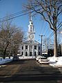
South Congregational Church
-
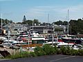
The harbor
-
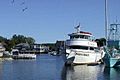
Boats on the Kennebunk River
-
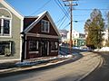
Businesses on Ocean Avenue
-
View of Dock Square
-
Louis T. Graves Memorial Public Library
-
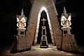
Monument dedicated to Lithuanians who died fighting for Lithuania's freedom
-

Protestors on Ocean Ave. near the Bush Compound, in 2008
-
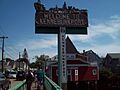
Kennebunkport welcome sign and town line, in 2008


See also
 In Spanish: Kennebunkport para niños
