
Durham, New Hampshire facts for kids
Quick facts for kids
Durham, New Hampshire
|
||
|---|---|---|
|
Town
|
||

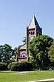
Thompson Hall on the University of New Hampshire campus
|
||
|
||

Location within Strafford County, New Hampshire
|
||
| Country | United States | |
| State | New Hampshire | |
| County | Strafford | |
| Settled | 1635 | |
| Incorporated | 1732 | |
| Area | ||
| • Total | 24.7 sq mi (64.1 km2) | |
| • Land | 22.4 sq mi (58.0 km2) | |
| • Water | 2.4 sq mi (6.1 km2) 9.50% | |
| Elevation | 50 ft (20 m) | |
| Population
(2020)
|
||
| • Total | 15,490 | |
| • Density | 691/sq mi (266.8/km2) | |
| Time zone | UTC-5 (EST) | |
| • Summer (DST) | UTC-4 (EDT) | |
| ZIP code |
03824
|
|
| Area code(s) | 603 | |
| FIPS code | 33-19700 | |
| GNIS feature ID | 0873584 | |

Durham is a town located in Strafford County, New Hampshire, in the United States. In 2020, about 15,490 people lived there. Durham is famous for being the home of the University of New Hampshire.
The main part of town, where most people live, is called the Durham census-designated place (CDP). This area includes the university campus and the busy streets around New Hampshire Route 108 and Main Street.
Contents
A Look at Durham's History

Durham is located next to Great Bay and the Oyster River. This was a perfect spot for the Western Abenaki people and their ancestors, who have lived in this area for about 11,000 years. The Oyster River (once called Shankhassick) provided shellfish and access to forests for hunting. The sea offered food and trade routes. Open fields were easy to farm. The Abenaki called their settlement Wecannecohunt.
English settlers first came to this region in 1622. King James I gave a large piece of land to Sir Fernandino Gorges and John Mason. This land included what is now New England. Gorges and Mason decided to split the land along the Piscataqua River. Gorges took the eastern part, which became Maine. Mason took the western part, which became New Hampshire. The Abenaki people called this whole area "N'dakinna". It was their traditional homeland.
The first colonists arrived in Wecannecohunt in 1622. They spent their early years fishing, cutting wood, and trapping animals. They sold salted fish, lumber, and fur to Europe. By 1633, settlers lived all along the Oyster River. By 1640, they owned land up to the river's fall line. The area was first known as the Oyster River Plantation.
The English settlers brought many animals like cattle, pigs, sheep, and horses. These animals needed a lot of land for grazing. They trampled and destroyed the Abenaki's carefully farmed fields. This caused many problems over food, land, and rights. Sometimes, when fighting broke out, the Abenaki would kill the livestock because they saw them as a threat to their own food.
During King William's War, on July 18, 1694, the English settlement was attacked. A French soldier named Claude-Sébastien de Villieu and about 250 Abenaki warriors led by their chief, Bomazeen, raided the area. In this attack, known as the Raid on Oyster River, 104 people were killed and 27 were taken captive. Half of the homes were burned down.
Oyster River was part of Dover for its first 100 years. It became an independent parish in 1716. In 1732, it officially became a town and was renamed Durham.
Benjamin Thompson, whose family was among the early settlers, left his money and family farm to the state. He wanted an agricultural college to be built. This college, the New Hampshire College of Agriculture and the Mechanic Arts, started in Hanover in 1866. It moved to Durham in 1893 and became the University of New Hampshire in 1923. Thompson Hall, a building with a famous clock tower, was built in 1892 and named after him.
In 1999, Durham hosted a debate for Republican candidates running for president in the 2000 United States Presidential Election. Future president George W. Bush was there, along with other well-known politicians like John McCain.
In 2017, Durham was the first community in New Hampshire to celebrate Indigenous Peoples' Day instead of Columbus Day. The next year, the Oyster River Cooperative School District also adopted Indigenous Peoples' Day for its school calendar.
Libraries in Durham
Over the years, Durham has had several libraries:
- Durham Social Library (1815–1857): This was one of the first libraries, with hundreds of books.
- Durham Agricultural Library (1862–1881): This smaller library focused on books about farming.
- Durham Public Library (1892–1906): This was the town's first true "public" library. It had over 3,500 books.
- Library of the New Hampshire College of Agriculture and the Mechanic Arts (1893–): When the college moved to Durham, it brought its library. In 1907, a new building called Hamilton Smith Hall was completed for the library.
- Dimond Library (1958): A new, modern library building was built on the University of New Hampshire campus.
In 1997, Durham voters decided to create a new public library. A temporary library opened in a storefront. Many volunteers helped to set it up. In 2013, a brand new public library building was finished on Madbury Road.
Police Department
Durham has had a police force since at least 1848. The Durham Police Department has 21 full-time and 2 part-time officers. They provide service 24 hours a day.
The police department has an "Adopt-A-Cop" program. In this program, police officers work with university fraternities. They attend meetings and events to build better relationships between the students and the community.
Fire Department and EMS
The first fire department in Durham was started in 1927. The first paid firefighter was hired in 1934. The Durham Fire Department is special because it gets money from both the town and the university.
McGregor Memorial EMS is a non-profit group that provides emergency medical services and training to the New Hampshire Seacoast area. They have been helping since 1968.
Durham's Geography
Durham covers about 64.1 square kilometers (24.7 square miles). Most of this is land, but about 6.1 square kilometers (2.4 square miles) is water. The town is drained by the Oyster River. The highest point in Durham is Beech Hill, which is about 50 feet (15 meters) above sea level. Durham is part of the Piscataqua River watershed, which means its water flows towards the coast.
Neighboring Towns
Durham shares borders with these towns:
Getting Around
You can travel to Durham by train! Amtrak's Downeaster train stops at Durham–UNH station. You can take the train north to places like Portland and Brunswick, Maine, or south to Boston's North Station.
Durham's Climate
Durham has a warm-summer humid continental climate. This means it has warm summers and cold, snowy winters.
| Climate data for Durham, New Hampshire, 1991–2020 normals, extremes 1893–present | |||||||||||||
|---|---|---|---|---|---|---|---|---|---|---|---|---|---|
| Month | Jan | Feb | Mar | Apr | May | Jun | Jul | Aug | Sep | Oct | Nov | Dec | Year |
| Record high °F (°C) | 68 (20) |
73 (23) |
89 (32) |
95 (35) |
99 (37) |
102 (39) |
103 (39) |
102 (39) |
99 (37) |
91 (33) |
80 (27) |
74 (23) |
103 (39) |
| Mean maximum °F (°C) | 54.1 (12.3) |
56.1 (13.4) |
65.7 (18.7) |
80.0 (26.7) |
88.7 (31.5) |
92.3 (33.5) |
93.9 (34.4) |
92.5 (33.6) |
88.5 (31.4) |
77.9 (25.5) |
68.3 (20.2) |
57.8 (14.3) |
95.8 (35.4) |
| Mean daily maximum °F (°C) | 32.9 (0.5) |
36.1 (2.3) |
44.6 (7.0) |
57.8 (14.3) |
68.4 (20.2) |
77.1 (25.1) |
82.5 (28.1) |
81.1 (27.3) |
73.3 (22.9) |
60.6 (15.9) |
48.3 (9.1) |
37.7 (3.2) |
58.4 (14.7) |
| Daily mean °F (°C) | 23.7 (−4.6) |
26.1 (−3.3) |
34.3 (1.3) |
45.8 (7.7) |
56.1 (13.4) |
65.2 (18.4) |
70.9 (21.6) |
69.3 (20.7) |
61.9 (16.6) |
49.8 (9.9) |
39.2 (4.0) |
29.3 (−1.5) |
47.6 (8.7) |
| Mean daily minimum °F (°C) | 14.4 (−9.8) |
16.2 (−8.8) |
24.0 (−4.4) |
33.9 (1.1) |
43.9 (6.6) |
53.4 (11.9) |
59.2 (15.1) |
57.4 (14.1) |
50.4 (10.2) |
39.1 (3.9) |
30.1 (−1.1) |
21.0 (−6.1) |
36.9 (2.7) |
| Mean minimum °F (°C) | −7.6 (−22.0) |
−5.0 (−20.6) |
2.8 (−16.2) |
20.8 (−6.2) |
29.8 (−1.2) |
40.3 (4.6) |
48.3 (9.1) |
45.6 (7.6) |
33.9 (1.1) |
24.4 (−4.2) |
14.5 (−9.7) |
2.3 (−16.5) |
−10.6 (−23.7) |
| Record low °F (°C) | −35 (−37) |
−30 (−34) |
−18 (−28) |
8 (−13) |
18 (−8) |
30 (−1) |
35 (2) |
28 (−2) |
21 (−6) |
11 (−12) |
−13 (−25) |
−31 (−35) |
−35 (−37) |
| Average precipitation inches (mm) | 2.65 (67) |
3.04 (77) |
3.49 (89) |
4.11 (104) |
3.63 (92) |
3.96 (101) |
4.02 (102) |
3.77 (96) |
4.00 (102) |
4.72 (120) |
3.92 (100) |
4.04 (103) |
45.35 (1,153) |
| Average snowfall inches (cm) | 14.5 (37) |
13.2 (34) |
9.8 (25) |
2.5 (6.4) |
0.0 (0.0) |
0.0 (0.0) |
0.0 (0.0) |
0.0 (0.0) |
0.0 (0.0) |
0.2 (0.51) |
2.3 (5.8) |
11.4 (29) |
54.2 (138) |
| Average precipitation days (≥ 0.01 in) | 8.8 | 8.0 | 9.0 | 11.1 | 11.6 | 11.5 | 10.5 | 9.8 | 9.5 | 10.4 | 10.6 | 10.5 | 121.3 |
| Average snowy days (≥ 0.1 in) | 3.3 | 3.9 | 2.3 | 0.5 | 0.0 | 0.0 | 0.0 | 0.0 | 0.0 | 0.0 | 0.6 | 2.8 | 13.4 |
| Source 1: NOAA | |||||||||||||
| Source 2: National Weather Service | |||||||||||||
Durham's Population
| Historical population | |||
|---|---|---|---|
| Census | Pop. | %± | |
| 1790 | 1,247 | — | |
| 1800 | 1,126 | −9.7% | |
| 1810 | 1,449 | 28.7% | |
| 1820 | 1,538 | 6.1% | |
| 1830 | 1,606 | 4.4% | |
| 1840 | 1,498 | −6.7% | |
| 1850 | 1,497 | −0.1% | |
| 1860 | 1,534 | 2.5% | |
| 1870 | 1,298 | −15.4% | |
| 1880 | 962 | −25.9% | |
| 1890 | 871 | −9.5% | |
| 1900 | 996 | 14.4% | |
| 1910 | 823 | −17.4% | |
| 1920 | 749 | −9.0% | |
| 1930 | 1,217 | 62.5% | |
| 1940 | 1,533 | 26.0% | |
| 1950 | 4,770 | 211.2% | |
| 1960 | 5,504 | 15.4% | |
| 1970 | 8,869 | 61.1% | |
| 1980 | 10,652 | 20.1% | |
| 1990 | 11,818 | 10.9% | |
| 2000 | 12,664 | 7.2% | |
| 2010 | 14,638 | 15.6% | |
| 2020 | 15,490 | 5.8% | |
| U.S. Decennial Census | |||

The number of people living in Durham is greatly affected by the University of New Hampshire campus. In 2010, there were 14,638 people in the town. Many of these people, about 7,266, lived in university dorms or other group housing.
Most of the people in Durham are white (93.8%). There are also people of Asian (3.2%), African American (0.9%), and Native American (0.1%) backgrounds. About 2.0% of the population is Hispanic or Latino.
The average age in Durham is quite young, around 21 years old. This is because so many university students live there.
Famous People from Durham

Many interesting people have connections to Durham, including:
- Eliphalet Daniels (1713–1799), a military leader.
- Dudley Dudley (born 1936), an activist for politics and the environment.
- Jack Edwards (born 1957), a sports announcer for the Boston Bruins hockey team.
- Sam Fuld (born 1981), a former professional baseball player and current General Manager for the Philadelphia Phillies.
- Manuela Lutze (born 1974), an Olympic rower who won two gold medals.
- Joyce Maynard (born 1953), a writer.
- Hercules Mooney (1715–1800), a lieutenant colonel in the U.S. Revolutionary War.
- Deron Quint (born 1976), a professional hockey player.
- Daniel C. Stillson (1826–1899), who invented the Stillson pipe wrench.

- John Sullivan (1740–1795), a general during the Revolutionary War.
- Benjamin Thompson (1806–1890), a farmer and businessman who helped start the U.N.H..
Places to Visit in Durham
- Durham Historic Association & Museum
- New Hampshire Historical Marker No. 8: Site of Piscataqua Bridge
- New Hampshire Historical Marker No. 50: Oyster River Massacre
- New Hampshire Historical Marker No. 89: Major General John Sullivan, 1740–1795
- New Hampshire Historical Marker No. 154: Packer's Falls
Images for kids
-
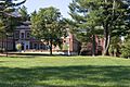
Pettee Hall
-
Taylor Hall
-
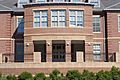
Murkland Hall
-
Thompson Hall
-
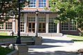
Dimond Library
-
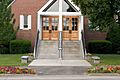
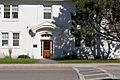
St. Thomas More Parish
-
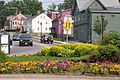
Downtown at Madbury Road and Main Street
-
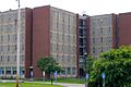
Babcock Hall


See also
 In Spanish: Durham (Nuevo Hampshire) para niños
