Strafford, New Hampshire facts for kids
Quick facts for kids
Strafford, New Hampshire
|
|
|---|---|
|
Town
|
|

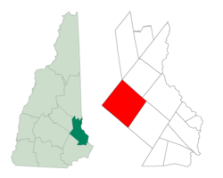
Location within Strafford County, New Hampshire
|
|
| Country | United States |
| State | New Hampshire |
| County | Strafford |
| Incorporated | 1820 |
| Villages |
|
| Area | |
| • Total | 51.2 sq mi (132.7 km2) |
| • Land | 49.0 sq mi (127.0 km2) |
| • Water | 2.2 sq mi (5.7 km2) |
| Elevation | 595 ft (181 m) |
| Population
(2020)
|
|
| • Total | 4,230 |
| • Density | 86/sq mi (33.3/km2) |
| Time zone | UTC-5 (EST) |
| • Summer (DST) | UTC-4 (EDT) |
| ZIP code |
03884
|
| Area code(s) | 603 |
| FIPS code | 33-73860 |
| GNIS feature ID | 0873726 |
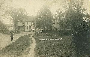
Strafford is a town in New Hampshire, United States. It is located in Strafford County. In 2020, about 4,230 people lived there. The two main areas in town are Center Strafford and Bow Lake Village.
Contents
History of Strafford
Strafford was once part of a larger town called Barrington. People living in Strafford found it too far to travel for town meetings. So, Strafford became its own town.
It was settled before the American Revolution. In 1820, Strafford officially became a town. It was named after Strafford County. Strafford County itself was named in 1773. This was done to honor Thomas Wentworth, who was the 1st Earl of Strafford.
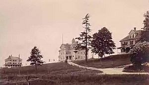
Austin-Cate Academy
The Austin Academy used to be in Center Strafford. George Cate, a rich shoe maker, visited the school. He was very impressed by it. When he passed away, he left a lot of money to the school. He asked that his name be added to the school's name.
After his death, a new building was built in 1903. It was designed by J. Edward Richardson. The school was then called "Austin-Cate Academy." Today, the state has bought the property. It is now used as a training center for the National Guard.
Geography of Strafford
Strafford covers about 132.7 square kilometers (51.2 square miles). Most of this area is land (127.0 square kilometers or 49.0 square miles). About 5.7 square kilometers (2.2 square miles) is water. This means water makes up about 4.27% of the town's total area.
Bow Lake is a large lake in the southern part of town. It covers about 1,160 acres. Several rivers flow through Strafford. These include the Isinglass River and its smaller branch, the Berrys River. The Big River also flows here.
The Isinglass River flows east towards the Cocheco River. This river eventually joins the Piscataqua River. The Big River flows west to the Suncook River. This river is part of the Merrimack River system.
The Blue Hills Range runs through the middle of Strafford. It goes from southwest to northeast. Parker Mountain is the highest point in this range. It is also the highest point in Strafford. It reaches about 1,420 feet (433 meters) above sea level.
Neighboring Towns
Strafford shares its borders with several other towns:
- Farmington (to the northeast)
- Rochester (to the east)
- Barrington (to the southeast)
- Northwood (to the southwest)
- Pittsfield (to the west)
- Barnstead (to the northwest)
Population Facts
| Historical population | |||
|---|---|---|---|
| Census | Pop. | %± | |
| 1820 | 2,144 | — | |
| 1830 | 2,200 | 2.6% | |
| 1840 | 2,021 | −8.1% | |
| 1850 | 1,920 | −5.0% | |
| 1860 | 2,047 | 6.6% | |
| 1870 | 1,669 | −18.5% | |
| 1880 | 1,531 | −8.3% | |
| 1890 | 1,304 | −14.8% | |
| 1900 | 1,040 | −20.2% | |
| 1910 | 786 | −24.4% | |
| 1920 | 764 | −2.8% | |
| 1930 | 617 | −19.2% | |
| 1940 | 714 | 15.7% | |
| 1950 | 770 | 7.8% | |
| 1960 | 722 | −6.2% | |
| 1970 | 965 | 33.7% | |
| 1980 | 1,663 | 72.3% | |
| 1990 | 2,965 | 78.3% | |
| 2000 | 3,626 | 22.3% | |
| 2010 | 3,991 | 10.1% | |
| 2020 | 4,230 | 6.0% | |
| U.S. Decennial Census | |||
In 2000, there were 3,626 people living in Strafford. These people lived in 1,281 households. About 1,022 of these were families. The town had about 73.7 people per square mile.
Most people in Strafford were White (98.48%). A small number were African American (0.14%), Native American (0.14%), or Asian (0.25%). Some people were from other races (0.06%) or from two or more races (0.94%). About 0.63% of the population was Hispanic or Latino.
Households and Families
Out of all households, 43.2% had children under 18 living there. Most households (68.5%) were married couples. About 8.2% had a female head of household with no husband. About 20.2% were not families.
About 15.1% of households were single people living alone. About 4.4% of these were people aged 65 or older. On average, there were 2.82 people per household. The average family had 3.14 people.
Age and Income
The population was spread out by age. About 30.0% were under 18. About 32.1% were between 25 and 44 years old. The median age in town was 37 years. This means half the people were younger than 37 and half were older.
The median income for a household in Strafford was $59,044. For families, the median income was $62,238. Males earned about $40,423 on average. Females earned about $30,524. The average income per person in the town was $23,500.
A very small number of families (1.0%) and people (1.9%) lived below the poverty line. This included 1.5% of those under 18 and 5.4% of those 65 or older.
Famous Person from Strafford
- Charles Simic (born 1938) was a famous poet. He was the fifteenth US Poet Laureate from 2007 to 2008.
See also
 In Spanish: Strafford (Nuevo Hampshire) para niños
 | Janet Taylor Pickett |
 | Synthia Saint James |
 | Howardena Pindell |
 | Faith Ringgold |


