Stratford, New Hampshire facts for kids
Quick facts for kids
Stratford, New Hampshire
|
|
|---|---|
|
Town
|
|

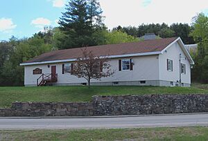
Town hall
|
|

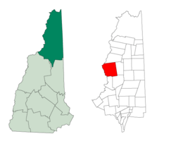
Location in Coös County, New Hampshire
|
|
| Country | United States |
| State | New Hampshire |
| County | Coös |
| Incorporated | 1773 |
| Villages | Beatties North Stratford Stratford Hollow |
| Area | |
| • Total | 79.8 sq mi (206.6 km2) |
| • Land | 79.2 sq mi (205.2 km2) |
| • Water | 0.5 sq mi (1.4 km2) 0.66% |
| Elevation | 890 ft (270 m) |
| Population
(2020)
|
|
| • Total | 662 |
| • Density | 8/sq mi (3.2/km2) |
| Time zone | UTC-5 (Eastern) |
| • Summer (DST) | UTC-4 (Eastern) |
| ZIP code |
03590
|
| Area code(s) | 603 |
| FIPS code | 33-74180 |
| GNIS feature ID | 0873727 |
Stratford is a small town in New Hampshire, United States. It is located in Coös County, right along the Connecticut River. In 2020, about 662 people lived here.
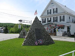
Stratford includes a few smaller areas called villages. These are North Stratford, Stratford Hollow, and Beatties. A main road, U.S. Route 3, goes through the town. There is also a railroad line, the St. Lawrence and Atlantic Railroad, which used to be part of the Grand Trunk Railway.
Stratford is part of the larger area around Berlin. A bridge called the Janice Peaslee Bridge connects Stratford to a town in Vermont called Maidstone, Vermont.
Contents
History of Stratford
The area that is now Stratford was first given out in 1762. Back then, it was called "Woodbury." Later, in 1773, it was officially given its current name, Stratford.
Geography and Nature
Stratford covers a total area of about 206.6 square kilometers (around 80 square miles). Most of this area is land, about 205.2 square kilometers. The rest, about 1.4 square kilometers, is water. This means water makes up less than 1% of the town's total area.
The highest point in Stratford is the top of a place called Sugarloaf. It stands about 3,700 feet (1,128 meters) above sea level.
Neighboring Towns
Stratford shares its borders with several other towns:
- To the north: Columbia
- To the east: Odell
- To the southeast: Stark
- To the south: Northumberland
- To the southwest: Maidstone, Vermont
- To the west: Brunswick, Vermont
- To the northwest: Bloomfield, Vermont
People of Stratford
| Historical population | |||
|---|---|---|---|
| Census | Pop. | %± | |
| 1790 | 146 | — | |
| 1800 | 281 | 92.5% | |
| 1810 | 339 | 20.6% | |
| 1820 | 335 | −1.2% | |
| 1830 | 443 | 32.2% | |
| 1840 | 441 | −0.5% | |
| 1850 | 552 | 25.2% | |
| 1860 | 716 | 29.7% | |
| 1870 | 886 | 23.7% | |
| 1880 | 1,016 | 14.7% | |
| 1890 | 1,128 | 11.0% | |
| 1900 | 968 | −14.2% | |
| 1910 | 844 | −12.8% | |
| 1920 | 794 | −5.9% | |
| 1930 | 918 | 15.6% | |
| 1940 | 1,049 | 14.3% | |
| 1950 | 973 | −7.2% | |
| 1960 | 1,029 | 5.8% | |
| 1970 | 980 | −4.8% | |
| 1980 | 989 | 0.9% | |
| 1990 | 927 | −6.3% | |
| 2000 | 942 | 1.6% | |
| 2010 | 746 | −20.8% | |
| 2020 | 662 | −11.3% | |
| U.S. Decennial Census | |||
In 2000, there were 942 people living in Stratford. These people lived in 397 households, and 235 of these were families. The population density was about 11.8 people per square mile.
About 26.7% of the households had children under 18 living with them. Many households (42.6%) were married couples. The average household had 2.37 people, and the average family had 3.03 people.
The median age in Stratford was 40 years old. This means half the people were older than 40 and half were younger. About 23.8% of the population was under 18.
Famous Person from Stratford
- Mary R. Platt Hatch (1848–1935), an author who wrote books.
See also
 In Spanish: Stratford (Nuevo Hampshire) para niños
 | Sharif Bey |
 | Hale Woodruff |
 | Richmond Barthé |
 | Purvis Young |


