
U.S. Route 3 facts for kids
Quick facts for kids
|
|
|---|---|
| Lua error in Module:Infobox_road/map at line 15: attempt to index field 'wikibase' (a nil value). | |
| Route information | |
| Length | 277.00 mi (445.79 km) |
| Existed | 1926–present |
| Major junctions | |
| South end | |
| North end | |
| Highway system | |
| United States Numbered Highways List • Bannered • Divided • Replaced |
|

U.S. Route 3 is a long road, also known as a highway, that stretches from Cambridge, Massachusetts all the way to the border of Canada. It's a really important route that connects many towns and cities in the northeastern United States.
What is U.S. Route 3?
U.S. Route 3 is a highway that helps people travel between states. It starts in Cambridge, Massachusetts, which is a city near Boston. From there, it goes north through the state of New Hampshire. Finally, it reaches the Canadian border, where it connects with another road in Quebec.
This highway is about 277 miles long. That's like driving from one end of a state to another! It was first established in 1926, which means it has been around for almost 100 years, helping people get where they need to go.
Where Does U.S. Route 3 Go?
U.S. Route 3 travels through two main states:
- Massachusetts: The highway begins in Cambridge. It passes through other towns like Arlington and Burlington. It also connects with bigger highways like Interstate 95 and Interstate 495.
- New Hampshire: After Massachusetts, Route 3 enters New Hampshire. It goes through cities such as Nashua, Manchester, and Concord. It also links up with other important roads like Interstate 93.
The road ends near Chartierville, Quebec in Canada. This makes it a key route for travel between the U.S. and Canada.
Images for kids
-
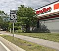
A sign for the U.S. Route 3 Business Loop in Laconia.
-
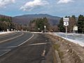
U.S. Route 3 in Lincoln, New Hampshire.


