
Cambridge, Massachusetts facts for kids
Quick facts for kids
Cambridge
|
|||
|---|---|---|---|
|
|
|||
|
|||
| Motto(s):
Literis Antiquis Novis Institutis Decora (Latin)
"Distinguished for Classical Learning and New Institutions"" |
|||

Location of Cambridge in Middlesex County, Massachusetts
|
|||

Cambridge
Location in Greater Boston area

Cambridge
Location in Massachusetts

Cambridge
Location in the United States
|
|||
| Country | United States | ||
| State | Massachusetts | ||
| County | Middlesex | ||
| Region | New England | ||
| Settled | 1630 | ||
| Incorporated | 1636 | ||
| City | 1846 | ||
| Named for | University of Cambridge | ||
| Government | |||
| • Type | Council–manager | ||
| Area | |||
| • Total | 7.10 sq mi (18.40 km2) | ||
| • Land | 6.40 sq mi (16.57 km2) | ||
| • Water | 0.71 sq mi (1.83 km2) | ||
| Elevation | 40 ft (12 m) | ||
| Population
(2020)
|
|||
| • Total | 118,403 | ||
| • Density | 18,512.04/sq mi (7,147.01/km2) | ||
| • Demonym | Cantabrigian | ||
| Time zone | UTC−5 (Eastern) | ||
| • Summer (DST) | UTC−4 (Eastern) | ||
| ZIP Code |
02138-02142
|
||
| Area code(s) | 617 / 857 | ||
| FIPS code | 25-11000 | ||
| GNIS feature ID | 0617365 | ||


.jpg)

.jpg)


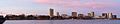
Cambridge is a city in Middlesex County, Massachusetts, United States. It's a suburb of Boston, located right across the Charles River. In 2020, about 118,403 people lived there, making it the fourth-largest city in Massachusetts. Cambridge was named after the University of Cambridge in England, which was important to the city's founders.
Cambridge is famous for its universities. Harvard University, founded in 1636, is the oldest university in the United States. The Massachusetts Institute of Technology (MIT), Lesley University, and Hult International Business School are also in Cambridge.
The area around Kendall Square, near MIT, is sometimes called "the most innovative square mile on the planet." This is because many new technology companies have started there since 2010.
Cambridge was founded in December 1630, making it one of the first cities in the Thirteen Colonies. It played a big role in the American Revolution. In May 1775, about 16,000 American patriots gathered in Cambridge Common. On July 2, 1775, George Washington arrived there to take command of the Continental Army. This is why Cambridge Common is known as the birthplace of the Continental Army.
Contents
History of Cambridge
Early Days and Colonial Times
Before Europeans arrived, the Massachusett people lived in the area for thousands of years. They called it Anmoughcawgen, which means 'fishing weir' or 'beaver dam'. European diseases greatly reduced the native population before many English settlers arrived in 1630.
In December 1630, settlers chose this spot because it was safe from enemy ships. The city was first called "the newe towne" or "Newtowne." It was one of the first towns founded by Puritans in the Massachusetts Bay Colony. The original village is now part of Harvard Square.
In 1636, Newe College was founded to train ministers. It was later renamed Harvard College after a generous donor, John Harvard. In May 1638, the town's name changed to Cambridge to honor the University of Cambridge in England. Many early leaders of the colony and the college had studied at the English university.
Over the years, parts of Cambridge became separate towns, like Newton and Lexington. By the time of the American Revolution, most people lived near Cambridge Common and Harvard College.
The Revolutionary War and Growth

On July 3, 1775, George Washington took command of the Patriot soldiers in Cambridge Common. This event is seen as the start of the Continental Army. In January 1776, Henry Knox brought cannons from Fort Ticonderoga, which helped Washington force the British Army to leave Boston. After the war, many properties belonging to British supporters were taken over.
Between 1790 and 1840, Cambridge grew quickly. New bridges and roads, like the West Boston Bridge (1792), connected Cambridge directly to Boston. This made it easier to travel and helped new industries and homes develop.
In the mid-1800s, Cambridge became a center for famous writers, including the "Fireside poets" like Henry Wadsworth Longfellow. Cambridge became a city in 1846. The main business area moved from Harvard Square to Central Square.
By the late 1800s, Cambridge had many new neighborhoods. Industries like brick-making and ice-cutting grew. Thousands of immigrants came to work in these new factories. The New England Glass Company, founded in 1818, was once the world's largest glass factory.
Modern Cambridge: From Industry to Innovation
By 1920, Cambridge was a major industrial city with almost 120,000 residents. Famous companies like Carter's Ink Company and many candy makers were located here. Main Street was even called "Confectioner's Row."
After the Great Depression and World War II, Cambridge's industries declined. The city then became more focused on education and research. Harvard University became even more important. When Radcliffe College for women was founded in 1879, Cambridge attracted many talented female students. MIT's move from Boston to Cambridge in 1916 also made Cambridge a top intellectual center.
In the 1980s, many high-tech companies started in Cambridge. Companies like VisiCorp (which made the first spreadsheet software) and Lotus Development were based here. Today, Kendall Square is a hub for tech giants like Google, Microsoft, and Amazon.
Cambridge also became a leader in biotechnology. In the 1970s, the city set up rules for new genetic research, which helped companies like Biogen and Genzyme grow. Now, many major biotech and pharmaceutical companies have offices and labs in Cambridge.
In the 1990s, a system called "rent control" ended in Cambridge. This change led to more housing construction and higher property values in the city. Cambridge is now known for having one of the most expensive housing markets in the Northeastern United States.
Since 1985, Cambridge has been a "sanctuary city," which means it has policies to protect immigrants.
Geography of Cambridge

Cambridge covers about 7.1 square miles (18.4 square kilometers). Most of this is land, but about 0.7 square miles (1.8 square kilometers) is water, mainly from the Charles River.
Neighboring Cities and Towns
Cambridge is in eastern Massachusetts. It shares borders with:
- Boston to the south and east, across the Charles River.
- Somerville to the north.
- Arlington to the northwest.
- Belmont and Watertown to the west.
The border with Somerville goes through busy neighborhoods. Many main "squares" like Inman, Porter, Harvard, and Lechmere are close to this city line.
Cambridge's Famous Squares
Cambridge is often called the "City of Squares" because its main business areas are at street intersections known as squares. Each square is like a small neighborhood center.
- Kendall Square is where Broadway, Main Street, and Third Street meet. It's famous for being "the most innovative square mile on the planet" because so many new tech and biotech companies are there. You'll find offices for Google, Microsoft, Amazon, and Apple here. It's served by the Kendall/MIT subway station.
- Central Square is at the crossing of Massachusetts Avenue, Prospect Street, and Western Avenue. It has many different kinds of restaurants and has become a lively area. The Central Station on the subway serves this square.
- Harvard Square is where Massachusetts Avenue, Brattle Street, Dunster Street, and JFK Street meet. This is the main area for Harvard University and a big shopping spot. It has its own Red Line station.
- Porter Square is about a mile north of Harvard Square on Massachusetts Avenue. It's where Massachusetts and Somerville Avenues cross. It has a subway and commuter rail stop, making it easy to get around.
- Inman Square is in mid-Cambridge, at the junction of Cambridge and Hampshire streets. It's known for its restaurants, bars, and unique shops.
- Lechmere Square is at Cambridge and First streets, near the CambridgeSide Galleria mall. It's served by the Lechmere station on the Green Line subway.
Other Neighborhoods
Cambridge has 13 official neighborhoods. Some of them include:
- East Cambridge (Area 1)
- MIT Campus (Area 2)
- The Port (Area 4), which used to be called Area 4.
- Cambridgeport (Area 5)
- Mid-Cambridge (Area 6)
- Riverside (Area 7)
- Baldwin (Area 8), formerly known as Agassiz.
- North Cambridge (Area 11)
Climate
Cambridge has four clear seasons: hot summers and cold winters. It gets a good amount of rain, and snow in the winter.
Population and People
| Historical population | ||
|---|---|---|
| Year | Pop. | ±% |
| 1764 | 1,582 | — |
| 1790 | 2,115 | +33.7% |
| 1800 | 2,453 | +16.0% |
| 1810 | 2,323 | −5.3% |
| 1820 | 3,295 | +41.8% |
| 1830 | 6,072 | +84.3% |
| 1840 | 8,409 | +38.5% |
| 1850 | 15,215 | +80.9% |
| 1860 | 26,060 | +71.3% |
| 1870 | 39,634 | +52.1% |
| 1880 | 52,669 | +32.9% |
| 1890 | 70,028 | +33.0% |
| 1900 | 91,886 | +31.2% |
| 1910 | 104,839 | +14.1% |
| 1920 | 109,694 | +4.6% |
| 1930 | 113,643 | +3.6% |
| 1940 | 110,879 | −2.4% |
| 1950 | 120,740 | +8.9% |
| 1960 | 107,716 | −10.8% |
| 1970 | 100,361 | −6.8% |
| 1980 | 95,322 | −5.0% |
| 1990 | 95,802 | +0.5% |
| 2000 | 101,355 | +5.8% |
| 2010 | 105,162 | +3.8% |
| 2020 | 118,403 | +12.6% |
| 2023 | 118,214 | −0.2% |
Source: United States Census records and Population Estimates Program data. Source: |
||

In 2020, Cambridge had a population of 118,403 people. The city is very diverse, with people from many different backgrounds. About 55% of the population is White, 10% Black, 19% Asian, and 9% Hispanic or Latino.
Cambridge is known for being a very liberal city. People who live in Cambridge are called Cantabrigians.
Economy of Cambridge

While Cambridge used to be a manufacturing hub, today its biggest employers are its educational institutions. Harvard and MIT together employ about 20,000 people.
Cambridge is a major center for technology and biotechnology. Many tech companies like Akamai, Google, Microsoft, and Amazon have offices here. Biotech and pharmaceutical companies like Genzyme, Biogen, and Novartis also have a strong presence, especially in Kendall Square.
The city is also home to many non-profit groups and research centers, thanks to its universities. Cambridge has a very strong financial rating, showing it's a stable and well-managed city.
Top Employers in Cambridge
As of 2019, the largest employers in Cambridge include:
- Harvard University
- Massachusetts Institute of Technology
- City of Cambridge
- Takeda Pharmaceuticals
- Biogen
- Novartis Institutes for Biomedical Research
- Cambridge Innovation Center
- Cambridge Health Alliance
- Mt. Auburn Hospital
- Sanofi Genzyme
Arts and Culture in Cambridge

Cambridge has a lively arts and culture scene, with everything from classical music to modern bands.
Museums to Explore
- Harvard Art Museum: This includes the Busch-Reisinger Museum (German art), the Fogg Art Museum (Western art), and the Arthur M. Sackler Museum (Middle East and Asian art).
- Harvard Museum of Natural History: Famous for its unique Glass Flowers collection.
- List Visual Arts Center, MIT
- MIT Museum
- Peabody Museum of Archaeology and Ethnology, Harvard
- Semitic Museum, Harvard
Public Art and Performances
Cambridge has many public art pieces all around the city. You can also enjoy temporary art displays at events like the annual Cambridge River Festival. During warmer months, street musicians and performers entertain people in Harvard Square.
Architecture: Old and New

Cambridge has many historic buildings, some dating back to the 1600s. It also has lots of modern buildings, especially on the Harvard and MIT campuses.
Some notable historic buildings include:
- Christ Church, Cambridge (1761)
- Longfellow House–Washington's Headquarters National Historic Site (1759): This was the home of poet Henry Wadsworth Longfellow and served as George Washington's headquarters.
- Cambridge City Hall (1888–1889)
Examples of modern architecture include:
- Stata Center at MIT by Frank Gehry.
- Carpenter Center for the Visual Arts at Harvard, the only building in North America by famous architect Le Corbusier.
- Simmons Hall at MIT by Steven Holl.
Music Scene
Cambridge has many music venues, like The Middle East, Club Passim, and The Plough and Stars, where you can hear different kinds of music.
Parks and Recreation

Even though Cambridge is a busy city, it has some great green spaces.
- The esplanade along the Charles River is a popular spot for walks and runs.
- Cambridge Common is a historic park.
- Fresh Pond Reservation is the largest green space in Cambridge, with a walking trail around a lake and a golf course.
- Mount Auburn Cemetery is a beautiful garden cemetery and a great place for birdwatching.
Education in Cambridge

Cambridge is famous worldwide as a center for learning.
Colleges and Universities
- Harvard University
- Massachusetts Institute of Technology (MIT)
- Lesley University
- Hult International Business School
- Longy School of Music of Bard College
Many Nobel Prize winners have been connected to universities in Cambridge.
Public Schools
The city has many public elementary and middle schools, including:
- Amigos School
- Baldwin School
- Cambridgeport School
- King Open School
For high school, students attend Cambridge Rindge and Latin School (CRLS).
Private Schools
Cambridge also has several private schools, such as:
- Buckingham Browne & Nichols School
- International School of Boston
- Shady Hill School
Media in Cambridge
Cambridge is part of the larger Boston media market. You can watch major TV channels like NBC, CBS, ABC, and Fox. There are also public TV stations like WGBH-TV.
For news, Cambridge has an online newspaper called Cambridge Day. The city also has several radio stations, including student-run stations from Harvard and MIT.
Cambridge Community Television (CCTV) provides public access TV channels for the city.
Getting Around Cambridge

Roads and Bridges
Several major roads pass through Cambridge, including Route 2 and Massachusetts Avenue. The Charles River forms the southern border, and 11 bridges connect Cambridge to Boston. The Longfellow Bridge and Harvard Bridge are two well-known ones.
Cambridge's streets can be a bit confusing because many are very old. They were built to connect early settlements and were shaped by the land.
Public Transportation

Cambridge has excellent public transportation, run by the Massachusetts Bay Transportation Authority (MBTA).
- The Red Line subway has several stops in Cambridge, including Alewife, Porter, Harvard, Central, and Kendall Square/MIT.
- The Green Line subway serves Lechmere station.
- There are also many bus routes, including a bus tunnel under Harvard Square.
- The Commuter Rail has a stop at Porter station.
Biking and Walking
Cambridge is a great city for biking and walking. It has many bike paths, including one along the Charles River. Bike lanes are common on streets. In 2000, Cambridge had the highest percentage of people who walked to work among large U.S. cities. The city has made its main squares more friendly for walkers.
City Services
Police and Fire Departments
The Cambridge Police Department keeps the city safe. The Massachusetts State Police also patrol the area. Harvard and MIT have their own police departments.
The Cambridge Fire Department protects the city from fires. It has eight fire stations and many fire trucks and rescue vehicles.
Emergency Medical Services (EMS)
PRO EMS, a private ambulance service, provides emergency medical help in Cambridge.
Public Library

The Cambridge Public Library offers many educational services. Its main building, built in 2009, connects to a beautiful older building from 1888.
Sister Cities
Cambridge has "sister city" relationships with other cities around the world. These partnerships help promote cultural exchange and understanding.
Cambridge has active sister city relationships with:
- Coimbra, Portugal
- Gaeta, Italy
- Tsukuba, Japan
- San José Las Flores, El Salvador
- Yerevan, Armenia
- Galway, Ireland
- Les Cayes, Haiti
See also
 In Spanish: Cambridge (Massachusetts) para niños
Images for kids
-
Cambridge skyline in November 2016


