
Belmont, Massachusetts facts for kids
Quick facts for kids
Belmont, Massachusetts
|
||
|---|---|---|

Looking north on Leonard Street in the town center
|
||
|
||
| Motto(s):
"The Town of Homes"
|
||

Location in Middlesex County in Massachusetts
|
||
| Country | United States | |
| State | Massachusetts | |
| County | Middlesex | |
| Settled | 1636 | |
| Incorporated | 1859 | |
| Government | ||
| • Type | Representative town meeting | |
| Area | ||
| • Total | 4.7 sq mi (12.2 km2) | |
| • Land | 4.7 sq mi (12.1 km2) | |
| • Water | 0.1 sq mi (0.1 km2) | |
| Elevation | 44 ft (13 m) | |
| Population
(2020)
|
||
| • Total | 27,295 | |
| • Density | 5,810/sq mi (2,237/km2) | |
| Time zone | UTC-5 (Eastern) | |
| • Summer (DST) | UTC-4 (Eastern) | |
| ZIP Code |
02478
|
|
| Area code(s) | 617 / 857 | |
| FIPS code | 25-05070 | |
| GNIS feature ID | 0618216 | |

Belmont is a town in Middlesex County, Massachusetts, United States. It is a western suburb of Boston. This means it's a town near a big city. Belmont is part of the Greater Boston metropolitan area. In 2020, about 27,295 people lived here. This was a 10.4% increase from 2010.
Contents
History of Belmont
Belmont was created on March 18, 1859. It was formed from parts of nearby towns. These towns were Watertown, Waltham, and Arlington. The people who started the town wanted it to be a place where alcohol could not be sold. Today, buying alcohol is legal in Belmont.
The town got its name from Bellmont. This was a large estate owned by John Perkins Cushing. He was a big supporter of the town's creation. Cushing Square is also named after him. His estate later became a branch of the Belmont Public Library. In 1880, a part of Belmont near Fresh Pond became part of Cambridge. This happened because Cambridge wanted to protect its water supply.
Before it became a town, Belmont was mostly farmland. Farmers grew crops and raised animals for Boston. It stayed like this until the early 1900s. Then, trolley service started, and roads got better. This made Belmont a popular place for homes. Many large estates were built. Belmont's population grew a lot in the 1920s.
Other businesses in Belmont included clay mining and managing waste. A large dump and quarry were turned into sites for Belmont High School and Clay Pit Pond. This shows how the town planned for its environment. As cars and highways became common, Belmont became a town where people lived and traveled to work in other places.
Railroad History


Belmont used to have two different railroads. They were the Fitchburg Railroad and the Central Massachusetts Railroad. Both later became part of the Boston & Maine Railroad system.
Today, the MBTA runs the Fitchburg Line through Belmont. This is part of its commuter rail service. Trains stop at Belmont Center and Waverley. These stations were once "level crossings." This meant people and cars had to cross the train tracks directly. In 1907, bridges and elevated tracks were built. Now, the trains go over or under the roads.
There is another old train station building in Belmont. It's called the Wellington Hill Station. It was built in the 1840s as a private school. From 1852 to 1879, it was used as a train station. Later, it was moved and used as a summer house. In 1974, it was given to the Belmont Historical Society. It was fixed up and moved to its current spot in 1980.
Plans are being made to build the Belmont Community Path. This will be a walking and biking trail. It will use old railroad paths. This trail will be part of the Mass Central Rail Trail.
Belmont Today
Belmont is still mostly a town with homes. Its population hasn't grown much since the 1950s. It is known for the Belmont Hill neighborhood, which has many large mansions. Most people live in other areas around the Hill.
The town has three main shopping areas. These are Belmont Center, Cushing Square, and Waverley Square. The Town Hall and other public buildings are in Belmont Center. There are also large public areas. These include Rock Meadow and Habitat. They were once parts of old farms.
Geography

Belmont covers about 4.7 square miles (12.2 km2). Most of this is land. A very small part is water.
Belmont shares its borders with several other towns. To the east is Cambridge. To the north is Arlington. Lexington is to the northwest. Waltham is to the west. And Watertown is to the south.
Climate
In Belmont, temperatures usually drop below 50°F (10°C) for about 195 days each year. The town gets about 45.2 inches (1150 mm) of rain each year. Snow covers the ground for about 52 days a year. The air is less humid for about 25 days a year.
Population Facts
| Historical population | ||
|---|---|---|
| Year | Pop. | ±% |
| 1860 | 1,198 | — |
| 1870 | 1,513 | +26.3% |
| 1880 | 1,615 | +6.7% |
| 1890 | 2,098 | +29.9% |
| 1900 | 3,929 | +87.3% |
| 1910 | 5,542 | +41.1% |
| 1920 | 10,749 | +94.0% |
| 1930 | 21,748 | +102.3% |
| 1940 | 26,867 | +23.5% |
| 1950 | 27,381 | +1.9% |
| 1960 | 28,715 | +4.9% |
| 1970 | 28,285 | −1.5% |
| 1980 | 26,100 | −7.7% |
| 1990 | 24,720 | −5.3% |
| 2000 | 24,194 | −2.1% |
| 2010 | 24,729 | +2.2% |
| 2020 | 27,295 | +10.4% |
| 2022* | 26,710 | −2.1% |
| * = population estimate. Source: United States Census records and Population Estimates Program data. | ||
In 2020, there were 27,295 people living in Belmont. About 17,640 people were registered to vote in 2021. In 2020, most residents were White (69.6%). About 18.5% were Asian. And 1.9% were Black or African American. About 4.7% of the population were Hispanic or Latino.
In 2010, about 20% of Belmont's residents were born outside the United States. This was an increase from 15% in 2000.
Belmont has been called a "Mormon enclave." This is because the Boston Massachusetts Temple of the LDS Church is located there. It is at the highest point in town. A golden statue of the Angel Moroni sits on top of the Temple.
Places to Visit
- Redtop, the home of author William Dean Howells
- Edwin O. Reischauer Memorial House
- The old Boston & Maine Railroad Station, now the MBTA Commuter Rail Belmont stop. It is now owned by the Lions Club.
- The Boston Massachusetts Temple of the LDS Church
- William Flagg Homer House
Education
Belmont has its own public school system. It is managed by an elected school committee.
There are four public elementary schools:
- Mary Lee Burbank School
- Daniel Butler School
- Winn Brook School
- Roger Wellington School
There is one public upper elementary school. It is called the Winthrop L. Chenery Upper Elementary School. There is also one public middle school, the Belmont Middle School. And there is one public high school, the Belmont High School.
Belmont High is known for its strong academics, music, and theater arts programs. Many students go on to good colleges. U.S. News & World Report gave Belmont High School a gold medal in 2009. It was named the 100th best public high school in the U.S.
Belmont also has private schools. Belmont Hill School is a private high school for grades 7–12. Belmont Day School is a private school for Pre-K–8.
Media
The Belmont Citizen-Herald is a weekly newspaper. It covers news in Belmont. It is published on Thursdays and is also online. The Citizen-Herald started in 1988. It was formed by combining two older newspapers.
The Boston Globe and Boston.com also have a website called Belmont Your Town. It shares local news. The Belmontonian and Belmont Patch are other online news sources.
The Belmont Media Center (BMC) started in 2005. It is a local non-profit organization. It runs a public, educational, and government access TV station. BMC offers classes and equipment for making TV shows. It also broadcasts local programs.
Transportation
Roads
Several main roads go through Belmont. Concord Avenue crosses the town from east to west. Common Street and Pleasant Street (Route 60) go north and south. Trapelo Road and Belmont Street run along the southern edge.
Belmont is served by two state highways. Route 60 (Pleasant Street) runs near the middle of town. Route 2 runs along Belmont's northern border with Arlington. Even though Belmont is small, Route 2 has five exits for the town. Other major highways nearby include I-95/MA-Route 128.
Public Transit
Belmont has public transportation from the Massachusetts Bay Transportation Authority. This includes the Fitchburg Commuter Rail line, buses, and trackless trolley lines.
Two MBTA Commuter Rail stations are in Belmont. They are Waverley and Belmont Center. From Belmont, it takes about 16 minutes to reach North Station in Boston by train.
Nearby in Cambridge is Alewife Station. This is the end of the Red Line subway. It connects Belmont to Boston and the wider public transit system.
Famous People


Because Belmont is close to universities like Harvard and MIT, many famous people have lived there. These include people who won the Nobel Prize. Here are some notable people from Belmont:
Business
- John Perkins Cushing, a trader
- Stephen P. Mugar, who started the Star Market stores
Arts and Music
- Winslow Homer (1836–1910), a famous painter
- Frederick Law Olmsted, a landscape architect
- Walter Piston, a composer
- Phil Wilson, a jazz musician
Media
- Sebastian Junger (born 1962), an author and filmmaker
- David E. Kelley, a TV producer and writer
- Addison Powell, an actor
- Jean Rogers, an actress
Sports
- Emily Cook, a freestyle skier
- Maxie Long, an Olympic gold medalist in running
- Paul Mara, a hockey player for the New York Rangers
- Becca Pizzi, a marathon runner
- Patty Shea, an Olympian in field hockey
- Wilbur Wood, a Major League Baseball pitcher
Literature
- Gerald Warner Brace, an author and teacher
- Leah Hager Cohen, an author
- William Dean Howells, an author
- Tom Perrotta, an author
Academics
- Bernard Bailyn (1922-2020), a historian and professor
- Vannevar Bush (1890–1974), an MIT Dean of Engineering
- Wolfgang Ketterle, an MIT physics professor and Nobel Prize winner (2001)
- Franco Modigliani, an MIT economics professor and Nobel Prize winner (1985)
- Edwin O. Reischauer, a Harvard professor and Ambassador to Japan
- Paul A. Samuelson, an MIT economics professor and Nobel Prize winner (1970)
- Robert Burns Woodward, an organic chemist and Nobel Prize winner (1965)
Images for kids
-
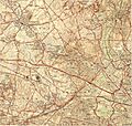
Topography of Belmont and environs
See also
 In Spanish: Belmont (Massachusetts) para niños
