Stark, New Hampshire facts for kids
Quick facts for kids
Stark, New Hampshire
|
|
|---|---|
|
Town
|
|

|
|

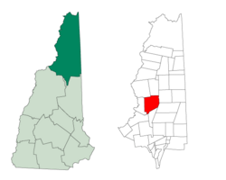
Location in Coös County, New Hampshire
|
|
| Country | United States |
| State | New Hampshire |
| County | Coös |
| Incorporated | 1795 |
| Villages | Stark Crystal Percy |
| Area | |
| • Total | 59.7 sq mi (154.7 km2) |
| • Land | 58.8 sq mi (152.3 km2) |
| • Water | 0.9 sq mi (2.4 km2) 1.53% |
| Elevation | 964 ft (294 m) |
| Population
(2020)
|
|
| • Total | 478 |
| • Density | 8/sq mi (3.1/km2) |
| Time zone | UTC-5 (Eastern) |
| • Summer (DST) | UTC-4 (Eastern) |
| ZIP code |
03582
|
| Area code(s) | 603 |
| FIPS code | 33-73060 |
| GNIS feature ID | 0873724 |
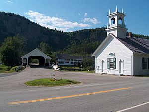
Stark is a small town in Coös County, New Hampshire, United States. In 2020, about 478 people lived there. The town is known for its famous covered bridge.
Stark includes smaller areas called Percy and Crystal. The main village of Stark is located by the Upper Ammonoosuc River. Main roads like New Hampshire Route 110 pass through Stark, connecting it to other towns. A large part of Stark is inside the beautiful White Mountain National Forest.
Contents
History of Stark, New Hampshire

The area that is now Stark was first given a name in 1774. It was called "Percy" back then. This name came from Hugh Percy, 1st Duke of Northumberland.
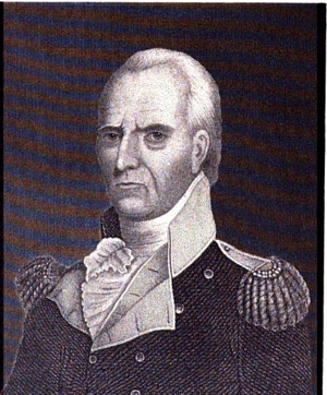
The town officially became a town in 1795. In 1832, its name was changed to "Stark." This new name honored General John Stark. He was a famous general who wrote the words that became New Hampshire's official motto: "Live Free or Die."
World War II POW Camp in Stark
In early 1944, a special camp was set up in Stark. It used to be a camp for the Civilian Conservation Corps. This new camp, called Camp Stark, held about 250 German prisoners of war (POWs).
This was the only World War II POW camp in all of New Hampshire. Most of the prisoners worked hard in the nearby forests. They helped supply wood for the paper mills in Berlin, New Hampshire. After the war ended, some of these men later came back to live in the United States and Canada. Camp Stark closed in 1946.
Geography of Stark
Stark covers a total area of about 154.7 square kilometers (about 59.7 square miles). Most of this area is land, with a small part being water. About 1.53% of the town's area is water.
The town is on the eastern edge of the Pilot Range. This area is part of the White Mountains. Several mountains in Stark are taller than 3,000 feet (914 meters) above sea level. The highest point in Stark is Mount Hutchins, which is 3,730 feet (1,137 meters) high. It sits on the border with the town of Northumberland.
Neighboring Towns
Stark shares its borders with several other towns:
- Odell (to the north)
- Dummer (to the east)
- Milan (to the southeast)
- Kilkenny (to the south)
- Lancaster (to the south)
- Northumberland (to the west)
- Stratford (to the northwest)
People of Stark
| Historical population | |||
|---|---|---|---|
| Census | Pop. | %± | |
| 1840 | 349 | — | |
| 1850 | 418 | 19.8% | |
| 1860 | 426 | 1.9% | |
| 1870 | 464 | 8.9% | |
| 1880 | 690 | 48.7% | |
| 1890 | 703 | 1.9% | |
| 1900 | 733 | 4.3% | |
| 1910 | 448 | −38.9% | |
| 1920 | 339 | −24.3% | |
| 1930 | 329 | −2.9% | |
| 1940 | 352 | 7.0% | |
| 1950 | 373 | 6.0% | |
| 1960 | 327 | −12.3% | |
| 1970 | 343 | 4.9% | |
| 1980 | 470 | 37.0% | |
| 1990 | 518 | 10.2% | |
| 2000 | 516 | −0.4% | |
| 2010 | 556 | 7.8% | |
| 2020 | 478 | −14.0% | |
| U.S. Decennial Census | |||
In 2020, the population of Stark was 478 people. Most residents were White (93.09%). A small number of people identified as Mixed Race (4.39%) or Hispanic or Latino (1.67%).
Back in 2000, there were 516 people living in Stark. There were 194 households, and 147 of them were families. The average household had about 2.65 people. The average family had about 2.99 people.
About 33% of households had children under 18 living with them. About 61.3% of households were married couples. The median age in Stark was 40 years old.
See also
 In Spanish: Stark (Nuevo Hampshire) para niños
 | William M. Jackson |
 | Juan E. Gilbert |
 | Neil deGrasse Tyson |

