Belknap Mountains facts for kids
Quick facts for kids Belknap Mountains |
|
|---|---|

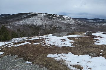
View of the south side of the Belknap Range from Whiteface Mountain: Gunstock Mountain on far left; Piper Mountain in center; Suncook Mountain and Mt. Klem to the right
|
|
| Highest point | |
| Elevation | 2,382 ft (726 m) |
| Geography | |
| Location | Belknap County, New Hampshire, US |
The Belknap Mountains are a group of mountains in the Lakes Region of New Hampshire, United States. They are located in Belknap County, near the towns of Gilford, Gilmanton, and Alton. The tallest mountain in this range is Belknap Mountain. It stands 2,382 feet (726 m) (about 726 meters) high. This makes it the highest point in all of Belknap County! A special area called Belknap Mountain State Forest protects the main part of the range, including the top of Belknap Mountain.
Contents
Exploring the Belknap Mountains
The Belknap Mountains stretch for about 8 miles (13 km) (13 kilometers). They form a curve, starting in Gilford and heading south. Then, they turn east through Gilmanton. The range finally ends in Alton, looking over Alton Bay on Lake Winnipesaukee.
Important Peaks of the Range
Several named mountains make up the Belknap range. From the northwest to the southeast, these are:
- Mount Rowe, which is 1,690 feet (520 m) (515 meters) tall.
- Gunstock Mountain, standing at 2,240 feet (680 m) (683 meters).
- Belknap Mountain, the highest at 2,382 feet (726 m) (726 meters).
- Straightback Mountain, reaching 1,890 feet (580 m) (576 meters).
- Mount Major, with a height of 1,786 feet (544 m) (544 meters).
There are also other smaller, unnamed peaks between Belknap Mountain and Straightback Mountain. These peaks are between 1,806 and 2,001 feet (550 and 610 m) (550 to 610 meters) high. Near them is Round Pond, a small body of water at 1,652 feet (504 m) (504 meters) above sea level.
Other Notable Summits
A smaller ridge extends southwest from Belknap Mountain. On this ridge, you'll find:
- Piper Mountain, at 2,044 feet (623 m) (623 meters).
- Whiteface Mountain, which is 1,670 feet (510 m) (509 meters) tall.
Water Flow in the Mountains
All the water from the Belknap Mountains eventually flows into the Merrimack River.
- The northeast side of the range has small streams that flow into Lake Winnipesaukee. The water then leaves the lake through the Winnipesaukee River, which joins the Merrimack River.
- On the west side, the Gunstock River also carries water into Lake Winnipesaukee.
- The far southwest part, near Whiteface Mountain, drains into the Tioga River, which also flows to the Winnipesaukee River.
- The south side of the range, including Round Pond, sends its water south into the Suncook River, which then flows into the Merrimack River.
Fun Activities: Skiing at Gunstock
Mount Rowe and Gunstock Mountain are home to Gunstock Mountain Resort. This is a very popular ski area in central New Hampshire. Many people visit to ski, snowboard, and enjoy other winter sports.
See also
 In Spanish: Montañas Belknap para niños
 | Isaac Myers |
 | D. Hamilton Jackson |
 | A. Philip Randolph |

