Gilford, New Hampshire facts for kids
Quick facts for kids
Gilford, New Hampshire
|
|||
|---|---|---|---|
|
Town
|
|||

|
|||
|
|||

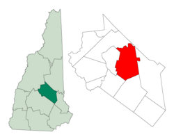
Location in Belknap County, New Hampshire
|
|||
| Country | United States | ||
| State | New Hampshire | ||
| County | Belknap | ||
| Incorporated | 1812 | ||
| Villages |
|
||
| Area | |||
| • Total | 53.6 sq mi (138.7 km2) | ||
| • Land | 38.8 sq mi (100.5 km2) | ||
| • Water | 14.7 sq mi (38.2 km2) 27.56% | ||
| Elevation | 745 ft (227 m) | ||
| Population
(2020)
|
|||
| • Total | 7,699 | ||
| • Density | 198/sq mi (76.6/km2) | ||
| Time zone | UTC-5 (Eastern) | ||
| • Summer (DST) | UTC-4 (Eastern) | ||
| ZIP code |
03249
|
||
| Area code(s) | 603 | ||
| FIPS code | 33-28740 | ||
| GNIS feature ID | 0873603 | ||
Gilford is a lovely town located in Belknap County, New Hampshire, in the United States. It's known for being right on the beautiful Lake Winnipesaukee. In 2020, about 7,699 people lived here, which was a bit more than in 2010.
Gilford is home to many cool places. These include Governors Island, Ellacoya State Beach, and Belknap Mountain State Forest. You can also find Gunstock Mountain Resort here, which is great for skiing and other activities. For music lovers, there's the Bank of New Hampshire Pavilion, an outdoor concert spot. A small village called Glendale is also part of Gilford.
Contents
History of Gilford
How Gilford Got Its Name
Gilford was first settled in 1778. It was originally part of a larger town called Gilmanton. Back then, it was known as Gunstock Parish.
The town's name changed in 1812. A brave soldier named Captain Lemuel B. Mason had fought in the Revolutionary War. He was part of the Battle of Guilford Court House in North Carolina in 1781. After the war, he moved to Gunstock Parish. Captain Mason suggested that the new town be named "Guilford" after that important battle. Later, because of a small mistake in writing, the name became "Gilford."
The old name, Gunstock, is still used today. You can find it in the names of Gunstock Mountain and the ski resort located there.
Geography of Gilford
Land and Water Areas
Gilford covers a total area of about 138.7 square kilometers (about 53.6 square miles). A big part of this, about 38.2 square kilometers (14.7 square miles), is water. This means that over a quarter of the town (27.56%) is covered by water, mostly from Lake Winnipesaukee.
Mountains and Rivers
The highest point in Gilford is Belknap Mountain. It stands tall at about 745 meters (2,384 feet) above sea level. This mountain is also the highest point in all of Belknap County.
A river called the Gunstock River flows through much of the town. It eventually empties into Lake Winnipesaukee. All the water in Gilford flows into the Merrimack River watershed.
Main Roads in Gilford
Several important roads run through Gilford:
- New Hampshire Route 11 goes across the town from east to west. It connects Gilford to towns like Alton and Rochester to the east, and Laconia to the west.
- Near the western edge of Gilford, NH 11 joins U.S. Route 3. They then head south on the Laconia Bypass, which is mostly in Gilford. This bypass leads towards Tilton and Franklin.
- New Hampshire Route 11A is another east-west road. It goes through the center of Gilford and past the entrance to Gunstock Mountain Resort.
- New Hampshire Route 11B starts near Sanders Bay on Lake Winnipesaukee. It travels northwest to Weirs Beach in Laconia.
Neighboring Towns
Gilford shares its borders with several other towns:
- Moultonborough (to the north)
- Alton (to the east)
- Gilmanton (to the southeast)
- Belmont (to the south)
- Laconia (to the west)
- Meredith (to the northeast)
Population of Gilford
| Historical population | |||
|---|---|---|---|
| Census | Pop. | %± | |
| 1820 | 1,816 | — | |
| 1830 | 1,872 | 3.1% | |
| 1840 | 2,072 | 10.7% | |
| 1850 | 2,432 | 17.4% | |
| 1860 | 2,811 | 15.6% | |
| 1870 | 3,361 | 19.6% | |
| 1880 | 2,821 | −16.1% | |
| 1890 | 3,585 | 27.1% | |
| 1900 | 661 | −81.6% | |
| 1910 | 744 | 12.6% | |
| 1920 | 738 | −0.8% | |
| 1930 | 783 | 6.1% | |
| 1940 | 996 | 27.2% | |
| 1950 | 1,251 | 25.6% | |
| 1960 | 2,043 | 63.3% | |
| 1970 | 3,219 | 57.6% | |
| 1980 | 4,841 | 50.4% | |
| 1990 | 5,867 | 21.2% | |
| 2000 | 6,803 | 16.0% | |
| 2010 | 7,126 | 4.7% | |
| 2020 | 7,699 | 8.0% | |
| U.S. Decennial Census | |||
Over the years, Gilford's population has grown quite a bit. In 1820, there were 1,816 people living here. By 2020, the population had reached 7,699. This shows how the town has developed and attracted more residents over time.
Most people living in Gilford are White (98.32%). There are also smaller groups of African American, Native American, and Asian residents. About 0.57% of the population identifies as Hispanic or Latino.
In 2000, about 30.8% of the homes in Gilford had children under 18 living there. The average age of people in Gilford was 43 years old.
Fun Places to Visit in Gilford
Gilford has many interesting places to see and things to do:
- Bank of New Hampshire Pavilion - A great spot for outdoor concerts.
- John J. Morrill General Store (built in 1857) - A historic store.
- Benjamin Rowe House (built around 1838) - An old, interesting house.
- Union Meetinghouse (built in 1834) - A historic meeting place.
- Gunstock Mountain Resort - Perfect for skiing, snowboarding, and other mountain activities.
- Lake Winnipesaukee Sailing Association - Where you can learn about or enjoy sailing on the lake.
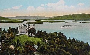
- Kimball Castle - A beautiful old castle with a view of the lake.
Famous People from Gilford
Some notable people have connections to Gilford:
- Glenn Cooper (born 1953) - A well-known author and film producer.
- Stilson Hutchins (1838–1912) - A newspaper reporter and publisher who founded The Washington Post.
- Megan Lyman (born 1991) - She was crowned Miss New Hampshire in 2012.
- Penny Pitou (born 1938) - The first U.S. woman to win an Olympic medal in downhill skiing.
- Chris Sheridan (born 1967) - A writer and television producer, known for shows like Family Guy.
See also
 In Spanish: Gilford (Nuevo Hampshire) para niños
 | Leon Lynch |
 | Milton P. Webster |
 | Ferdinand Smith |


