Winnipesaukee River facts for kids
Quick facts for kids Winnipesaukee River |
|
|---|---|

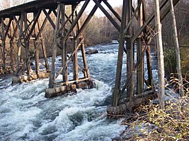
Winnipesaukee River entering Franklin
|
|
| Country | United States |
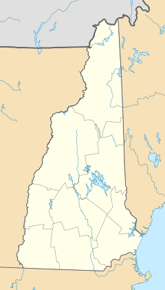
| State | New Hampshire |
| Counties | Belknap, Merrimack |
| Cities and towns | Laconia, Belmont, Tilton, Northfield, Franklin |
| Physical characteristics | |
| Main source | Lake Winnipesaukee (Paugus Bay) Lakeport 504 ft (154 m) 43°32′54″N 71°27′54″W / 43.54833°N 71.46500°W |
| River mouth | Merrimack River Franklin 261 ft (80 m) 43°26′14″N 71°38′53″W / 43.43722°N 71.64806°W |
| Length | 10.5 mi (16.9 km) |
| Basin features | |
| Tributaries |
|
The Winnipesaukee River is a river in central New Hampshire, USA. It is about 10.5-mile-long (16.9 km). This river connects Lake Winnipesaukee to the Merrimack River.
The Winnipesaukee River flows through the beautiful Lakes Region. Its waters eventually join the Pemigewasset River to form the larger Merrimack River. The area that drains into the Winnipesaukee River is about 488 square miles (1,264 km2).
River Sections
The Winnipesaukee River has two main parts. Each part flows through different towns and landscapes.
Upper River Section
The upper part of the river starts at Lake Winnipesaukee. It flows out of the lake at a dam in Lakeport, which is part of Laconia.
Right after the dam, the river quickly enters Opechee Bay. About 1 mile (1.6 km) later, the river leaves Opechee Bay over another dam. It then flows right through the middle of Laconia.
In the 1800s, many factories were built along the river in Laconia. They used the river's strong flow to power their machines. This 1-mile (1.6 km) section of the river through Laconia ends at Lake Winnisquam. Lake Winnisquam is the fourth-largest lake in New Hampshire.
The river then crosses about 5-mile (8 km) of Lake Winnisquam. It then reaches a dam at the lake's end, leading to a short drop into Silver Lake.
Lower River Section
The lower part of the Winnipesaukee River begins at Silver Lake. This spot is on the border between Belmont and Tilton, New Hampshire.
The river flows through the towns of Tilton and Northfield. It then goes down a narrow valley towards Franklin. Along this path, there are more small dams that use the river's power.
From Tilton to Franklin, the river drops quite a bit, about 90 feet per mile (17 m/km). This creates exciting rapids for people who enjoy boating. Boaters often start near Cross Mill Bridge and finish at the U.S. Route 3 Sanborn Bridge in downtown Franklin. There is a special water measuring station in Tilton.
River's End
The Winnipesaukee River meets the Pemigewasset River just south of downtown Franklin. When these two rivers join, they form the Merrimack River.
Images for kids
 | Delilah Pierce |
 | Gordon Parks |
 | Augusta Savage |
 | Charles Ethan Porter |


