Ossipee, New Hampshire facts for kids
Quick facts for kids
Ossipee, New Hampshire
|
||
|---|---|---|
|
Town
|
||
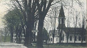
Center Ossipee c. 1909
|
||
|
||
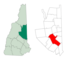
Location in Carroll County, New Hampshire
|
||
| Country | United States | |
| State | New Hampshire | |
| County | Carroll | |
| Incorporated | 1785 | |
| Villages |
|
|
| Area | ||
| • Total | 75.3 sq mi (195.0 km2) | |
| • Land | 70.5 sq mi (182.5 km2) | |
| • Water | 4.8 sq mi (12.4 km2) 6.38% | |
| Elevation | 681 ft (208 m) | |
| Population
(2020)
|
||
| • Total | 4,372 | |
| • Density | 62/sq mi (24.0/km2) | |
| Time zone | UTC-5 (Eastern) | |
| • Summer (DST) | UTC-4 (Eastern) | |
| ZIP codes | ||
| Area code(s) | 603 | |
| FIPS code | 33-58740 | |
| GNIS feature ID | 0873694 | |
Ossipee is a town in Carroll County, New Hampshire, United States. In 2020, about 4,372 people lived there. It is the main town, also called the county seat, of Carroll County.
Ossipee has several small villages and is a popular place for vacations. It is also home to part of the Pine River State Forest.
Contents
History of Ossipee
Ossipee was first known by different names, like "Wigwam Village" and "New Garden." The town got its current name from the Ossipee Indians. They were one of the twelve Algonquian tribes.
This area was once home to an Indian fort made of stockades (strong wooden fences). This fort helped protect the tribe from the Mohawks, another tribe from the west. In 1725, Captain John Lovewell rebuilt the fort after it was destroyed. This new fort was one of the biggest in New England. Today, the fort's old location is part of the Indian Mound Golf course.
On February 22, 1785, the state government officially made Ossipee a town. This process is called incorporation.
Farming and Factories in Ossipee
Even though some parts of Ossipee were rocky, farmers found the land good for raising animals and growing crops like wheat and potatoes. The main products from Ossipee were farm goods, lumber, and cattle.
By 1859, Ossipee had many businesses. There were twelve sawmills for cutting wood and five gristmills for grinding grain. The town also had factories that made bedsteads (parts of beds), doors, and window parts. There was even a paper mill and four tanneries for making leather.
Railroads and Tourism
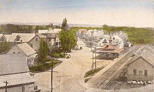
In 1871, the Portsmouth, Great Falls & Conway Railroad reached Ossipee Corner. By 1875, the train service extended to Center Ossipee. The trains brought more trade and visitors to the town. This helped Ossipee become a popular summer resort. However, train service for people stopped in 1961, and for goods in 1972.
Ossipee Mountains and Resources
The town shares its name with the Ossipee Mountains. These mountains form a circle and show where an ancient volcano once had a ring dike (a circular rock formation). Ossipee is also a big source of sand and gravel. These materials are sent by train to Boston.
The First Snowmobile?
Ossipee claims to be the place where the first snowmobile was invented. In 1917, a man named Virgil D. White worked on a special kit. This kit could change a Ford Model T car into a "snowmobile." He even got a patent for his invention and copyrighted the word "snowmobile."
The conversion kit was quite expensive back then, costing about $395. Virgil White got his patent in 1918. By 1922, his snowmobile kit was available for sale only at Ford dealerships.
Geography of Ossipee
Ossipee covers about 195 square kilometers (75 square miles) in total. Most of this area, about 182.5 square kilometers (70.5 square miles), is land. The rest, about 12.4 square kilometers (4.8 square miles), is water. Water makes up about 6.38% of the town's total area.
The Ossipee River and its smaller streams flow through Ossipee. Ossipee Lake, in the northeast part of town, is where the Ossipee River begins. Other rivers like the Pine, Beech, Bearcamp, and Lovell also flow into Ossipee Lake.
The highest point in Ossipee is about 681 meters (2,080 feet) above sea level. This point is on a ridge in the Ossipee Mountains in the western part of the town.
Roads and Villages
Several state roads cross through Ossipee. These include Route 16, Route 25, Route 28, and Route 171.
The two main communities in Ossipee are:
- Center Ossipee: This village is located where Route 16 and Route 25 meet in the south.
- Ossipee Corner: This village is about 5 miles south of Center Ossipee. It's where Route 28 and Route 171 meet, and it's also close to Route 16.
Other smaller villages in Ossipee include West Ossipee, Moultonville, and Water Village.
Neighboring Towns
Ossipee shares its borders with these towns:
- Madison (to the north)
- Freedom (to the north)
- Effingham (to the east)
- Wakefield (to the southeast)
- Wolfeboro (to the south)
- Tuftonboro (to the southwest)
- Moultonborough (to the west)
- Tamworth (to the northwest)
Climate in Ossipee
Ossipee has a warm-summer humid continental climate. This means it has warm summers and cold, snowy winters.
| Climate data for Ossipee, 1991–2020 simulated normals (476 ft elevation) | |||||||||||||
|---|---|---|---|---|---|---|---|---|---|---|---|---|---|
| Month | Jan | Feb | Mar | Apr | May | Jun | Jul | Aug | Sep | Oct | Nov | Dec | Year |
| Mean daily maximum °F (°C) | 30.0 (−1.1) |
33.3 (0.7) |
41.5 (5.3) |
54.7 (12.6) |
67.1 (19.5) |
75.7 (24.3) |
80.8 (27.1) |
79.5 (26.4) |
71.6 (22.0) |
58.5 (14.7) |
46.0 (7.8) |
35.4 (1.9) |
56.2 (13.4) |
| Daily mean °F (°C) | 19.6 (−6.9) |
21.4 (−5.9) |
30.4 (−0.9) |
43.0 (6.1) |
54.9 (12.7) |
63.9 (17.7) |
69.1 (20.6) |
67.3 (19.6) |
59.5 (15.3) |
47.5 (8.6) |
36.5 (2.5) |
26.2 (−3.2) |
44.9 (7.2) |
| Mean daily minimum °F (°C) | 9.0 (−12.8) |
9.7 (−12.4) |
19.4 (−7.0) |
31.1 (−0.5) |
42.6 (5.9) |
52.2 (11.2) |
57.2 (14.0) |
55.2 (12.9) |
47.3 (8.5) |
36.3 (2.4) |
27.0 (−2.8) |
17.1 (−8.3) |
33.7 (0.9) |
| Average precipitation inches (mm) | 3.38 (85.76) |
3.17 (80.61) |
3.72 (94.44) |
4.11 (104.49) |
3.65 (92.73) |
4.34 (110.30) |
4.21 (106.88) |
3.79 (96.28) |
3.77 (95.74) |
5.22 (132.67) |
4.11 (104.41) |
4.39 (111.48) |
47.86 (1,215.79) |
| Average dew point °F (°C) | 11.7 (−11.3) |
12.0 (−11.1) |
19.0 (−7.2) |
29.1 (−1.6) |
41.9 (5.5) |
53.1 (11.7) |
58.8 (14.9) |
57.9 (14.4) |
51.4 (10.8) |
39.2 (4.0) |
28.0 (−2.2) |
19.0 (−7.2) |
35.1 (1.7) |
| Source: PRISM Climate Group | |||||||||||||
People of Ossipee: Demographics
| Historical population | |||
|---|---|---|---|
| Census | Pop. | %± | |
| 1790 | 339 | — | |
| 1800 | 1,143 | 237.2% | |
| 1810 | 1,330 | 16.4% | |
| 1820 | 1,988 | 49.5% | |
| 1830 | 1,935 | −2.7% | |
| 1840 | 2,170 | 12.1% | |
| 1850 | 2,123 | −2.2% | |
| 1860 | 1,997 | −5.9% | |
| 1870 | 1,822 | −8.8% | |
| 1880 | 1,782 | −2.2% | |
| 1890 | 1,630 | −8.5% | |
| 1900 | 1,479 | −9.3% | |
| 1910 | 1,354 | −8.5% | |
| 1920 | 1,122 | −17.1% | |
| 1930 | 1,230 | 9.6% | |
| 1940 | 1,498 | 21.8% | |
| 1950 | 1,412 | −5.7% | |
| 1960 | 1,409 | −0.2% | |
| 1970 | 1,647 | 16.9% | |
| 1980 | 2,465 | 49.7% | |
| 1990 | 3,309 | 34.2% | |
| 2000 | 4,211 | 27.3% | |
| 2010 | 4,345 | 3.2% | |
| 2020 | 4,372 | 0.6% | |
| U.S. Decennial Census | |||
In 2010, there were 4,345 people living in Ossipee. There were 1,826 households, and 1,165 of these were families. Many homes, about 3,057, were housing units. About 40% of these were empty, mostly used for vacations or seasonal stays.
Most of the people in Ossipee (97.1%) were white. A small number were African American (0.4%), Native American (0.3%), or Asian (0.6%). About 1% of the population was Hispanic or Latino.
About 25% of households had children under 18 living with them. Nearly half of the households (49.1%) were married couples. About 36% of households were not families. Around 29.6% of all households had just one person living there. About 11.3% of people lived alone and were 65 years old or older.
The average household had 2.28 people, and the average family had 2.76 people.
In terms of age, 19% of the people were under 18. About 19.4% were 65 years old or older. The average age in Ossipee was 47.4 years. For every 100 females, there were about 100.5 males.
From 2011 to 2015, the average yearly income for a household was about $46,203. For families, it was about $60,758. The average income per person in the town was $24,443. About 17.9% of all people and 14.7% of families lived below the poverty line. This included 16.8% of people under 18 and 12.7% of those 65 or older.
Economy of Ossipee
The biggest employers in Ossipee are the Carroll County Government, Hannaford (a grocery store), Affinity, and Ossipee Aggregates (a company that deals with sand and gravel).
Places to Visit in Ossipee
- Ossipee Historical Society Museum: Learn about the town's past.
- Ossipee Lake: A large lake for recreation.
- Ossipee Pine Barrens: A unique natural area with pine trees.
Famous People from Ossipee
- Dale Bozzio (born 1955), lead singer of the 1980s band Missing Persons
- Fred H. Brown (1879–1955), a US senator and the 59th governor of New Hampshire
- Captain John Lovewell (1691–1725), a soldier who helped rebuild the fort
- Chester Earl Merrow (1906–1974), a US congressman
- William B. Small (1817–1878), a US congressman
- John Greenleaf Whittier (1807–1892), a famous poet who spent summers here
See also
 In Spanish: Ossipee (Nuevo Hampshire) para niños
 | Lonnie Johnson |
 | Granville Woods |
 | Lewis Howard Latimer |
 | James West |


