North Walpole, New Hampshire facts for kids
Quick facts for kids
North Walpole, New Hampshire
|
|
|---|---|

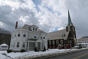
St. Peter's Roman Catholic Church
|
|
| Country | United States |
| State | New Hampshire |
| County | Cheshire |
| Town | Walpole |
| Area | |
| • Total | 0.70 sq mi (1.81 km2) |
| • Land | 0.69 sq mi (1.80 km2) |
| • Water | 0.00 sq mi (0.01 km2) |
| Elevation | 308 ft (94 m) |
| Population
(2020)
|
|
| • Total | 785 |
| • Density | 1,131.12/sq mi (436.64/km2) |
| Time zone | UTC-5 (Eastern (EST)) |
| • Summer (DST) | UTC-4 (EDT) |
| ZIP code |
03609
|
| Area code(s) | 603 |
| FIPS code | 33-56420 |
| GNIS feature ID | 0868821 |
North Walpole is a small community in the town of Walpole, located in Cheshire County, New Hampshire, United States. It is known as a census-designated place (CDP). In 2020, about 785 people lived there, making it the largest village within the town of Walpole.
North Walpole is situated along New Hampshire Route 12. It sits right across the Connecticut River from Bellows Falls, Vermont. The village also has its own ZIP code, 03609, which is different from the rest of Walpole.
Contents
History of North Walpole
In the past, melting snow each spring caused the Connecticut River to swell. This was important for "log drives." Log drivers would guide huge numbers of cut trees down the river. They made sure the logs passed safely through a special channel over the dam at Bellows Falls.
These log drives were a big part of the area's history. However, they stopped after 1915. People who owned pleasure boats on the river started to complain. They said the floating logs made it dangerous for their boats.
Geography and Location
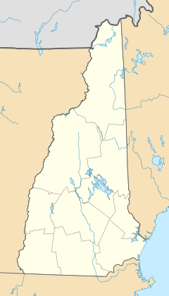
North Walpole is in the very northwest part of the town of Walpole. The Connecticut River forms its southern and western borders. To the north, it touches the town of Charlestown in Sullivan County.
New Hampshire Route 12 runs through the middle of the village. It is known as Main Street and Church Street there. If you go north on Route 12, it's about 7 miles to Charlestown. It's about 20 miles to Claremont. Going south, it's about 4.5 miles to Walpole village. It's about 21 miles to Keene.
The Arch Bridge connects North Walpole to Bellows Falls, Vermont. This bridge crosses the Connecticut River.
The North Walpole area covers about 1.8 square kilometers (0.7 square miles). A very small part of this area, about 0.51%, is water.
Population and People
| Historical population | |||
|---|---|---|---|
| Census | Pop. | %± | |
| 2010 | 828 | — | |
| 2020 | 785 | −5.2% | |
| U.S. Decennial Census | |||
In 2010, there were 828 people living in North Walpole. By 2020, the population was 785. Most people living in North Walpole are white. A small number of people are from other racial backgrounds.
In 2010, there were 340 households in the village. About 35% of these households had children under 18 living with them. Many households were made up of married couples. Some households had a single parent. About 30% of all households were single individuals. About 10.5% of people lived alone and were 65 or older.
Notable People
- Bill Jackowski (1914–1996) was a famous baseball umpire. He worked in the National League from 1952 to 1968.
See also
 In Spanish: North Walpole (Nuevo Hampshire) para niños
 | Charles R. Drew |
 | Benjamin Banneker |
 | Jane C. Wright |
 | Roger Arliner Young |


