Charlestown (CDP), New Hampshire facts for kids
Quick facts for kids
Charlestown, New Hampshire
|
|
|---|---|

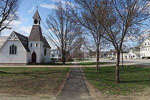
Main Street
|
|
| Country | United States |
| State | New Hampshire |
| County | Sullivan |
| Town | Charlestown |
| Area | |
| • Total | 1.00 sq mi (2.59 km2) |
| • Land | 0.95 sq mi (2.47 km2) |
| • Water | 0.05 sq mi (0.12 km2) |
| Elevation | 374 ft (114 m) |
| Population
(2020)
|
|
| • Total | 1,078 |
| • Density | 1,131.16/sq mi (436.83/km2) |
| Time zone | UTC-5 (Eastern (EST)) |
| • Summer (DST) | UTC-4 (EDT) |
| ZIP code |
03603
|
| Area code(s) | 603 |
| FIPS code | 33-11300 |
| GNIS feature ID | 2378055 |
Charlestown is a small community in New Hampshire, United States. It is known as a census-designated place (CDP), which means it's a special area defined for counting people. Charlestown is the main village within the larger town of Charlestown.
In 2020, about 1,078 people lived in this part of Charlestown. The entire town of Charlestown had a population of 4,806 people.
Exploring Charlestown's Location
Charlestown is located in the western part of the town. It sits right next to the Connecticut River. This river also forms the border between New Hampshire and Vermont.
The main road in Charlestown is New Hampshire Route 12. This road is also called Main Street. If you go north on Route 12 for about 10 miles, you'll reach Claremont. If you head south for about 7 miles, you'll get to North Walpole.
Another important road is New Hampshire Route 11. It crosses the Connecticut River just north of the village. This road connects you to Interstate 91, a major highway. Interstate 91 can take you north to White River Junction, Vermont, or south to Brattleboro, Vermont.
Size and Water Areas
The Charlestown CDP covers a total area of about 2.6 square kilometers (1.0 square mile). Most of this area, about 2.5 square kilometers (0.95 square miles), is land. A small part, about 0.1 square kilometers (0.05 square miles), is water. This means that about 4.68% of the area is covered by water.
Who Lives in Charlestown?
| Historical population | |||
|---|---|---|---|
| Census | Pop. | %± | |
| 1950 | 1,176 | — | |
| 1960 | 1,173 | −0.3% | |
| 1970 | 1,285 | 9.5% | |
| 1980 | 1,294 | 0.7% | |
| 1990 | 1,173 | −9.4% | |
| 2000 | 1,145 | −2.4% | |
| 2010 | 1,152 | 0.6% | |
| 2020 | 1,078 | −6.4% | |
| U.S. Decennial Census | |||
In 2010, there were 1,152 people living in Charlestown. These people lived in 467 different homes. About 28% of these homes had children under 18 living there. Many homes, about 44%, were families with married couples.
The people living in Charlestown come from different age groups. About 20% of the residents were under 18 years old. Around 18% were 65 years old or older. The average age of people in Charlestown was about 42.7 years.
See also
 In Spanish: Charlestown (condado de Sullivan) para niños
 | Laphonza Butler |
 | Daisy Bates |
 | Elizabeth Piper Ensley |


