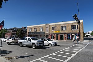
Jaffrey (CDP), New Hampshire facts for kids
Quick facts for kids
Jaffrey, New Hampshire
|
|
|---|---|
 |
|
| Country | United States |
| State | New Hampshire |
| County | Cheshire |
| Town | Jaffrey |
| Area | |
| • Total | 3.52 sq mi (9.13 km2) |
| • Land | 3.40 sq mi (8.82 km2) |
| • Water | 0.12 sq mi (0.31 km2) |
| Elevation | 1,004 ft (306 m) |
| Population
(2020)
|
|
| • Total | 3,058 |
| • Density | 898.35/sq mi (346.86/km2) |
| Time zone | UTC-5 (Eastern (EST)) |
| • Summer (DST) | UTC-4 (EDT) |
| ZIP code |
03452
|
| Area code(s) | 603 |
| FIPS code | 33-38420 |
| GNIS feature ID | 2378075 |
Jaffrey is a special area called a census-designated place (CDP). It's the main village in the town of Jaffrey. This town is located in Cheshire County, New Hampshire, in the United States. In 2020, about 3,058 people lived in the Jaffrey CDP. The entire town of Jaffrey had a population of 5,320 people.
Geography
The Jaffrey CDP is located in the eastern part of the town of Jaffrey. The Contoocook River flows through it, heading north. U.S. Route 202 is a major road that goes right through the middle of the village.
If you follow Route 202 northeast, you'll reach Peterborough in about 6 miles (10 km). If you go south on Route 202, you'll get to Winchendon, Massachusetts, which is about 11 miles (18 km) away.
New Hampshire Route 124 crosses US 202 in the center of Jaffrey. This route goes east for about 10 miles (16 km) to New Ipswich. It also goes northwest for about 12 miles (19 km) to Marlborough. Another road, New Hampshire Route 137, goes north from Jaffrey for about 14 miles (23 km) to Hancock.
The Jaffrey CDP has specific borders. To the north, it's bordered by roads like Harkness Road and Amos Fortune Road. To the east, you'll find Cheshire Pond and Contoocook Lake. The southern border is the town line of Rindge. To the west, the border follows US 202 and other local roads.
The U.S. Census Bureau says that the Jaffrey CDP covers a total area of about 3.5 square miles (9.1 square kilometers). Most of this area, about 3.4 square miles (8.8 square kilometers), is land. The rest, about 0.1 square miles (0.3 square kilometers), is water.
Population and People
| Historical population | |||
|---|---|---|---|
| Census | Pop. | %± | |
| 1960 | 1,648 | — | |
| 1970 | 1,922 | 16.6% | |
| 1980 | 2,684 | 39.6% | |
| 1990 | 2,558 | −4.7% | |
| 2000 | 2,802 | 9.5% | |
| 2010 | 2,757 | −1.6% | |
| 2020 | 3,058 | 10.9% | |
| U.S. Decennial Census | |||
In 2010, there were 2,757 people living in the Jaffrey CDP. These people lived in 1,224 households. About 704 of these households were families.
Most of the people living in Jaffrey CDP were White (95.9%). There were also smaller numbers of people who identified as African American, Native American, Asian, or from two or more races. About 2.0% of the population identified as Hispanic or Latino.
In terms of age, about 23.8% of the people were under 18 years old. About 13.1% were 65 years old or older. The average age of people in the CDP was about 39.3 years.
See also
 In Spanish: Jaffrey (condado de Cheshire) para niños
 | Dorothy Vaughan |
 | Charles Henry Turner |
 | Hildrus Poindexter |
 | Henry Cecil McBay |


