Deerfield River facts for kids
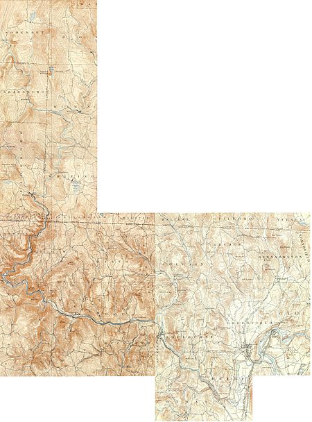
The Deerfield River is a river that flows for about 76 miles (122 km) through southern Vermont and northwestern Massachusetts. It eventually joins the Connecticut River. This river was very important in the early days for settling the western part of Franklin County, Massachusetts, and the town named after it, Deerfield, Massachusetts. The Deerfield River is the second longest river that flows into the Connecticut River in Massachusetts.
The Deerfield River meets the Connecticut River in Greenfield, Massachusetts. This happens just after a place called Turners Falls. The Deerfield River is one of the most used rivers in the United States. It has a dam almost every 7 miles (11 km) along its path. In Shelburne Falls, you can find cool natural rock formations called glacial potholes and a beautiful Bridge of Flowers. Both are popular spots for visitors.
Contents
Where Does the River Flow?
The river drops almost 1,100 feet (335 meters) over 50 miles (80 km). This big drop means it has a lot of power from the water. This power has been used in many places. Several other streams, almost as big as the Deerfield River itself, flow into it from the north. One of these is the Green River.
Dams: Making Power from Water
There are 10 dams on the Deerfield River. These dams are used to create electricity. Three different companies own these dams:
- TransCanada owns eight dams: Somerset, Searsburg, Harriman, Sherman, #2, #3, #4, and #5.
- Brookfield Power owns the Bear Swamp Pump Storage project and the Fife Brook dam.
- Nautilus Power LLC owns the smaller Gardner Falls Dam, which was built in 1904.
These power plants were bought from another company in 2005. In 1994, a special agreement was made. This agreement helps make sure enough water is released from the dams. This allows people to use the river for fun activities like boating. It also helps protect the animals and plants that live in the river.
A very tall dam, about 260 feet (79 meters) high, was planned for the Stillwater area in Deerfield many years ago. But local people did not want it, and they managed to stop the plan.
| Name | Power (MW) | Built | Notes |
|---|---|---|---|
| Searsburg Station | 5 | 1922 | |
| Harriman Station | 39 | 1925 | |
| Sherman Station | 7 | 1927 | |
| Deerfield #5 | 14 | 1974 | |
| Former Deerfield #5 powerhouse | No longer used, now underwater in the Bear Swamp reservoir. | ||
| Bear Swamp Generating Station | 600 | 1974 | Pumps water uphill to store energy, then releases it to make power when needed. |
| Fife Brook Station | 10 | 1974 | |
| Deerfield #4 | 6 | 1913 | Located near Charlemont and Buckland. |
| Deerfield #3 | 7 | 1912 | Located in Shelburne Falls. |
| Gardners Falls | 3.5 | 1904 | |
| Deerfield #2 | 6 | 1913 |
A Look Back: The River's History
Building power plants on the Deerfield River started in 1910. That's when the New England Power Company was created to buy rights to the river's water and build dams. The biggest dam, Harriman, was built in the early 1920s. It has a special overflow part called the "Glory Hole." This is a funnel-shaped concrete tube that helps stop too much water from flowing over the dam.
The last dam built on the Deerfield was Fife Brook Dam in the early 1970s. It was built along with the Bear Swamp Pumped Storage facility. Think of this facility like a giant battery for electricity. When there's extra electricity, it's used to pump water to a reservoir at the top of a mountain. This water is stored there. Then, when people need more electricity (like in the afternoon or evening), the water is released. It flows back down through turbines, which are like generators, to create power.
The third commercial nuclear power plant in the United States was built in the town of Rowe, Massachusetts, right by the Deerfield River and the Sherman Reservoir. It was called "Yankee Rowe" and made electricity for New England from 1960 to 1992.
The eastern entrance of the Hoosac Tunnel is also on the river, in Florida, Massachusetts. This is a railroad tunnel that is still used today. It was started in 1851 and finished in 1875. New tools were used to build it, like one of the first pneumatic drills. It also was one of the first big projects to use nitroglycerine and electric blasting caps. The American Society of Civil Engineers recognized the tunnel as a special historic landmark in 1975.
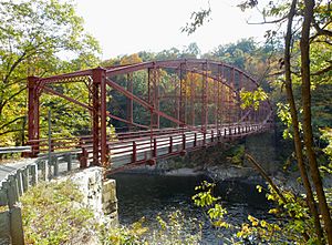
The Bardwell's Ferry Bridge is a 198-foot (60-meter) long bridge built in 1882. It crosses the Deerfield River between Shelburne and Conway. It is the longest bridge of its kind in Massachusetts and is listed on the National Register of Historic Places.
Fun on the River: Activities and Adventures
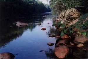
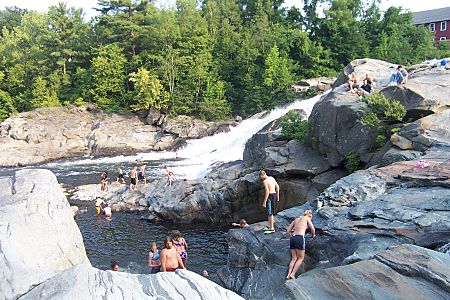
There are many fun things to do on and around the Deerfield River! You can go whitewater kayaking, canoeing, tubing, and swimming. It's also a great place for fishing and camping. In Deerfield, there's a popular swimming spot near the Stillwater Bridge. Here, some people jump from cliffs up to forty feet high into the water. This is allowed, but not encouraged.
For whitewater paddling, there are two main parts of the river. The Fife Brook section is good for paddlers who are at a Class II or III skill level. The "Dryway" section is more challenging, for Class IV paddlers.
Several smaller streams that flow into the Deerfield River are also great for whitewater paddling. These include the West Branch of the Deerfield in Readsboro, Vermont (Class IV-V), Dunbar Brook in Monroe, Massachusetts (Class V), Pelham Brook in Rowe, Massachusetts (Class V), Cold River in Florida and Charlemont, Massachusetts (Class IV), and the Chickley River in Hawley, Massachusetts (Class III).
The Deerfield River is also an excellent place to catch trout, especially for fly fishing. Two sections of the river, between the Fife Brook dam and the Route 2 bridge, are "catch and release" areas. This means you must let the fish go after you catch them. The five main dams on the river help control the water flow, which makes it a good place for trout fishing all year round.
 | Toni Morrison |
 | Barack Obama |
 | Martin Luther King Jr. |
 | Ralph Bunche |


