Charlemont, Massachusetts facts for kids
Quick facts for kids
Charlemont, Massachusetts
|
|||||
|---|---|---|---|---|---|

Goodnow Hall, home of the town offices
|
|||||
|
|||||
| Motto(s):
Deo duce, ferro comitante (Latin)
"God being my guide, my sword, my companion." |
|||||

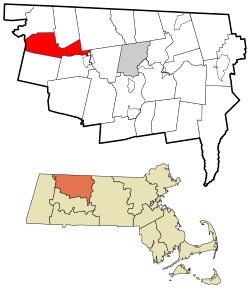
Location in Franklin County in Massachusetts
|
|||||
| Country | United States | ||||
| State | Massachusetts | ||||
| County | Franklin | ||||
| Settled | 1742 | ||||
| Incorporated | 1765 | ||||
| Government | |||||
| • Type | Open town meeting | ||||
| Area | |||||
| • Total | 26.4 sq mi (68.3 km2) | ||||
| • Land | 25.9 sq mi (67.2 km2) | ||||
| • Water | 0.4 sq mi (1.1 km2) | ||||
| Elevation | 965 ft (294 m) | ||||
| Population
(2020)
|
|||||
| • Total | 1,185 | ||||
| • Density | 44.94/sq mi (17.350/km2) | ||||
| Time zone | UTC-5 (Eastern) | ||||
| • Summer (DST) | UTC-4 (Eastern) | ||||
| ZIP code |
01339
|
||||
| Area code(s) | 413 | ||||
| FIPS code | 25-12505 | ||||
| GNIS feature ID | 0619379 | ||||
Charlemont is a small town in Franklin County, Massachusetts, United States. In 2020, about 1,185 people lived there. It is part of the larger Springfield area.
Contents
History of Charlemont
Early Settlement and Challenges
Charlemont was first settled in 1742 by a man named Moses Rice. He bought a large piece of land, about 2,200 acres (8.9 km²). At that time, Charlemont was on the edge of the settled areas. Native American groups sometimes raided the town.
One day, while Moses Rice was farming, he was shot and hurt by Native Americans. Another man was killed, and Moses's eight-year-old grandson, Asa, was captured and taken to Canada. Moses was left for dead but survived.
Becoming a Town
The town officially became Charlemont in 1765. It was probably named after a town in Northern Ireland. For a long time, farming was the main way people made a living. Later, the railroad came through town, heading towards the Hoosac Tunnel.
Today, Charlemont is also known for tourism. It has a ski area and other fun places along the Mohawk Trail.
Revolutionary War Times
Before the Revolutionary War, people in Charlemont were unhappy with British rule. The local church minister, Rev. Jonathan Leavitt, arrived in 1767. He had gone to Yale College.
However, Rev. Leavitt supported the British, which was different from what most people in Charlemont thought. By 1777, things got difficult. Leavitt refused to be paid in the new colonial money because it was losing value quickly. So, the town decided to close the church. They even put a guard at the door to stop him from preaching there.
But Rev. Leavitt didn't give up. He moved his sermons to the schoolhouse. He continued to preach there until 1785, when he was finally removed from his job. He later sued the town for his unpaid salary and won some money.
Helping Others Escape
Even though Rev. Leavitt had different views, his family stayed in the area. Some of his descendants, like Col. Roger Hooker Leavitt and his brother Hart Leavitt, became important helpers on the Underground Railroad. They gave shelter to many enslaved people who were escaping to freedom in the North.
A soldier and historian from the Revolutionary War, Lemuel Roberts, also helped his father start a farm in Charlemont before he went to fight in the Siege of Boston.
Geography of Charlemont
Charlemont covers about 26.4 square miles (68.3 km²). Most of this area is land, with a small part being water. It is located in the western part of Franklin County, right next to the border with Berkshire County.
Rivers and Mountains
The Deerfield River flows through Charlemont, joining the North River on the eastern side of town. Most of Charlemont is north of the Deerfield River. The town is surrounded by the eastern Berkshires mountains. Todd Mountain and the Mohawk Trail State Forest are in the western part of town. Other mountains like Bald Mountain and Westfield Mountain are also nearby.
Roads and Transportation
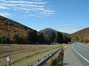
The famous Mohawk Trail, also known as Massachusetts Route 2, follows the Deerfield River through Charlemont. Near the town center, Route 2 meets Route 8A for a short distance.
A railroad line runs along the southern bank of the river. It carries freight trains from Greenfield towards the Hoosac Tunnel in nearby Florida. The closest major highway, Interstate 91, is a few miles east of town.
Charlemont also has a bus stop for the Franklin Regional Transit Authority (FRTA) bus line. For longer trips, you can find bus and air services in nearby towns like Greenfield and North Adams. The closest train service is in Pittsfield, and the nearest big airport is Albany International Airport in New York.
Population of Charlemont
| Historical population | ||
|---|---|---|
| Year | Pop. | ±% |
| 1840 | 1,181 | — |
| 1850 | 1,173 | −0.7% |
| 1860 | 1,075 | −8.4% |
| 1870 | 1,005 | −6.5% |
| 1880 | 932 | −7.3% |
| 1890 | 972 | +4.3% |
| 1900 | 1,094 | +12.6% |
| 1910 | 1,001 | −8.5% |
| 1920 | 808 | −19.3% |
| 1930 | 816 | +1.0% |
| 1940 | 789 | −3.3% |
| 1950 | 855 | +8.4% |
| 1960 | 897 | +4.9% |
| 1970 | 897 | +0.0% |
| 1980 | 1,149 | +28.1% |
| 1990 | 1,249 | +8.7% |
| 2000 | 1,358 | +8.7% |
| 2010 | 1,266 | −6.8% |
| 2020 | 1,185 | −6.4% |
| 2022* | 1,181 | −0.3% |
| * = population estimate. Source: United States Census records and Population Estimates Program data. |
||
In 2000, there were 1,358 people living in Charlemont. The town had 524 households and 353 families. Charlemont is one of the smaller towns in Franklin County.
About 25.1% of the people in Charlemont were under 18 years old. The average age in town was 38 years. Most households were married couples living together.
Education in Charlemont
Charlemont is part of the Mohawk Trail Regional School District. This district includes several nearby towns like Ashfield and Shelburne.
Younger students in Charlemont go to Hawlemont Regional Elementary School, which teaches grades K–6. After elementary school, students attend Mohawk Trail Regional High School.
There is also a private school in town called the Academy at Charlemont. Other private and religious schools are in nearby towns.
For higher education, the closest community college is Greenfield Community College in Greenfield. The nearest state college is Massachusetts College of Liberal Arts in North Adams. The biggest state university nearby is the University of Massachusetts Amherst.
Fun Things to Do in Charlemont
Charlemont offers many fun activities, especially outdoors!
- Alpine Skiing: Charlemont is famous for its ski area, Berkshire East Ski Area. It's open from late fall to early spring and has snowmaking and night skiing.
- Camping: You can go camping at Country Aire Campground/RV Park, located on Route 2 along the Mohawk Trail.
- Hiking: There are many popular mountains to hike in Charlemont, like Mount Institute, Negus Mountain, Pocumtuck Mountain, and Todd Mountain.
- Water Rafting: White water rafting is very popular on the Deerfield River. Companies like Crabapple Whitewater and Berkshire Whitewater offer exciting trips.
- Mohawk Park: This small park along Route 2 has a statue called Hail to the Sunrise. It honors the area's Native American history.
- Mountain Biking: Since 2015, Thunder Mountain Bike Park has been open at Berkshire East Ski Area. You can take a lift up the mountain and bike down exciting trails.
- Zip Lines: Charlemont has several zip line canopy tours. Berkshire East Canopy Tours, Zoar Outdoor, and Experience Based Learning all offer thrilling zip line adventures.
Notable People from Charlemont
- Catharine Webb Barber (1823–1893), a newspaper editor and author.
- Robert S. Houston (1820–1902), a Wisconsin state politician, stonemason, and dairy farmer, was born in Charlemont.
- Celeste M. A. Winslow (1837–1908), an author.
See also
 In Spanish: Charlemont (Massachusetts) para niños
 | Valerie Thomas |
 | Frederick McKinley Jones |
 | George Edward Alcorn Jr. |
 | Thomas Mensah |


