Shelburne, Massachusetts facts for kids
Quick facts for kids
Shelburne, Massachusetts
|
||
|---|---|---|
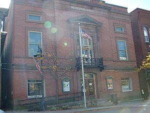
Shelburne Memorial Hall
|
||
|
||
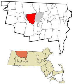
Location in Franklin County in Massachusetts
|
||
| Country | United States | |
| State | Massachusetts | |
| County | Franklin | |
| Settled | 1756 | |
| Incorporated | 1768 | |
| Government | ||
| • Type | Open town meeting | |
| Area | ||
| • Total | 23.4 sq mi (60.6 km2) | |
| • Land | 23.2 sq mi (60.0 km2) | |
| • Water | 0.2 sq mi (0.6 km2) | |
| Elevation | 935 ft (285 m) | |
| Population
(2020)
|
||
| • Total | 1,884 | |
| • Density | 80.52/sq mi (31.09/km2) | |
| Time zone | UTC−5 (Eastern) | |
| • Summer (DST) | UTC−4 (Eastern) | |
| ZIP Code |
01370
|
|
| Area code(s) | 413 | |
| FIPS code | 25-61135 | |
| GNIS feature ID | 0618175 | |
Shelburne is a town in Franklin County, Massachusetts, United States. In 2020, about 1,884 people lived there. It is part of the larger Springfield area.
A part of the village called Shelburne Falls is located in Shelburne. The other part is in the nearby town of Buckland.
Contents
History of Shelburne
Shelburne was first settled in 1756. It was originally part of Deerfield, Massachusetts and was known as "Deerfield Northwest."
In 1768, it became an official district named Shelburne. It was named after William Petty, 2nd Earl of Shelburne. He was a British politician who later became Prime Minister during the American Revolutionary War. Shelburne officially became a town in 1775.
The town has two main parts. The main area has farms among rolling hills. The area around Shelburne Falls was mostly a place for mills and factories.
Geography and Nature
Shelburne is in the middle of Franklin County. It covers about 60.6 square kilometers (23.4 square miles). Most of this area is land, with a small amount of water.
The town is next to Colrain to the north and Greenfield to the east. It also borders Deerfield, Conway, Buckland, and a small part of Charlemont.
Rivers and Mountains
The Deerfield River flows along the southern and western edges of Shelburne. Many small streams flow into this river from the low hills. Massaemett Mountain is the highest point in town. It is located just east of Shelburne Falls.
In Shelburne Falls, you can find the "Glacial Potholes." These are cool holes in the rocks near a waterfall. They were made by large rocks moving in the Deerfield River long ago.
Roads and Transportation
Massachusetts Route 2, also known as the Mohawk Trail, runs through Shelburne. This is a main road that goes from east to west across northern Massachusetts.
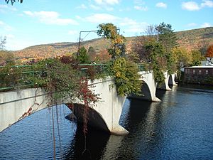
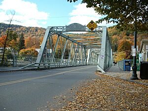
Massachusetts Route 112 also serves Shelburne Falls. It follows the river and crosses a truss bridge built in 1890. This bridge goes into Buckland.
The closest major highway, Interstate 91, is in nearby Greenfield and Deerfield. You can get to it from Route 2.
For public transportation, there is bus service in Greenfield. The Franklin Regional Transit Authority (FRTA) also has a route that stops in Shelburne Falls. The closest airport for national flights is Bradley International Airport in Windsor Locks, Connecticut.
Population and People
| Historical population | ||
|---|---|---|
| Year | Pop. | ±% |
| 1840 | 1,183 | — |
| 1850 | 1,239 | +4.7% |
| 1860 | 1,448 | +16.9% |
| 1870 | 1,582 | +9.3% |
| 1880 | 1,621 | +2.5% |
| 1890 | 1,558 | −3.9% |
| 1900 | 1,508 | −3.2% |
| 1910 | 1,498 | −0.7% |
| 1920 | 1,436 | −4.1% |
| 1930 | 1,544 | +7.5% |
| 1940 | 1,636 | +6.0% |
| 1950 | 1,756 | +7.3% |
| 1960 | 1,739 | −1.0% |
| 1970 | 1,836 | +5.6% |
| 1980 | 2,002 | +9.0% |
| 1990 | 2,012 | +0.5% |
| 2000 | 2,058 | +2.3% |
| 2010 | 1,893 | −8.0% |
| 2020 | 1,884 | −0.5% |
| 2022 | 1,886 | +0.1% |
Source: United States Census records and Population Estimates Program data. |
||
In 2000, there were 2,058 people living in Shelburne. The town had 834 households. About 27.6% of these households had children under 18.
The average age of people in Shelburne was 45 years old. About 21.1% of the population was under 18.
Schools and Learning
Shelburne is part of the Mohawk Trail Regional School District. This district serves several towns for elementary and high school education.
Younger students, from pre-kindergarten to sixth grade, go to Buckland-Shelburne Regional Elementary School. Students in grades 7–12 attend Mohawk Trail Regional High School in Buckland.
There are also private schools in the area. Some well-known ones include Deerfield Academy and Northfield Mount Hermon School.
For college, Greenfield Community College is nearby. The University of Massachusetts Amherst is also a state university in the region.
Famous People from Shelburne
- Cady Coleman (astronaut)
- William Henry "Bill" Cosby Jr. (comedian)
- Augustus O. Dole
- Mary Phylinda Dole
- Silas Lamson
- Josh Simpson (glass artist)
See also
 In Spanish: Shelburne (Massachusetts) para niños
 | Kyle Baker |
 | Joseph Yoakum |
 | Laura Wheeler Waring |
 | Henry Ossawa Tanner |


