Buckland, Massachusetts facts for kids
Quick facts for kids
Buckland, Massachusetts
|
|||
|---|---|---|---|
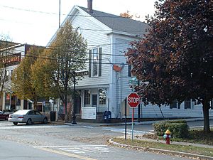
Buckland Town Hall
|
|||
|
|||
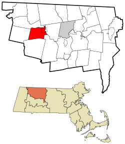
Location in Franklin County in Massachusetts
|
|||
| Country | United States | ||
| State | Massachusetts | ||
| County | Franklin | ||
| Settled | 1779 | ||
| Incorporated | 1779 | ||
| Government | |||
| • Type | Open town meeting | ||
| Area | |||
| • Total | 19.9 sq mi (51.5 km2) | ||
| • Land | 19.7 sq mi (50.9 km2) | ||
| • Water | 0.2 sq mi (0.5 km2) | ||
| Elevation | 607 ft (185 m) | ||
| Population
(2020)
|
|||
| • Total | 1,816 | ||
| • Density | 91.33/sq mi (35.26/km2) | ||
| Time zone | UTC-5 (Eastern) | ||
| • Summer (DST) | UTC-4 (Eastern) | ||
| ZIP code |
01338
|
||
| Area code(s) | 413 | ||
| FIPS code | 25-09595 | ||
| GNIS feature ID | 0618159 | ||
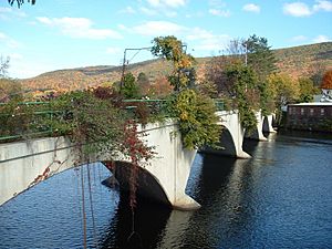
Buckland is a small and charming town in Franklin County, Massachusetts, USA. About 1,816 people live there, according to the 2020 census. The town shares a special village called Shelburne Falls with its neighbor, Shelburne. A famous local attraction, the Bridge of Flowers, starts in Buckland's part of Shelburne Falls.
Contents
History of Buckland
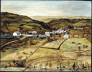
Buckland was first settled way back in 1742. Back then, it was known as "No Town" because it wasn't officially part of any nearby villages like Charlemont or Ashfield. The land was just one big area.
In 1742, two people named Othneil Taylor and Asaph White set up a sawmill. Soon, more people started to settle there. However, the settlers found it hard to travel to Ashfield Village for important services. They had to cross the Deerfield River or go a very long distance.
So, they asked the government of Massachusetts to make their area a separate town. On April 14, 1779, their wish came true, and the town was officially named Buckland. People believe it was named Buckland because there was a lot of deer hunting in the area.
Buckland is also famous as the birthplace of Mary Lyon. She was a very important person who founded the Mount Holyoke Female Seminary. Today, this school is known as Mount Holyoke College, a well-known college for women.
Geography and Nature
Buckland is located in the western part of Franklin County. It covers about 51.5 square kilometers (20 square miles) in total. Most of this area, about 50.9 square kilometers, is land. Only a small part, about 0.5 square kilometers, is water.
The town is surrounded by other towns. To the north is Charlemont, and to the northeast is Shelburne. Conway is to the southeast, Ashfield is to the south, and Hawley is to the west.
Buckland's town center is about 21 kilometers (13 miles) west of Greenfield. It's also about 64 kilometers (40 miles) north of Springfield. If you want to go to Boston, it's about 166 kilometers (103 miles) away to the west-northwest.
The Deerfield River forms the northern and eastern edges of Buckland. Two brooks, Clesson Brook and Clark Brook, flow north through the town into the river. These brooks create the main valley in the town. On either side of this valley, you'll find several hills. Some of these include Walnut Hill, Drank Hill, and Snow Mountain to the west. To the east, there are Mary Lyon Hill and Moonshine Hill. A small state forest is located on part of Moonshine Hill.
Travel and Transportation
A small part of Massachusetts Route 2, also known as the Mohawk Trail, goes through the northeast corner of Buckland. This is a scenic road that many people enjoy driving. The closest major highway, Interstate 91, is in nearby Greenfield.
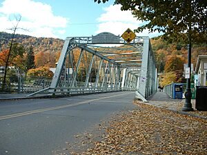
There's a special parking area called a park and ride lot on Route 2. It's near the bridge that crosses the river to Shelburne Falls. South of the river, a freight train line passes through Buckland. This line goes from Conway in the east towards the Hoosac Tunnel in the mountains to the west.
Buckland is on a bus line run by the Franklin Regional Transit Authority (FRTA). However, there are no regular bus stops directly in Buckland. The closest stops are in Charlemont and Shelburne Falls.
If you need to catch a train, the nearest Amtrak station is in Greenfield. For small plane flights, the Turners Falls Municipal Airport is the closest option. If you need to fly on a bigger plane for national travel, the nearest major airport is Bradley International Airport in Windsor Locks, Connecticut.
Population and People
In 2000, about 1,991 people lived in Buckland. There were 772 households and 542 families. Buckland is one of the smaller towns in Franklin County when it comes to population.
Most of the people in Buckland are White (about 96.5%). There are also smaller numbers of African American, Native American, and Asian residents. About 1.16% of the population is Hispanic or Latino.
About 33.2% of the households had children under 18 living with them. Most households (54.1%) were married couples living together. About 21.8% of all households were people living alone.
The average age of people in Buckland was 40 years old. About 25% of the population was under 18 years old. About 13.3% of the people were 65 years old or older.
In 2000, the average income for a household in Buckland was about $45,833 per year. For families, the average income was about $51,420. About 6.9% of the total population lived below the poverty line.
Education in Buckland
Buckland is part of the Mohawk Trail Regional School District. This district includes several other towns like Ashfield, Charlemont, and Shelburne.
Younger students, from kindergarten to sixth grade, go to Buckland-Shelburne Regional Elementary School. This school also serves students from the neighboring town of Shelburne. After elementary school, students go to Mohawk Trail Regional High School. The high school sports teams are called the Warriors, and their colors are blue and gold.
There are also some private schools and charter schools in the nearby Greenfield area. Some well-known ones include Deerfield Academy and Eaglebrook School in Deerfield.
For higher education, the closest community college is Greenfield Community College in Greenfield. The nearest state college is Massachusetts College of Liberal Arts in North Adams. The biggest state university nearby is the University of Massachusetts Amherst. There are also many private colleges in the Northampton area, including those in the Five Colleges group.
See also
 In Spanish: Buckland (Massachusetts) para niños
 | John T. Biggers |
 | Thomas Blackshear |
 | Mark Bradford |
 | Beverly Buchanan |


