Rowe, Massachusetts facts for kids
Quick facts for kids
Rowe, Massachusetts
|
||
|---|---|---|

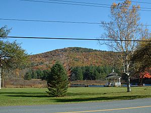
Adams Mountain, with the Village Green and Mill Pond in the foreground
|
||
|
||

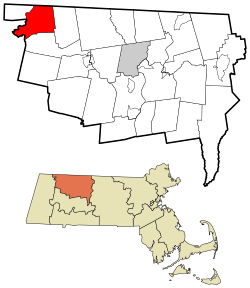
Location in Franklin County in Massachusetts
|
||
| Country | United States | |
| State | Massachusetts | |
| County | Franklin | |
| Settled | 1762 | |
| Incorporated | 1785 | |
| Government | ||
| • Type | Open town meeting | |
| Area | ||
| • Total | 24.0 sq mi (62.2 km2) | |
| • Land | 23.4 sq mi (60.7 km2) | |
| • Water | 0.6 sq mi (1.5 km2) | |
| Elevation | 1,467 ft (447 m) | |
| Population
(2020)
|
||
| • Total | 424 | |
| • Density | 17.66/sq mi (6.817/km2) | |
| Time zone | UTC−5 (Eastern) | |
| • Summer (DST) | UTC−4 (Eastern) | |
| ZIP Code |
01367
|
|
| Area code(s) | 413 | |
| FIPS code | 25-58335 | |
| GNIS feature ID | 0618174 | |
Rowe is a small town in Franklin County, Massachusetts, United States. In 2020, about 424 people lived there.
Contents
A Look at Rowe's Past
Long ago, Native American tribes used the Rowe area for fishing and gathering food. White settlers first came in 1744. They built a fort there to protect themselves from attacks.
In 1762, a man named Rev. Cornelius Jones bought the land. He called it "Myrifield," which means "thousand" in Greek. By 1785, enough people lived there for it to become an official town. The Massachusetts General Court renamed it Rowe, after John Rowe, a well-known merchant from Boston.
Rowe grew because of mills along the river. Mills are factories that use water power to grind grain or saw wood. Other businesses also started, like mining for sulfur, talc, and soapstone. You can still see signs of this at the abandoned settlement of Davis Mine.
In the late 1880s, a railroad was built along the river. This made Rowe a small vacation spot. But by the early 1900s, most of the industries slowed down. Rowe became a quiet, rural town until the 1950s.
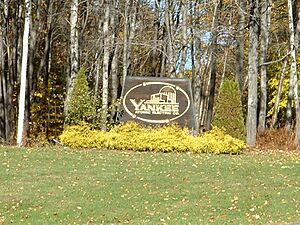
During the "baby boom" (when many babies were born after World War II), Rowe became home to the Yankee Rowe Nuclear Power Station. This was the first nuclear power plant in New England. It was near the Sherman Dam, close to the Vermont border. The plant operated from 1960 to 1992. It is now completely shut down. The used nuclear material from the plant is planned to be moved to a special storage facility.
Exploring Rowe's Geography
Rowe covers about 62.2 square kilometers (24 square miles). Most of this is land (60.7 sq km or 23.4 sq mi), and a small part is water (1.5 sq km or 0.6 sq mi).
Rowe is located on the northern edge of Franklin County and Massachusetts. It shares borders with Windham County, Vermont, to the north and Berkshire County to the west. Nearby towns include Whitingham, Vermont (north), Heath (east), Charlemont (south), and Florida and Monroe (west).
Rowe is about 23 miles (37 km) west-northwest of Greenfield. It's also about 53 miles (85 km) north-northwest of Springfield and 112 miles (180 km) west-northwest of Boston.
The Deerfield River flows along Rowe's eastern side. Near the Vermont border, the river is dammed to create the Sherman Reservoir. Rowe also has two other large bodies of water: the Upper Bear Swamp Reservoir and Pelham Lake. Pelham Lake feeds Pelham Brook, which flows into the Deerfield River.
The town has many hills. There are two main ridges on either side of Pelham Brook. Negus Mountain is in the southwest. Todd Mountain and Adams Mountain are on the eastern ridge. Adams Mountain is the highest point in Rowe. A large area southeast of Pelham Lake is part of Pelham Lake Park. There are also two small parts of Monroe State Forest in town.
Rowe is one of the few small towns in Massachusetts that does not have any state highways running through it. The closest state highways are Massachusetts Route 8A in Heath and Massachusetts Route 2 (the Mohawk Trail) in Charlemont and Florida. The nearest major highway, Interstate 91, is further east. A short section of railroad tracks, leading to the Hoosac Tunnel, passes through the southwest corner of town. However, Rowe does not have its own train, bus, or air service. The closest bus and small airport services are in North Adams. For train travel, the nearest Amtrak station is in Pittsfield. For national flights, the closest major airport is Albany International Airport in New York.
Local Areas in Rowe
Here are some smaller areas or villages within Rowe:
Rowe's Weather
| Climate data for Rowe 3 NE, Massachusetts, 1991–2020 normals: 1735ft (529m) | |||||||||||||
|---|---|---|---|---|---|---|---|---|---|---|---|---|---|
| Month | Jan | Feb | Mar | Apr | May | Jun | Jul | Aug | Sep | Oct | Nov | Dec | Year |
| Mean daily maximum °F (°C) | 28.9 (−1.7) |
31.3 (−0.4) |
38.6 (3.7) |
50.9 (10.5) |
62.9 (17.2) |
70.4 (21.3) |
75.1 (23.9) |
74.6 (23.7) |
68.3 (20.2) |
56.2 (13.4) |
44.3 (6.8) |
34.4 (1.3) |
53.0 (11.7) |
| Daily mean °F (°C) | 20.0 (−6.7) |
22.0 (−5.6) |
29.3 (−1.5) |
41.2 (5.1) |
52.4 (11.3) |
61.1 (16.2) |
65.9 (18.8) |
64.6 (18.1) |
57.9 (14.4) |
46.2 (7.9) |
36.0 (2.2) |
26.5 (−3.1) |
43.6 (6.4) |
| Mean daily minimum °F (°C) | 11.1 (−11.6) |
12.6 (−10.8) |
19.9 (−6.7) |
31.5 (−0.3) |
41.8 (5.4) |
51.8 (11.0) |
56.6 (13.7) |
54.6 (12.6) |
47.5 (8.6) |
36.2 (2.3) |
27.6 (−2.4) |
18.6 (−7.4) |
34.2 (1.2) |
| Average precipitation inches (mm) | 4.25 (108) |
3.71 (94) |
4.39 (112) |
4.37 (111) |
4.01 (102) |
4.65 (118) |
4.82 (122) |
4.82 (122) |
4.60 (117) |
4.99 (127) |
3.88 (99) |
4.66 (118) |
53.15 (1,350) |
| Source: NOAA | |||||||||||||
Who Lives in Rowe?
| Historical population | ||
|---|---|---|
| Year | Pop. | ±% |
| 1840 | 700 | — |
| 1850 | 659 | −5.9% |
| 1860 | 619 | −6.1% |
| 1870 | 581 | −6.1% |
| 1880 | 502 | −13.6% |
| 1890 | 541 | +7.8% |
| 1900 | 549 | +1.5% |
| 1910 | 456 | −16.9% |
| 1920 | 333 | −27.0% |
| 1930 | 298 | −10.5% |
| 1940 | 233 | −21.8% |
| 1950 | 199 | −14.6% |
| 1960 | 231 | +16.1% |
| 1970 | 277 | +19.9% |
| 1980 | 336 | +21.3% |
| 1990 | 378 | +12.5% |
| 2000 | 351 | −7.1% |
| 2010 | 393 | +12.0% |
| 2020 | 424 | +7.9% |
| 2022 | 421 | −0.7% |
Source: United States Census records and Population Estimates Program data. |
||
In 2000, there were 351 people living in Rowe. This made it one of the smallest towns in Franklin County and Massachusetts. The population density was about 14.9 people per square mile (5.8 people per square kilometer). This means there weren't many people living close together.
Most of the people living in Rowe were White (99.72%). About 1.14% of the population identified as Hispanic or Latino.
There were 154 households. A household is a group of people living in one home. About 22.7% of these households had children under 18. Most households (59.1%) were married couples living together. Some (5.8%) had a female head of the household without a husband. About 31.8% were non-families, meaning people living together who are not related.
The average age of people in Rowe was 48 years old. About 19.7% of the population was under 18. About 18.8% were 65 years or older.
The average income for a household in Rowe was $41,944. For families, the average income was $53,750. The average income per person was $28,134. A very small number of people (2.8%) lived below the poverty line, which means they had very low incomes.
Learning in Rowe
Rowe is part of the Mohawk Trail Regional School District, which includes nine towns in western Franklin County. Students in Rowe attend Rowe Elementary School from pre-kindergarten through sixth grade. After that, all students in the district go to Mohawk Trail Regional High School in Buckland.
There is a private school in nearby Charlemont. Other private and religious schools are in North Adams.
For higher education, the closest community college is Greenfield Community College in Greenfield. The nearest state college is Massachusetts College of Liberal Arts in North Adams. The biggest state university is the University of Massachusetts Amherst. The closest private college is Williams College in Williamstown. There are also several other colleges in the Northampton/Amherst area.
Places to Visit in Rowe
- The Rowe Center is a Unitarian Universalist organization that started in 1924. It offers different summer camp programs for young people. It also has workshops and spiritual retreats for adults. Reverend Anita Pickett founded the summer camp in 1924.
- The Rowe Historical Society is at 282 Zoar Road. It runs the Kemp-McCarthy Museum. You can find information about the museum, its collections, and events at www.rowehistoricalsociety.org.
- The former mining village of Davis, Massachusetts is in the eastern part of town, near Pelham Lake. It is now a ghost town, meaning it is mostly abandoned.
See also
 In Spanish: Rowe (Massachusetts) para niños
 | Sharif Bey |
 | Hale Woodruff |
 | Richmond Barthé |
 | Purvis Young |


