
Hampden, Massachusetts facts for kids
Quick facts for kids
Hampden, Massachusetts
|
||
|---|---|---|

Hampden Town House
|
||
|
||

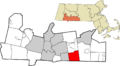
Location in Hampden County in Massachusetts
|
||
| Country | United States | |
| State | Massachusetts | |
| County | Hampden | |
| Settled | 1741 | |
| Incorporated | March 28, 1878 | |
| Government | ||
| • Type | Open town meeting | |
| Area | ||
| • Total | 19.7 sq mi (50.9 km2) | |
| • Land | 19.6 sq mi (50.9 km2) | |
| • Water | 0.0 sq mi (0.0 km2) | |
| Elevation | 290 ft (88 m) | |
| Population
(2020)
|
||
| • Total | 4,966 | |
| • Density | 253.4/sq mi (97.6/km2) | |
| Time zone | UTC-5 (Eastern) | |
| • Summer (DST) | UTC-4 (Eastern) | |
| ZIP code |
01036
|
|
| Area code(s) | 413 | |
| FIPS code | 25-28075 | |
| GNIS feature ID | 0618184 | |
| Website | http://www.hampdenma.gov/ | |

Hampden is a small town in Hampden County, Massachusetts, in the United States. In 2020, about 4,966 people lived there. Hampden is part of the larger Springfield area. The town is named after John Hampden, a famous English patriot.
Contents
History of Hampden
The area where Hampden is located was once called Minnechaug by the Nipmuc Native Americans. This name means "berry land" or "berry hill." In 1674, the land was sold and became known as Springfield Mountain.
The first European settlers arrived around 1741. They were the Stebbins and Hitchcock families. The first sawmill, which cut wood, was built near the Scantic River.
The Rattlesnake Incident
A famous event called the "Rattlesnake Incident of 1761" happened in Hampden. On August 7, 1761, a 22-year-old named Timothy Merrick was bitten by a snake and died while working in a field. This sad event became a well-known story. It was even turned into one of the earliest songs written in North America, called "On Springfield Mountain". This song is also the basis for the modern folk song "Rattlesnake Mountain".
Early Town Life
Hampden grew along the banks of the Scantic River. The river's water powered the first mills, which helped businesses grow. Many early homes were built close to the river. For its first 100 years, Hampden was mostly a farming town. It was considered part of Wilbraham.
In 1878, Hampden officially became its own town, separate from Wilbraham. At that time, some industries started to grow in Hampden. However, some large mills were destroyed by fires. As cars became popular, people could work outside of town. This led to more farming, with many orchards and dairy farms.
Over time, many people from Springfield built summer vacation homes in Hampden. These often became year-round homes. Today, Hampden is mostly a residential town, meaning people live there but often work elsewhere.
Important Events
Hampden was one of the first towns to put up a monument for World War I. It was built in January 1920 and still stands today.
The famous writer H.P. Lovecraft visited Hampden. His trip inspired his 1928 story, "The Dunwich Horror". The fictional town in his story is based on Hampden and the nearby areas.
In August 1955, Hurricane Diane caused a lot of damage in Hampden. Many bridges were washed away due to flooding.
Since 2000, Hampden has worked to protect its natural spaces. Residents have helped save over 100 acres (0.40 km2) of land for parks and open areas. This includes the top of Minnechaug Mountain, which is one of the town's highest hills. You can find hiking trails there.
In September 2004, a fire damaged the Laughing Brook Wildlife Sanctuary. This building was dedicated to the author Thornton Burgess. His original home on the property was not harmed.
In October 2005, heavy rains caused the Scantic River to flood again. Many homes and businesses were affected, and a bridge was washed away.
Geography of Hampden
Hampden covers about 19.6 square miles (51 km2) of land. It is located on the eastern side of the Connecticut River Valley. The town has hills that rise to over 1,000 feet (300 m) above sea level. The highest points are Pine Mountain and Rattlesnake Peak, both about 1,070 feet (330 m) high. Hampden does not have any large lakes, but it has several small streams that flow into the Connecticut River.
Hampden is right on the border with Connecticut. It is surrounded by other towns: Wilbraham to the north, Monson to the east, Stafford, Connecticut and Somers, Connecticut to the south, and East Longmeadow to the west. From the town center, Hampden is about 11 miles (18 km) southeast of Springfield.
Transportation in Hampden
Hampden is one of the few towns in Massachusetts that does not have any major highways or state routes passing through it. It also does not have any traffic lights. The closest state road, Route 83, is very near but does not enter the town.
There is no public transportation like buses or trains within Hampden. The closest train service is in Springfield. For air travel, the nearest major airport is Bradley International Airport in Connecticut.
Climate in Hampden
Winters in Hampden can be different each year. Sometimes they are mild, with temperatures in the 30s. Other times, they can be very cold. In January 1960, a record cold temperature of −40 degrees Fahrenheit (−40 °C) was recorded. In July 2006, the temperature reached 100 degrees Fahrenheit. These are the extreme temperatures recorded in Hampden.
Snowfall also varies. In March 1995, there was a lot of snow, with a depth of 28 inches. However, some winters have very little snow. Summers can be hot and humid, or warm and dry.
Population of Hampden
| Historical population | ||
|---|---|---|
| Year | Pop. | ±% |
| 1880 | 958 | — |
| 1890 | 831 | −13.3% |
| 1900 | 782 | −5.9% |
| 1910 | 645 | −17.5% |
| 1920 | 624 | −3.3% |
| 1930 | 684 | +9.6% |
| 1940 | 1,023 | +49.6% |
| 1950 | 1,322 | +29.2% |
| 1960 | 2,345 | +77.4% |
| 1970 | 4,572 | +95.0% |
| 1980 | 4,745 | +3.8% |
| 1990 | 4,709 | −0.8% |
| 2000 | 5,171 | +9.8% |
| 2010 | 5,139 | −0.6% |
| 2020 | 4,966 | −3.4% |
| 2022* | 4,915 | −1.0% |
| * = population estimate. Source: United States Census records and Population Estimates Program data. | ||
In 2010, there were 5,109 people living in Hampden. There were 1,887 households, and 1,467 families. About 32.1% of households had children under 18. The average household had 2.66 people.
The population's age was spread out. About 23.7% were under 18, and 18.5% were 65 or older. The average age was 47.1 years.
Hampden Public Library
The Hampden Public Library first opened in 1891. For a short time in 2005 and 2006, the library and senior center were closed. This happened because of budget issues. However, they were reopened in the summer of 2006. The town spends money each year to support its public library.
Education in Hampden
Green Meadows Elementary School opened in 1956. In the same year, Hampden joined with the nearby town of Wilbraham to create a combined school district for high school students. They built Minnechaug Regional High School in Wilbraham, which opened in 1959. Thornton W. Burgess Middle School was built in 1967, but it closed in 2018 due to fewer students.
Places of Worship
Hampden has three churches. They belong to the Baptist, Roman Catholic, and Federated faiths. The Federated church combines the United Church of Christ, Congregational and United Methodist churches. The Roman Catholic church is called St. Mary's. The Baptist Church is Bethlehem Church. The Federated church is Federated Community Church.
Notable People from Hampden
- Jack Arute, a racing announcer and host
- Thornton W. Burgess, a conservationist and author
- Peter Fatse, a professional baseball coach for the Boston Red Sox
- Dan Haseltine, a singer and songwriter for the Christian rock band Jars of Clay
- Albert Payson Terhune, an author and journalist
Points of Interest in Hampden
- The former site of Laughing Brook Wildlife Sanctuary: This was once the home of author Thornton Burgess.
- Minnechaug Mountain: This area offers hiking trails and nature walks on land owned by the town. You can find parking for the trails on South Road.
- Algonquin Trail: Also known as the "Boy Scout Trail" or "Ridge Trail," this path goes through the town from north to south. It passes through the Minnechaug Mountain reserve. Efforts are being made to connect it with other trail systems in nearby towns.
- Hollow Road: This road between Hampden and Wilbraham is known for local stories about being haunted. The Wilbraham side of the road is closed.
- Rock-A-Dundee Road: This road is also part of many local legends and ghost stories.
Images for kids
-

Hampden Town House
-

Seal of Hampden, Massachusetts
-
Location of Hampden in Hampden County
See also
 In Spanish: Hampden (Massachusetts) para niños
