Wales, Massachusetts facts for kids
Quick facts for kids
Wales, Massachusetts
|
||
|---|---|---|
|
||
| Motto(s):
The Past Our Heritage, The Future Our Legacy
|
||

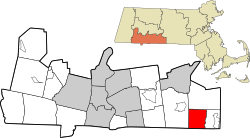
Location in Hampden County in Massachusetts
|
||
| Country | United States | |
| State | Massachusetts | |
| County | Hampden | |
| Settled | 1726 | |
| Incorporated | 1775 | |
| Government | ||
| • Type | Open town meeting | |
| Area | ||
| • Total | 15.9 sq mi (41.3 km2) | |
| • Land | 15.7 sq mi (40.7 km2) | |
| • Water | 0.2 sq mi (0.6 km2) | |
| Elevation | 949 ft (289 m) | |
| Population
(2020)
|
||
| • Total | 1,832 | |
| • Density | 114.89/sq mi (44.36/km2) | |
| Time zone | UTC−5 (Eastern) | |
| • Summer (DST) | UTC−4 (Eastern) | |
| ZIP Code |
01081
|
|
| Area code(s) | 413 | |
| FIPS code | 25-72390 | |
| GNIS feature ID | 0619389 | |
Wales is a small town in Hampden County, Massachusetts, United States. In 2020, about 1,832 people lived there. It is part of the larger Springfield area.
Contents
History of Wales
Wales was first settled by European people in 1726. It officially became a town on August 23, 1775. Back then, it was called "South Brimfield."
The town's name changed to Wales on February 20, 1828. It was named after James Lawrence Wales, a person who helped the community. Some of the first settlers included Anthony Needham, John Bullen, and Samuel and Dorothy Munger.
The Munger family became very important in the town. Samuel Munger Jr. served as a selectman, which is like a local leader. He was also a deacon at the Baptist Church. Nathaniel Munger was part of a group of 12 men who helped solve problems in the area. He was also a deacon at the Baptist Church.
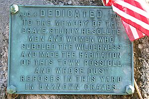
The "Meadow District" in Wales was once known as "Munger's Meadow." This area has graves of some of the very first people who settled in the town.
Geography of Wales
Wales is located in the southeastern part of Hampden County. It covers about 41.3 square kilometers (15.9 square miles). Most of this area is land, with a small part being water.
The town shares its borders with other towns. To the west is Monson. To the south, it borders Stafford and Union, Connecticut in Connecticut. To the east is Holland, and to the north is Brimfield.
Massachusetts Route 19 is a main road that goes through Wales. This road leads north to Brimfield and south into Connecticut, where it becomes Connecticut Route 19 and goes to Stafford Springs, Connecticut.
Education in Wales
Wales has its own school for younger students called Wales Elementary School. This school teaches children from kindergarten up to sixth grade. It has its own special committee that helps run the school.
After elementary school, students from Wales go to Tantasqua Regional Junior High School for grades 7 and 8. Then, they attend Tantasqua Regional High School in Sturbridge.
Wales Elementary School is part of School Union 61. The Tantasqua district and Union 61 share some leaders, like the superintendent. These school districts also include students from Brimfield, Brookfield, Holland, and Sturbridge.
Wales Public Library
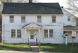
The Wales Public Library first opened its doors in 1897. It's a place where everyone in the town can go to read books, learn new things, and use computers. The town supports the library as an important resource for the community.
Population and People
In 2000, there were 1,737 people living in Wales. There were 660 households, and 481 of these were families. The town's population has grown over the years.
Here's how the population has changed:
- 1850: 711 people
- 1900: 773 people
- 1950: 497 people
- 2000: 1,737 people
- 2010: 1,838 people
- 2020: 1,832 people
See also
 In Spanish: Wales (Massachusetts) para niños
 | William Lucy |
 | Charles Hayes |
 | Cleveland Robinson |


