Union, Connecticut facts for kids
Quick facts for kids
Union, Connecticut
|
||
|---|---|---|
| Town of Union | ||

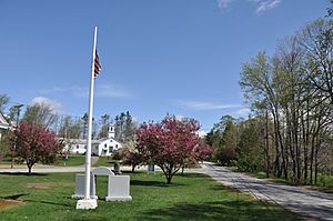
The town green
|
||
|
||
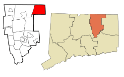
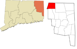
 Tolland County and Connecticut Tolland County and Connecticut |
||
| Country | ||
| U.S. state | ||
| County | Tolland | |
| Region | Northeastern CT | |
| Incorporated | 1734 | |
| Government | ||
| • Type | Selectman-town meeting | |
| Area | ||
| • Total | 29.8 sq mi (77.2 km2) | |
| • Land | 28.7 sq mi (74.3 km2) | |
| • Water | 1.1 sq mi (2.9 km2) | |
| Elevation | 981 ft (299 m) | |
| Population
(2020)
|
||
| • Total | 785 | |
| • Density | 27/sq mi (10.6/km2) | |
| Time zone | UTC−5 (Eastern) | |
| • Summer (DST) | UTC−4 (Eastern) | |
| ZIP code |
06076 (Stafford Springs) and 06242 (Eastford)
|
|
| Area code(s) | 860/959 | |
| FIPS code | 09-77830 | |
| GNIS feature ID | 0213519 | |
Union is a small town in Connecticut, located in the northeastern part of Tolland County. It is part of the Northeastern Connecticut Planning Region. In 2020, its population was 785, making it the least populated town in Connecticut. Union is home to the village of Mashapaug, which is near the Massachusetts state line. The town is about 33 miles northeast of Hartford, Connecticut's capital.
Contents
History of Union, Connecticut
Early Settlement and Growth
The first European settlers arrived in Union in 1727. This made Union the last town east of the Connecticut River to be settled. James McNall from Ireland was the first settler. His brother William soon followed him. The town officially became a town in October 1734. Its name, Union, means "union of lands."
Union was first part of Windham County. It later joined Tolland County when it was formed on October 13, 1785.
Population Changes Over Time
In 1756, about 500 people lived in Union. The population grew to 767 by 1800. After that, it started to get smaller. By 1890, only 431 people lived there. Today, the town's official population is still less than 1,000 residents.
Community Life in Union
Local Associations and Groups
Union is home to Venturing Crew 83. This is a youth group connected to the Connecticut Rivers Council of the Boy Scouts of America. The Union Volunteer Fire Department supports this group.
Geography and Nature in Union
Land and Water Features
Union covers about 29.8 square miles. Most of this area, about 28.7 square miles, is land. The rest, about 1.1 square miles, is water.
Union has the highest town center in eastern Connecticut, at 1,015 feet. It is the fourth highest in the entire state. The highest point in eastern Connecticut is Burley Hill, which is 1,315 feet high. This hill is in the northwestern part of Union. Even I-84 reaches its highest point in Connecticut within Union, at 1,002 feet.
Forests and Parks
About one-third of Union is state park land. This includes Bigelow Hollow State Park, Nipmuck State Forest, and the Mountain Laurel Sanctuary. Parts of the Yale-Myers Forest and Hull Foresters are also in Union. In total, there are almost 34,000 acres of forestland in the town.
Mashapaug Lake is a large lake in Union. People use the lake for fishing, boating, and swimming.
Population and People of Union
Population Trends
| Historical population | |||
|---|---|---|---|
| Census | Pop. | %± | |
| 1790 | 631 | — | |
| 1800 | 767 | 21.6% | |
| 1810 | 752 | −2.0% | |
| 1820 | 757 | 0.7% | |
| 1830 | 711 | −6.1% | |
| 1840 | 669 | −5.9% | |
| 1850 | 728 | 8.8% | |
| 1860 | 732 | 0.5% | |
| 1870 | 627 | −14.3% | |
| 1880 | 539 | −14.0% | |
| 1890 | 431 | −20.0% | |
| 1900 | 428 | −0.7% | |
| 1910 | 322 | −24.8% | |
| 1920 | 267 | −17.1% | |
| 1930 | 196 | −26.6% | |
| 1940 | 234 | 19.4% | |
| 1950 | 261 | 11.5% | |
| 1960 | 383 | 46.7% | |
| 1970 | 443 | 15.7% | |
| 1980 | 546 | 23.3% | |
| 1990 | 612 | 12.1% | |
| 2000 | 693 | 13.2% | |
| 2010 | 854 | 23.2% | |
| 2020 | 785 | −8.1% | |
| U.S. Decennial Census | |||
In 2000, there were 693 people living in Union. There were 285 households and 200 families. Most people in the town were White (98.56%).
About 27.4% of households had children under 18. Most households (64.6%) were married couples. The average household had 2.43 people. The average family had 2.87 people.
Age and Income
The population in Union was spread out by age. About 21.5% were under 18. About 34.6% were between 25 and 44 years old. The average age was 40 years.
The median income for a household in Union was $58,214. For families, it was $65,417. About 3.5% of the population lived below the poverty line.
Education in Union
Local Schools
Students in Union attend the Union School District for grades Kindergarten through 8. The only school in the district is Union Elementary School.
High School Options
For high school, students can choose from several schools. These include Stafford High School and Rockville Vocational-Agricultural School. They can also attend Windham Regional Technical Vocational School or Woodstock Academy.
Things to Do and See in Union
Outdoor Activities and Recreation
Union has over 40,000 acres of forestland. This makes it a great place for outdoor fun. Popular activities include hunting, fishing, hiking, camping, and picnicking. The higher elevation and many evergreen trees make the area cooler. Most activities happen at Bigelow Hollow State Park and Mashapaug Lake.
Snowmobiling is also a popular activity in the area during winter.
Interesting Places to Visit
The village of Mashapaug in Union is home to the Traveler Restaurant. This unique restaurant gives away used books to its customers.
Camp Pomperaug is a Boy Scout camp in Union. It is next to the state forest. The camp has old stone foundations from a former mill. It also has a small Revolutionary War cemetery. Some people believe this burial site is haunted.
The Union Free Public Library is in one of the town's few public buildings. The library started in 1894 and opened in 1895. In 1912, it moved into its own building, where it still is today.
- Union Green Historic District
Notable People from Union
- Alonzo Horton (1813–1902) was born in Union. He is known as the second founder of San Diego, California. He also founded Hortonville, Wisconsin. His family moved away from Union in 1815.
- Moses G. Leonard (1809–1899) grew up in Union. He later became a United States representative for New York. He was born in nearby Stafford.
- Ebenezer Stoddard (1785–1847) was born in Union. He served as a United States Representative from Connecticut. He was also the Lieutenant Governor of Connecticut.
See also
 In Spanish: Union (Connecticut) para niños
 | Dorothy Vaughan |
 | Charles Henry Turner |
 | Hildrus Poindexter |
 | Henry Cecil McBay |


