
Quabbin Reservoir facts for kids
Quick facts for kids Quabbin Reservoir |
|
|---|---|

November 2005
|
|

Quabbin Reservoir
Location in Massachusetts

Quabbin Reservoir
Location in the United States
|
|
| Location | Massachusetts, US |
| Coordinates | 42°21′33″N 72°18′00″W / 42.35917°N 72.30000°W |
| Lake type | Reservoir |
| Primary inflows | New Hampshire, US |
| Primary outflows | Atlantic Ocean |
| Basin countries | United States |
| Max. length | 18 miles (28.9 km) |
| Surface area | 38.6 mi2 (99.97 km2) |
| Average depth | 51 ft (16 m) |
| Max. depth | 150 ft (46 m) |
| Water volume | 412,000,000,000 US gal (1.56 km3) |
| Shore length1 | 181 mi (291 km) |
| Surface elevation | 522 ft (159 m) |
| Settlements | Belchertown, Petersham, Hardwick, Ware, New Salem, Shutesbury, Pelham |
| 1 Shore length is not a well-defined measure. | |
The Quabbin Reservoir is the largest inland body of water in Massachusetts. It was built between 1930 and 1939. Today, it is the main source of drinking water for Boston and 40 other towns nearby. It also provides water to three towns west of the reservoir. It can even be a backup water supply for three more towns.
By 1989, the reservoir supplied water for 2.5 million people. This was about 40% of Massachusetts' population at that time. The Quabbin Reservoir can hold a huge amount of water, about 412 billion gallons. It covers an area of 38.6 square miles (99.9 km2).
Contents
How Quabbin Reservoir Works
The Quabbin Reservoir sends water to the Wachusett Reservoir through the Quabbin Aqueduct. The land around Quabbin, called its watershed, is managed by the Massachusetts Department of Conservation and Recreation. The system that delivers the water is run by the Massachusetts Water Resources Authority.
The reservoir was created by building the Winsor Dam and the Goodnough Dike. These structures hold back the water from three parts of the Swift River. The Quabbin Reservoir is part of the larger Chicopee River Watershed. This watershed eventually flows into the Connecticut River.
Water Flow and Spillway
When the reservoir is very full, extra water can flow out through the Quabbin Spillway. This spillway is near Quabbin Hill Road in Belchertown. It allows water to bypass the Winsor Dam and rejoin the Swift River.
In 1947, a new water channel called the Chicopee Valley Aqueduct was built. It was made to deliver Quabbin water to three towns in Western Massachusetts: Chicopee, South Hadley, and Wilbraham.
The Story of Quabbin Reservoir
Boston's Growing Need for Water
In the early 1800s, the city of Boston started to run out of fresh water. The city was growing fast, and its local water sources were not enough. People looked for new ways to get water, like from underground or from rivers. But none seemed big or clean enough.
In 1848, after much discussion, the state government allowed a new project. They built the Cochituate Aqueduct to bring water to Boston. This water came from Lake Cochituate in Wayland and Natick.
This project set up three important rules for water supply:
- The public, not private companies, would own the water system.
- Water would come from reservoirs in higher areas and flow by gravity. This means no pumps were needed.
- Protecting the land around the water source would keep the water clean. This was better than just filtering it.
By 1875, Boston needed even more water. So, the Boston Water Board was created. They built five new reservoirs on the Sudbury River in Framingham, Massachusetts. A new aqueduct, the Sudbury Aqueduct, was finished in 1878 to bring this water to the city.
Planning for the Quabbin Reservoir
In 1893, a state health report looked at how many people were using water. It suggested creating a Metropolitan Water District for Boston and nearby towns. It also recommended building two new reservoirs. One was on the Nashua River, and the other was in the Swift River Valley.
In 1895, the state government created the Metropolitan Water District. It included 26 towns near Boston. The Wachusett Reservoir was finished in 1908. Experts thought water from the Swift River would be needed by 1915. However, people started using water meters in their homes. This helped reduce waste. So, building new water sources was delayed until the 1930s.
Frank E. Winsor was a chief engineer for the Metropolitan Water District from 1926 until he passed away in 1939. He helped design and build the Winsor Dam, Goodnough Dike, and the Quabbin Reservoir. The Winsor Dam is named after him.
A study in 1922 officially approved the Swift River Valley as the next big water project. It also created the Metropolitan District Commission (MDC). This group, now called the MWRA, would build and manage the system.
In 1926, the Ware River Act was passed. This started the first part of the project. A 12-mile-long tunnel was built to connect the Wachusett Reservoir with the Ware River. This is known as the Ware River Diversion. In the 1930s, this tunnel was made longer to reach the Swift River. The full tunnel is now called the Quabbin Aqueduct.
Challenges and Opposition
Lawmakers in Boston strongly supported the project. But people living in the towns that would be flooded were against it. The state of Connecticut even sued Massachusetts. They said that water meant for the Connecticut River was being illegally taken.
Connecticut lost the lawsuit. However, Massachusetts still had to let a certain amount of water flow down the Swift River. This was to make sure the river stayed healthy.
How the Reservoir Was Created
Before the reservoir, there was a hill called Quabbin Hill in Enfield. There was also a lake called Quabbin Lake in Greenwich. These names came from a Native American word meaning "place of many waters." This became the name for the new reservoir.
The Quabbin Reservoir was made by flooding the Swift River Valley. This valley was entirely within Massachusetts. Workers built a dam on the river and a dike across a low point. This stopped Beaver Brook from flowing out.
Construction on the dam began in the mid-1930s. The Swift River was moved into a special tunnel. On August 14, 1939, this tunnel was sealed with rocks. Over the next seven years, the water slowly rose behind the new Winsor Dam. This dam is 2,640 feet (800 m) long and 170 feet (52 m) high. The slightly smaller Goodnough Dike also helped hold the water.
The rising water covered the old roads that connected the towns. It swallowed most of about 60 hills and mountains. Only their tops remained. Prescott Ridge became the Prescott Peninsula. The Quabbin Reservoir was completely full for the first time in June 1946.
From 1941 to 1951, the land that became the Prescott Peninsula was used by the military. It was called the Quabbin Reservoir Precision Bombing and Gunnery Range. Airplanes from Hanscom Army Air Field and Westover Army Air Field used it for practice. They also practiced landings there. Later, officials checked the area for any leftover unexploded bombs or pollution.
Towns That Disappeared
To create the Quabbin Reservoir, four towns had to be flooded. They officially stopped being towns in April 1938. These towns were Dana, Enfield, Greenwich, and Prescott.
The land from these towns was added to nearby towns. These included Belchertown, Pelham, New Salem, Petersham, Hardwick, and Ware. Another town touching the reservoir is Shutesbury. Most of the reservoir today is in New Salem or Petersham.
About 60,000 acres of land were bought for the dam. The rest was taken by the state in 1938. The town of Dana voted to give up their land for the project. Around 2,500 people lost their homes because of the flooding.
Old roads that once led to the flooded towns can still be followed to the water's edge. Not everything from the towns was destroyed. Town memorials and cemeteries were moved to Quabbin Park Cemetery in Ware. Many public buildings were moved to other places. For example, the Prescott First Congregational Church was moved to South Hadley. The North Prescott Methodist Episcopal Church was moved to Orange and then to New Salem. The old Prescott Town Hall is now in Petersham.
Some college buildings are named after these lost towns. Hampshire College in Amherst has student housing named Greenwich, Prescott, Enfield, and Dana. Eagle Hill School also has residence halls named Greenwich, Prescott, Dana, and Enfield.
Visiting Quabbin Reservoir
To protect the water supply, most areas around the reservoir can only be reached by walking. There are limited parking spots at some of the gates.
Parts of Dana were on higher ground. You can still visit the remains of the town, like old cellar holes. There is also a historic stone marker where the town center used to be.
Most of Prescott is above water on what is now the Prescott Peninsula. However, you cannot visit Prescott for most of the year due to state rules. The Swift River Valley Historical Society does offer an annual tour of the town. Some houses and roads that were part of North Prescott (now New Salem) still exist. There is also a town line marker for old Prescott.
There is a visitor center south of the reservoir. You can also find an observation tower and Enfield Lookout there. This area is called Quabbin Park. You can drive to it from the south using State Route 9. The park is a popular place for hiking and other outdoor activities. This area used to be part of the town of Enfield.
Fishing and Boating
You can go fishing in certain areas in the northern parts of the reservoir. There are three places where you can launch a boat. To stop the spread of harmful water plants and animals, private boats must be cleaned before they can go on the reservoir. The DCR also has boats you can rent.
You can find more information about how to access Quabbin and maps on the DCR's official Public Access site: http://www.mass.gov/eea/agencies/dcr/water-res-protection/watershed-mgmt/public-access.html.
Wildlife and Nature
The large forest around the Quabbin Reservoir is home to many different animals. It has been a place where some animal species have been brought back to Massachusetts. You might see bald eagles, loons, moose, deer, coyotes, black bears, foxes, and bobcats living here.
You can learn more about how the forests are managed at Quabbin and other water supply areas on the DWSP's Watershed Forestry Page.
Images for kids
-
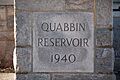
A stone sign welcoming visitors to the Quabbin Reservoir.

