Lake Cochituate facts for kids
Quick facts for kids Lake Cochituate |
|
|---|---|

South Pond
|
|
| Location | Middlesex County, Massachusetts |
| Coordinates | 42°19′08″N 71°22′41″W / 42.3189879°N 71.3781509°W |
| Type | Reservoir |
| Catchment area | 17 sq mi (44 km2) |
| Basin countries | United States |
| Max. length | 3.76 mi (6.05 km) |
| Surface area | 625 acres (2.53 km2) |
| Surface elevation | 154 ft (47 m) |
| Settlements | Natick, Wayland, Framingham |
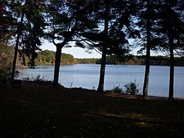
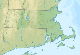
Lake Cochituate is a large body of water located in the towns of Natick, Wayland, and Framingham in Massachusetts, United States. It used to be a very important source of drinking water for the city of Boston. Today, it is no longer used for that purpose. Instead, it is a popular spot for fun outdoor activities and is home to Cochituate State Park.
Contents
Exploring Lake Cochituate
Lake Cochituate is actually made up of three connected parts. These are called North Pond, Middle Pond, and South Pond. Each pond offers different things to see and do.
South Pond Features
South Pond has a big piece of land sticking out into the water, like a giant finger. This land is where the US Army Soldier Systems Center is located. On the eastern side of South Pond, you can find the walking trails of Pegan Cove Park.
Middle Pond Activities
Middle Pond is home to Cochituate State Park. This park is a great place to visit. It has special ramps where you can launch boats into the water. There are also picnic areas where families and friends can enjoy meals outdoors.
North Pond Beaches
North Pond is a popular spot for swimming and relaxing. It has two different beaches. One is Wayland Town Beach, and the other is Saxonville Beach, which is part of Framingham.
Nearby Landmarks
Right next to Middle Pond, you'll see the modern MathWorks Lakeside campus. This building was once a brewery where beer was made back in 1957. A old train track used to run along parts of the lake. This track brought supplies to the brewery and other businesses nearby. Soon, a new walking and biking path called the Cochituate Rail Trail will follow this old train route. It will connect downtown Natick to Saxonville, a part of Framingham.
Lake Size and Surroundings
The three ponds of Lake Cochituate, along with their connecting waterways, cover a total area of 625 acres (2.53 km2). Just south of Lake Cochituate is a smaller pond called Dug Pond. This pond is next to Natick High School. The area of land that drains water into Lake Cochituate is called its watershed. This watershed covers about 17 square miles (44 km2) and includes parts of Natick, Wayland, Framingham, Ashland, and Sherborn. The lake's water eventually flows into the Sudbury River, then the Concord River, and finally the Merrimack River. There's also a village named Cochituate in Wayland, which shares the lake's name.
Powerful Storm Event
In 2005, a very strong thunderstorm hit the lake area. It caused a powerful "microburst," which is like a small, very strong tornado. This microburst knocked down many trees and affected some visitors. A special plaque has been placed at the lake to remember this event and those who were there during the storm. It reminds everyone of the power of nature.
Lake Cochituate's Past
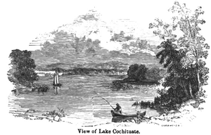
Lake Cochituate was created by building the Lake Cochituate Dam. This dam helped turn the lake into a reservoir to provide clean drinking water for the city of Boston. This was done through a long water channel called the 14-mile (23 km) Cochituate Aqueduct.
Boston's First Major Water Supply
Lake Cochituate was Boston's very first big system for getting water. Before this, Boston used water from Jamaica Pond. The work to build the Lake Cochituate system started in 1848 and finished in 1863. It supplied water to Boston until 1951. By then, bigger water sources like the Wachusett and Quabbin Reservoir were being used.
Engineers and Historic Dam
The plans for this important water project were made by skilled engineers. The dam built in 1890, which replaced two older dams, is now listed on the National Register of Historic Places. This means it's an important historical site. You can also see the old building that controlled the water flow into the Cochituate Aqueduct on the east side of the lake.
 | Emma Amos |
 | Edward Mitchell Bannister |
 | Larry D. Alexander |
 | Ernie Barnes |


