Framingham, Massachusetts facts for kids
Quick facts for kids
Framingham
|
||
|---|---|---|
|
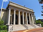
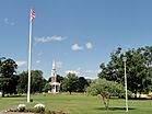
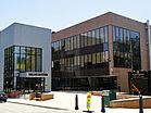
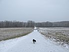
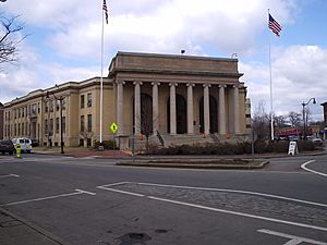
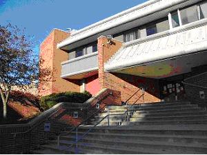
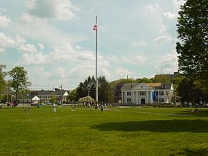
Left-right from top: Memorial Hall in Concord Square Historic District, Framingham Common, Framingham State University, Callahan State Park
|
||
|
||
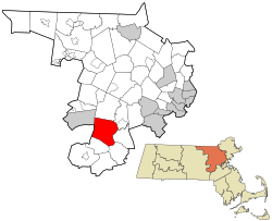
Location in Middlesex County in Massachusetts
|
||
| Country | United States | |
| State | Massachusetts | |
| County | Middlesex | |
| Region | New England | |
| Settled | 1650 | |
| Incorporated (town) | June 25, 1700 | |
| Incorporated (city) | January 1, 2018 | |
| Government | ||
| • Type | City | |
| Area | ||
| • Total | 26.50 sq mi (68.65 km2) | |
| • Land | 25.04 sq mi (64.86 km2) | |
| • Water | 1.46 sq mi (3.78 km2) | |
| Elevation | 165 ft (50 m) | |
| Population
(2020)
|
||
| • Total | 72,362 | |
| • Density | 2,889.39/sq mi (1,115.61/km2) | |
| Time zone | UTC−5 (Eastern) | |
| • Summer (DST) | UTC−4 (Eastern) | |
| ZIP Codes |
01701 and 01702
|
|
| Area code(s) | 508/774 | |
| FIPS code | 25-24960 | |
| GNIS feature ID | 0618224 | |
Framingham (![]() i/ˈfreɪmɪŋhæm/) is a city in the state of Massachusetts, United States. It became a city in 2018. Before that, it was the largest town in Massachusetts.
i/ˈfreɪmɪŋhæm/) is a city in the state of Massachusetts, United States. It became a city in 2018. Before that, it was the largest town in Massachusetts.
Framingham is located in Middlesex County. It is part of the Greater Boston area. The city covers about 25 square miles (65 km2). In 2020, its population was 72,362. This makes it the 14th most populated city in Massachusetts.
Framingham has one of the largest Brazilian American populations in the U.S. Many Brazilians have lived here since the 1980s.
Contents
History of Framingham
Early Days and Native People
Before Europeans arrived, the Nipmuc lived in the Framingham area. They settled near Farm Pond, which they called Washakamaug ("eel fishing place"). The Nipmuc were skilled at managing the land. They hunted deer and beaver and fished in local waters. They also grew crops like squash, corn, and beans. An old Native trail, the Old Connecticut Path, ran through this area.
When Puritan settlers came, the Nipmuc population quickly dropped. This was due to new diseases and conflicts with the settlers. Many Nipmuc were forced to move to "praying towns" like nearby Natick.
European Settlement and King Philip's War
The first European settler was John Stone in 1647. He started a farm by the Sudbury River. In 1660, Thomas Danforth, a Bay Colony official, gained a large amount of land. He called it "Danforth's Farms."
Between 1675 and 1676, King Philip's War caused big problems. This war was between English settlers and Native American tribes. Nipmuc leader Tantamous lived on Nobscot Hill. He was arrested by the colony in 1676 and later executed. In January 1676, a group of Nipmuc men went to the Eames family home. This led to violence where Mary Eames and five children were killed.
Becoming a Town and City
The area was named after Thomas Danforth's hometown, Framlingham, in England. The "L" was dropped later. Framingham officially became a town in 1700, after Danforth's death. The first church was built in 1701. A teacher was hired in 1706, and the first schoolhouse opened in 1716.
On February 22, 1775, British spies visited Framingham. They saw the town's militia training. Framingham sent about 130 men to the Battles of Lexington and Concord. One of these men was wounded.
Abolitionist Movement and Growth
Before the American Civil War, Framingham was a meeting place for people who wanted to end slavery. Every July 4th from 1854 to 1865, the Massachusetts Anti-Slavery Society held rallies. These events took place at Harmony Grove by Farm Pond. In 1854, William Lloyd Garrison burned copies of laws that supported slavery. Other famous abolitionists like Sojourner Truth and Henry David Thoreau also attended.
After World War II, Framingham grew a lot. Many new homes were built, especially split-level and ranch-style houses.
Framingham is known for the Framingham Heart Study. This long-term study looks at heart disease. The Dennison Manufacturing Company also started here in 1844. It made jewelry boxes and later became a large industrial company.
In 2000, Framingham celebrated its 300th birthday. It became the largest town in Massachusetts. Framingham tried to become a city three times before. Finally, on January 1, 2018, it officially became a city. Yvonne M. Spicer was elected as its first mayor. She was the first African-American woman to be popularly elected mayor in Massachusetts.
Geography and Climate
Framingham covers about 26.4 square miles (68.5 km2). Most of this is land, with about 1.3 square miles (3.4 km2) being water.
Population and People
| Historical population | ||
|---|---|---|
| Year | Pop. | ±% |
| 1850 | 4,252 | — |
| 1860 | 4,227 | −0.6% |
| 1870 | 4,968 | +17.5% |
| 1880 | 6,235 | +25.5% |
| 1890 | 9,239 | +48.2% |
| 1900 | 11,302 | +22.3% |
| 1910 | 12,948 | +14.6% |
| 1920 | 17,033 | +31.5% |
| 1930 | 22,210 | +30.4% |
| 1940 | 23,214 | +4.5% |
| 1950 | 28,086 | +21.0% |
| 1960 | 44,526 | +58.5% |
| 1970 | 64,048 | +43.8% |
| 1980 | 65,113 | +1.7% |
| 1990 | 64,989 | −0.2% |
| 2000 | 66,910 | +3.0% |
| 2010 | 68,318 | +2.1% |
| 2020 | 72,362 | +5.9% |
| 2023 | 71,875 | −0.7% |
Source: United States Census records and Population Estimates Program data. Source: |
||
In 2010, Framingham had 68,318 people. About 20.9% of the population was under 18. The average age was 38 years old.
Framingham is home to many different groups of people. In 2010, about 71.9% of residents were White. About 5.8% were Black, and 6.3% were Asian. About 13.4% of the population was Hispanic or Latino. Many Brazilian immigrants live in Framingham. A large number of them come from the city of Governador Valadares in Brazil.
Education in Framingham
Framingham's public school system started in 1706. That's when the town hired its first schoolmaster. The first public school building opened in 1716. The first high school, Framingham Academy, opened in 1792. The first town-run high school opened in 1852.
Today, Framingham has 14 public schools. These include Framingham High School, three middle schools, and nine elementary schools. There is also a pre-school. The city also has a regional vocational high school and a charter school.
Framingham also has several private schools. These include Summit Montessori School and the Sudbury Valley School. There is also a parochial school and a Jewish day school.
Since 1998, Framingham has updated many of its schools. Major renovations have been done to several buildings. Some older school buildings are now used by other colleges or organizations.
Framingham is home to three colleges. These include Framingham State University and Massachusetts Bay Community College's Framingham Campus.
Transportation
Framingham is located between Worcester and Boston. These are two major cities in Massachusetts. The city has good connections by rail and highway.
Major Roads
Framingham is served by one Interstate and four state highways.
| Route number | Type | Local name | Direction |
|---|---|---|---|
| Interstate, toll road | The Massachusetts Turnpike (Mass Pike) | east/west | |
| State route, divided highway | Worcester Rd., The Boston/Worcester Turnpike, Ted Williams Highway | east/west | |
| State route, partial divided highway | Cochituate Rd., Worcester Rd. and Pleasant St. | east/west | |
| State route, primary road | Old Connecticut Path, School St, Concord St., and Hollis St. | north/south | |
| State route, primary road | Waverly St. | east/west |
Public Transportation
Train Service
- You can take a train directly to Chicago on Amtrak's Lake Shore Limited. You can also connect to other cities on the Amtrak network.
- The MBTA commuter rail goes to Boston's South Station and Back Bay Station. This is on the MBTA's Framingham/Worcester Line. The trip to Back Bay Station takes about 42–45 minutes.
Bus Service
- MassPort runs the Logan Express bus service. This bus goes directly to Logan International Airport.
- Peter Pan Bus Lines offers service to Worcester, New York, and Boston.
- The MetroWest Regional Transit Authority (MWRTA) operates local bus services. These buses connect different parts of Framingham and nearby towns.
Economy
Framingham's economy mainly relies on stores and office buildings. There are also some small factories and service businesses. Framingham has three main business areas: The "Golden Triangle," Downtown/South Framingham, and West Framingham.
The Golden Triangle
The Golden Triangle is a large shopping area. It is located on the eastern side of Framingham and extends into Natick. It is one of the biggest shopping districts in New England.
This area grew after Shoppers World was built in 1951. Shoppers' World was an outdoor shopping mall. It was the second one in the U.S. and the first east of the Mississippi River. Many other stores and malls were built nearby because of it. Today, the area includes many large stores and shopping centers.
Besides stores, there are also many office buildings. The world headquarters of TJX is here. IDG and IDC also have their main offices in this area.
Downtown and South Framingham
The downtown area is centered around Memorial Square. The city hall, called The Memorial Building, is a key building here. This area has been rebuilt recently with new roads and sidewalks.
South Framingham became a business hub when the railroad arrived in the 1880s. It used to have large companies like Dennison Manufacturing. After these companies closed, the area faced challenges. However, many Hispanic and Brazilian immigrants helped to bring new life to the district. Today, you can find many Brazilian and Spanish stores and restaurants. There are also city offices, the library, and a performing arts center.
West Framingham
The business area in West Framingham is mostly along Route 9. It has two large office and industrial parks. Companies like Bose, Staples, and Cumberland Farms have their main offices here. Other big companies like Genzyme and Capital One also have facilities.
Many apartment and condominium buildings are also in West Framingham. This area has many services like supermarkets, restaurants, hotels, and day-care centers.
Villages and Route 9 Areas
The Framingham Centre Common Historic District is the city's old and historic center. Framingham State University is a major part of this area. The center has small stores, restaurants, and offices. The historic village hall and the Framingham History Center are also here.
The villages of Nobscot and Saxonville also have small businesses. In 2016, the Christa McAuliffe public library branch moved to Nobscot. Saxonville is home to old mill buildings, now an industrial park. It is also one of the city's historic districts.
Healthcare
Framingham has the MetroWest Medical Center. This hospital includes the Leonard Morse Hospital campus in Natick.
Media
News and Websites
Framingham has several news sources:
- Framingham Source, a local news website.
- Framingham Online News, another local news website.
- The MetroWest Daily News, a daily newspaper.
- The Framingham Tab, a weekly local newspaper.
- The Boston Globe has a regional edition that covers Framingham.
- A Semana, a weekly newspaper in Portuguese for the Brazilian community.
- The Gatepost, a student newspaper from Framingham State University.
Television and Radio
Framingham has a public access TV channel called Access Framingham. Residents can create their own TV shows. Framingham High School has its own student-run TV station, FHS-TV. Its morning news program, "Flyer News," has won many awards. The City of Framingham also has a Government Channel. It shows city meetings and public information.
There are several radio stations that serve Framingham. Some play talk radio or religious programs. Others play Portuguese-language music or college radio.
Movies Filmed in Framingham
Framingham has been a filming location for movies. In 2016, parts of Patriots Day were filmed here. This movie is about the Boston Marathon bombing. In 2009, The Company Men was also filmed in Framingham. Large parts of the movie Don't Look Up were also shot in Framingham.
Places to Visit
Framingham has many athletic fields and public facilities. Many of these were built during the Great Depression by the Civilian Conservation Corps.
Culture and History
- Amazing Things Arts Center: A place for arts and performances.
- Buckminster Square: This site has a statue of a blacksmith preparing for the Revolutionary War.
- Framingham History Center: Learn about the city's past.
- Danforth Museum: An art museum.
- Pike Haven Homestead: A historic house built in 1693. It was lived in by the same family for eight generations.
Parks and Green Spaces
- Bowditch Field: Framingham's main sports facility. It has a football stadium, baseball field, and tennis courts. It was renovated in 2010.
- Butterworth Park: A park near downtown with a baseball field, basketball court, and tennis court.
- Winch Park: Located in Saxonville, it has a baseball stadium, basketball court, and tennis courts. It also has fields for football, soccer, and lacrosse.
- Callahan State Park: A large state park in North Framingham.
- Cochituate State Park: Has a small section in Framingham with Saxonville Beach on Lake Cochituate.
- Framingham Common: In Framingham Center, it has an outdoor stage for concerts. It's popular with students from Framingham State University.
- Cushing Park: A large park with the Framingham Peace and 9/11 Memorials. It used to be a hospital during World War II.
- Long Athletic Complex: Has several baseball and softball fields. It hosts many of Framingham's Little League games.
Nature and Recreation
- Garden in the Woods: A botanical garden with the largest collection of native wildflowers in New England.
- Framingham Country Club: A private club with an 18-hole golf course.
- Nobscot Scout Reservation: A private facility open to the public most of the year.
- Framingham has public beaches at Lake Cochituate, Lake Washakum, and Learned Pond.
- The former Cushing hospital grounds are now used for walking, biking, and picnics.
- Farm Pond: A picnic area that used to host Fourth of July fireworks.
- Edward F. Loring Skating Arena: A public ice skating rink.
- The Cochituate Rail Trail: A 3.7-mile trail for walking, jogging, and biking. It connects Saxonville in Framingham to Natick Center.
Notable People from Framingham
Many interesting people have connections to Framingham!
Sports Stars
- David Blatt: A basketball coach who coached the Cleveland Cavaliers.
- Ron Burton: A former NFL running back for the Boston Patriots.
- Rich Gedman: A former Major League Baseball catcher for the Boston Red Sox.
- Lou Merloni: A Major League Baseball player for the Boston Red Sox.
- Pie Traynor: A famous Major League Baseball player in the Major League Baseball Hall of Fame.
Artists and Scientists
- Dave Amato: Current guitarist for REO Speedwagon.
- Nancy Dowd: An Academy Award-winning screenwriter.
- Ginger Fish: A member of the band Marilyn Manson.
- Dr. Solomon Carter Fuller: A pioneer in the study of psychology and Alzheimer's disease.
- Meta Vaux Warrick Fuller: A famous African-American sculptor.
- Og Mandino: A well-known author.
- Christa McAuliffe: A teacher and astronaut who was part of the Space Shuttle Challenger mission.
- Jo Dee Messina: A country music singer.
- Nancy Travis: An actress.
Media Personalities
- Tom Caron: A baseball analyst for New England Sports Network.
- Katie Nolan: Works for ESPN.
- Jordan Rich: A radio host for WBZ (AM).
Military and Religious Figures
- John Nixon: A General in the Continental Army during the American Revolution.
- Peter Salem: A soldier in the Revolutionary War.
- Paul S. Loverde: A retired Roman Catholic bishop.
Sister Cities
Framingham has two sister cities:
- Lomonosov, Russia
- Governador Valadares, Brazil
See also
 In Spanish: Framingham (Massachusetts) para niños
 | Sharif Bey |
 | Hale Woodruff |
 | Richmond Barthé |
 | Purvis Young |


