
Russell, Massachusetts facts for kids
Quick facts for kids
Russell, Massachusetts
|
||
|---|---|---|

Railroad station, c. 1901–1907
|
||
|
||

Location in Hampden County in Massachusetts
|
||
| Country | United States | |
| State | Massachusetts | |
| County | Hampden | |
| Settled | 1782 | |
| Incorporated | 1792 | |
| Government | ||
| • Type | Open town meeting | |
| Area | ||
| • Total | 17.8 sq mi (46.0 km2) | |
| • Land | 17.3 sq mi (44.9 km2) | |
| • Water | 0.4 sq mi (1.1 km2) | |
| Elevation | 300 ft (91 m) | |
| Population
(2020)
|
||
| • Total | 1,643 | |
| • Density | 92.51/sq mi (35.72/km2) | |
| Time zone | UTC−5 (Eastern) | |
| • Summer (DST) | UTC−4 (Eastern) | |
| ZIP Codes |
01071, 01097
|
|
| Area code(s) | 413 | |
| FIPS code | 25-58650 | |
| GNIS feature ID | 0618190 | |

Russell is a town in Hampden County, Massachusetts, United States. In 2020, about 1,643 people lived there. Russell is part of the larger Springfield area.
Contents
History of Russell
Russell was once home to the Pocumtuc people. They spoke an Algonquian language. Many native groups, including the Pocumtuc, faced challenges. After a conflict called King Philip's War (1675–1676), many Pocumtuc moved west or north.
Early Settlement and Farming
Settlers began moving to the Russell area around 1725. The land was hilly and rocky, which made farming difficult. Farmers mostly grew food for themselves, not to sell. They often made things at home or traded with neighbors.
Around 1800, many farmers left the uplands. Better farmland became available in other states. By 1825, new factories in New England offered jobs. People could earn money and buy goods. Farming became less important for many families. Many old farms were left empty and turned back into forests.
Industrial Growth and Villages
The Industrial Revolution brought changes to the Westfield River valley. Water power from the river's waterfalls helped build factories. Three villages grew around these mills. A railroad line was also built through the valley.
One village was Crescent Mills, near Huntington. A paper company used to operate there. Today, a company called Texxon still makes special fabrics for shoes.
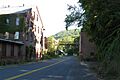
The main village and town center is Russell Village. A paper company once made specialty papers here. This company later closed down. In the 1950s, Russell Village had many stores and services. But as more people got cars, they started shopping in bigger towns nearby.

Another industrial village was Woronoco. It was named after a local tribe. A company called Strathmore Paper Company made high-quality paper there. Horace A. Moses bought Strathmore in 1904. He was a businessman and also helped start Junior Achievement. Moses created Woronoco as a special "company town." It had good housing and places for community activities. He also had a large farm estate near Russell Pond. He raised apples and hunting dogs there. Later, parts of his estate were sold to the Boy Scouts of America. Today, the Horace A. Moses Scout Reservation still has buildings from his time.
Recent Changes and Challenges
In 1965, Russell joined other towns to form the Gateway Regional School District. This district educates many students. Russell has a high tax rate because there are not many businesses to help pay for town services.
The paper companies in Russell closed in the 1990s. This meant the town lost many jobs and tax money. Today, there is only one small factory left. Most residents travel to other towns for shopping.
In the 1990s, Mennonite families moved to Russell. They started a church, a furniture factory, and a bakery. Every year since 2003, the Mennonite Youth Chorus from Russell sings songs to remember the victims of the September 11 attacks at the Ground Zero site in New York City.
In 2004, there was a plan to build a plant that would make energy from wood. This plant would have been at the old paper company site. It caused a lot of discussion. Some people liked the idea because it would create jobs and lower taxes. Others worried about truck traffic, air pollution, and water use.
Today, many of the town's discussions are about taxes and the economy.
Geography of Russell
Russell is located in western Hampden County. It shares borders with several towns. These include Granville to the south and Huntington to the north.
The main village of Russell is in the northwest. The village of Woronoco is in the eastern part of town. Both villages are along the Westfield River. U.S. Route 20 connects them. This road goes southeast to Westfield and northwest to Lee. Interstate 90, also known as the Massachusetts Turnpike, crosses Russell. However, there are no exits for the town on this highway.
Land and Water Features
The town of Russell covers about 46.0 square kilometers (17.8 square miles). Most of this area is land, with a small part being water.
Russell has two very different types of land. The South Quarter is mostly high land, like a plateau. The rest of the town is a deep valley along the Westfield River.
The high lands of the South Quarter end at a steep slope. This slope is part of a large valley formed long ago. The Connecticut River still flows through this valley. The steep areas are covered in forests and have many streams.
Along the Westfield River valley, glaciers once shaped the land. They made cliffs steeper on hills like Mount Tekoa. As the glaciers melted, they created a large lake called Lake Hitchcock. This lake had an arm that reached into the Westfield River. The river has three waterfalls within the town. These waterfalls were important for the town's industrial growth.
Population and People
| Historical population | ||
|---|---|---|
| Year | Pop. | ±% |
| 1850 | 521 | — |
| 1860 | 605 | +16.1% |
| 1870 | 635 | +5.0% |
| 1880 | 823 | +29.6% |
| 1890 | 879 | +6.8% |
| 1900 | 793 | −9.8% |
| 1910 | 965 | +21.7% |
| 1920 | 1,237 | +28.2% |
| 1930 | 1,237 | +0.0% |
| 1940 | 1,242 | +0.4% |
| 1950 | 1,298 | +4.5% |
| 1960 | 1,366 | +5.2% |
| 1970 | 1,382 | +1.2% |
| 1980 | 1,570 | +13.6% |
| 1990 | 1,594 | +1.5% |
| 2000 | 1,657 | +4.0% |
| 2010 | 1,775 | +7.1% |
| 2020 | 1,643 | −7.4% |
| 2022 | 1,631 | −0.7% |
Source: United States Census records and Population Estimates Program data. |
||
In 2010, there were 1,775 people living in Russell. There were 656 households. About 31.1% of these households had children under 18. Most households (57.8%) were married couples.
The population was spread out by age. About 25% of the people were under 18. About 9.9% were 65 or older. The average age in town was 40.4 years. The population was almost evenly split between males and females.
The average income for a household in Russell was $57,308. About 9.0% of the population lived below the poverty line. This included 14.7% of those under 18.
Education in Russell
Russell does not have its own schools. Students from Russell go to schools in Huntington. These include Littleville Elementary School, Gateway Regional Middle School, Gateway Regional Junior High School, and Gateway Regional High School.
Notable People from Russell
- Clarissa Chapman Armstrong, a missionary in Hawaii, was born in Russell.
- Reuben Atwater Chapman, who became a chief justice in Massachusetts, was born here.
- Joel Doolittle, a justice of the Vermont Supreme Court, was also born in Russell.
Images for kids
-
Woronoco
See also
 In Spanish: Russell (Massachusetts) para niños
