Huntington, Massachusetts facts for kids
Quick facts for kids
Huntington
|
|||
|---|---|---|---|

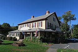
Former Huntington Country Store
|
|||
|
|||

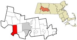
Location in Hampshire County in Massachusetts
|
|||
| Country | United States | ||
| State | Massachusetts | ||
| County | Hampshire | ||
| Settled | 1769 | ||
| Incorporated (Norwich) | 1775 | ||
| Incorporated (Huntington) | March 5, 1855 | ||
| Government | |||
| • Type | Open town meeting | ||
| Area | |||
| • Total | 26.8 sq mi (69.4 km2) | ||
| • Land | 26.3 sq mi (68.2 km2) | ||
| • Water | 0.5 sq mi (1.2 km2) | ||
| Elevation | 382 ft (116 m) | ||
| Population
(2020)
|
|||
| • Total | 2,094 | ||
| • Density | 78.15/sq mi (30.173/km2) | ||
| Time zone | UTC−5 (Eastern) | ||
| • Summer (DST) | UTC−4 (Eastern) | ||
| ZIP Code |
01050
|
||
| Area code(s) | 413 | ||
| FIPS code | 25-31785 | ||
| GNIS feature ID | 0618203 | ||
Huntington is a small town located in Hampshire County, Massachusetts, in the United States. In 2020, about 2,094 people lived there. It is part of the larger Springfield area.
The town has a main village also called Huntington, located in the south. There are also smaller unofficial neighborhoods like Norwich and Norwich Bridge in the center. Other villages, Knightville and Indian Hollow, used to be in the north. They were removed when the Knightville Dam was built between 1939 and 1941.
Contents
History of Huntington
European settlers first came to the area that is now Huntington in 1760. Many of them came from Norwich, Connecticut. They came to cut down the valuable trees. These early settlers were mostly farmers. They grew their own food, raised animals, and caught fish. They also made many of their own household items.
In 1762, most of what is now Huntington and Chester was sold. It was known as Plantation Number 9. The new owners allowed the 19 families already living there to stay. They had to build houses, clear land, and hire a Protestant minister.
On June 29, 1773, the eastern part of Murrayfield became the district of Norwich. It had most of the powers of a town. Norwich became a full town in 1786.
Early Growth and Changes
Early businesses in the town grew slowly. Around 1800, Daniel and Richard Falley opened a hotel and store. This was near where Norwich, Blandford, and Chester met. A post office opened nearby on a major stagecoach route. This area became known as "Falleys' Cross road."
In 1841, the Western Railroad was built. This brought more people and businesses to the area. The train stop was called Chester Village. Soon, the post office and the neighborhood were also called Chester Village.
Some town borders caused problems. Streets and even houses were split between different towns. This made things difficult for schools and police. In 1853, parts of Blandford and Chester were added to Norwich.
In 1855, the town's name was changed to Huntington. This was to honor Charles P. Huntington. He helped make the annexation happen. Charles Huntington also gave $100 to start a library in the town. Chester Village then became known as "the village" of Huntington.
Town Meetings and Transportation
In the early days, Norwich town meetings were held in the church. This was common in Colonial Massachusetts. In 1841, a separate town hall was built in Knightville. Later, town meetings were held in a private hall in Huntington village. This building burned down in 1863 but was rebuilt. The new building served as the town hall until 1954.
In 1905, a trolley line was extended to Huntington. Another trolley line also ran to the town of Lee for a while. U.S. Route 20, a major road, was built through the town in 1920.
The Huntington Textile Company made cloth for the U.S. military during the World Wars. However, it closed down in 1952.
Geography of Huntington
Huntington is located in the southwest part of Hampshire County. Towns in Hampden County border it to the south and west. The Westfield River flows through the town. Its West Branch joins it in the village of Huntington.
U.S. Route 20 follows the Westfield River through the town. This road leads southeast about 12 miles (19 km) to Westfield. It also goes northwest about 23 miles (37 km) to Lee.
The United States Census Bureau says that Huntington covers a total area of 26.8 square miles (69.4 km²). About 26.3 square miles (68.2 km²) of this is land. The remaining 0.5 square miles (1.2 km²), or 1.78%, is water.
Population and People
Huntington has a small population. In 2000, there were 2,174 people living in the town. There were 809 households, which are groups of people living together. About 597 of these were families.
The population density was about 81.6 people per square mile (31.5/km²). This means there aren't many people living close together.
The people in Huntington are spread out by age. About 27.7% of the population was under 18 years old. About 9.7% were 65 years or older. The average age in the town was 37 years old.
See also
 In Spanish: Huntington (Massachusetts) para niños
 | Ernest Everett Just |
 | Mary Jackson |
 | Emmett Chappelle |
 | Marie Maynard Daly |


