
Boston Harbor facts for kids

.jpg)
Boston Harbor is a natural harbor and estuary (where a river meets the sea) located next to Boston, Massachusetts. It's home to the Port of Boston, a very important shipping center in the Northeastern United States.
Contents
A Look Back: Boston Harbor's History

Boston Harbor has been a key place in American history since it was first explored by Europeans like John Smith in 1614. Early on, people saw it as one of the best natural harbors in the world.
- Why was it so great?
- It was deep enough for big ships.
- Many islands protected it from the open Atlantic Ocean.
- It connected to rivers like the Charles River, Neponset River, and Mystic River. This made it easy to travel deeper into Massachusetts.
The harbor was the site of the famous Boston Tea Party in 1773. For many years, people kept building wharves (docks) and piers, and even created new land by filling in parts of the harbor. By 1660, almost everything imported into the Boston area came through Boston Harbor. As more and more people arrived, Boston grew into a busy city.
Cleaning Up Boston Harbor

As Boston's population grew, the harbor became very polluted. By the late 1800s, people were told not to swim there. Early sewage stations were built, but raw sewage (untreated waste) was still often pumped directly into the harbor.
In 1919, the Metropolitan District Commission was created to help manage the harbor's water quality. However, things didn't improve much, and most people weren't aware of how bad the water was. In 1972, the Clean Water Act was passed to improve water quality across the country.
- The Big Cleanup Project
Since the mid-1970s, many groups in Boston have worked hard for a cleaner harbor. A huge project called the Boston Harbor Project, costing $4.5 billion, was launched. This project was needed because sewage treatment plants in Quincy and Deer Island weren't working well.
High levels of bacteria often made swimming unsafe at harbor beaches and in the Charles River. Lawsuits were filed, leading to a court order for a massive cleanup of Boston Harbor. This led to the creation of the Massachusetts Water Resources Authority in 1985, which took over water and sewer treatment.
The cleanup continued for decades. Before these projects, the water was so polluted that a band called The Standells even released a song in 1965 called "Dirty Water" about the Charles River.
- Today's Clean Harbor
Now, the water quality in both the Harbor and the Charles River has greatly improved. Boston Harbor has gone from being one of the dirtiest harbors to one of the cleanest in the nation! Today, it's safe for fishing and swimming almost every day. Sometimes, beaches still close after heavy rainstorms due to bacteria from stormwater runoff.
In 2022, plastic pieces from rock explosives were found washing up on shores near Cape Cod and Rhode Island. An investigation by the U.S. Army Corps of Engineers linked this to a past Boston Harbor dredging project. They are now working to prevent similar environmental issues in the future.
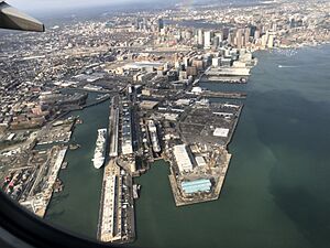
Exploring Boston Harbor's Geography

.jpg)
Boston Harbor is a large harbor at the western end of Massachusetts Bay. It's protected from the open Atlantic Ocean by land on the north (like the Winthrop Peninsula and Deer Island), land on the south (like the Nantasket Peninsula), and many islands in the middle.
The harbor is often divided into two main parts:
The Inner Harbor
The inner harbor was historically the main port of Boston. It still has most of the city's port facilities. The Boston waterfront, which is the area along the water, has been updated with homes and fun places to visit.
- Where it is: The inner harbor stretches from where the Charles River and Mystic River meet the harbor, all the way to Logan International Airport and Castle Island. Castle Island is now connected to Boston by land. This is where the inner harbor meets the outer harbor.
The Outer Harbor
The outer harbor is to the south and east of the inner harbor. It includes three smaller bays: Dorchester Bay, Quincy Bay, and Hingham Bay. Out towards the sea, two deep areas for ships to anchor, President Roads and Nantasket Roads, are separated by Long Island.
- Rivers that flow in: Several rivers flow into the outer harbor, including the Neponset River, the Weymouth Fore River, the Weymouth Back River, and the Weir River.
- Shipping areas: Deep channels allow ships to travel from President Roads to the inner harbor, and from Nantasket Roads to the Weymouth Fore River and Hingham Bay. Some commercial port facilities are located in the Fore River area, which has a history of shipbuilding.
How Land Was Created
In the 1830s, people noticed that the harbor was changing. Islands were wearing away, and sediment (dirt and sand) was moving around. People worried the inner harbor was filling up.
Scientists and engineers began to understand that the harbor's channels were created and kept clear by the force of water moving in and out, and by the rivers and tides. This idea was called the theory of Tidal scour. This understanding helped calm fears about land-filling projects.
As Boston grew in the 1800s, there was a huge need for more land. A law from 1641 allowed property owners to extend their land into the water up to 100 rods (about 1,650 feet) from the high tide line. This was unusual, as most other states set private property lines at the high tide mark.
- Boston's unique growth: This law, combined with Boston's unique geography, led to a lot of land being created by filling in parts of the harbor. By the end of the 1800s, Boston had created more new land in just two generations than it had in the previous two centuries!
The Many Harbor Islands


Boston Harbor has many islands. Since 1996, 34 of them have been part of the Boston Harbor Islands National Recreation Area. Here are some of the islands in or near the harbor:
- Bumpkin Island
- Button Island
- Calf Island
- Castle Island
- Deer Island
- Gallops Island
- Georges Island
- Grape Island
- Great Brewster Island
- Green Island
- Hangman Island
- Langlee Island
- Little Brewster Island
- Little Calf Island
- Long Island
- Lovells Island
- Middle Brewster Island
- Moon Island
- Nixes Mate
- Outer Brewster Island
- Peddocks Island
- Raccoon Island
- Ragged Island
- Rainsford Island
- Sarah Island
- Shag Rocks
- Sheep Island
- Slate Island
- Snake Island
- Spectacle Island
- Spinnaker Island
- The Graves
- Thompson Island
Some islands, like Castle Island and Deer Island, are still recognizable but are now connected to the mainland by land that was filled in. Deer Island became connected after a big hurricane in 1938.
Nut Island is another former island that was connected to the mainland in the 1940s to build a sewage treatment facility.
Two other former islands, Apple Island and Governors Island, were completely covered by land created for Logan International Airport.
The Harbor Islands are a very quiet voting area for Boston. As of 2018, there were only two active voters, who worked at the Thompson Island Outward Bound Educational Center.
Fish Farming in the Harbor?
In 1996, there was a plan to use the large tanks on Moon Island as a fish farm. The idea was to raise fish like tuna or lobster, or store them temporarily. This would allow them to be sold when prices were higher. However, this plan has not happened yet.
These are important lighthouses and markers that help ships navigate safely in Boston Harbor:
- Boston Light
- Deer Island Light
- Egg Rock Light
- Long Island Head Light
- Lovells Island Range Lights
- Nixes Mate
- Spectacle Island Range Lights
- The Graves Light
Images for kids
-
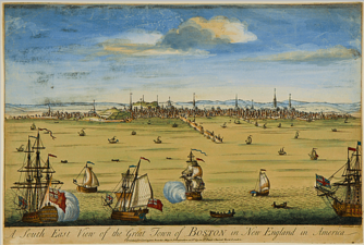
"South East View of the Great Town of Boston," by John Carwitham, c. 1765
-
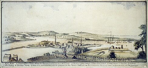
View from Beacon Hill, c. 1770s (Library of Congress Prints and Photographs Division Washington)
-
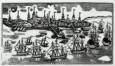
Boston Harbor, c. 18th century, by Nathaniel Dearborn after Paul Revere (Museum of Fine Arts, Boston)
-
Boat Race, Boston Harbor, by A. A. Lawrence, 1852 (Museum of Fine Arts, Boston)
-
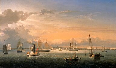
Boston Harbor by Fitz Hugh Lane, 1854
-
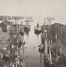
Boston harbor and East Boston from State Street Block, by John P. Soule, 19th century
-
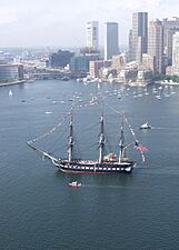
USS Constitution, 2005
-
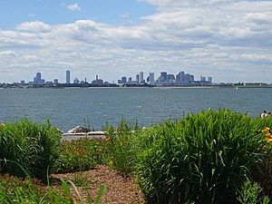
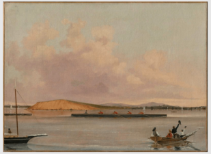
Boston's skyline from Spectacle Island
-
Container and cruise terminals and dry dock #3 in 2019


