
Passumpsic River facts for kids
Quick facts for kids Passumpsic River |
|
|---|---|

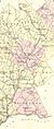
The Passumpsic River in 1875
|
|
| Country | United States |
| Physical characteristics | |
| Main source | Main stem: Lyndonville, VT West Branch: east of Crystal Lake, northeast of Sutton, VT and north of Sheffield, VT East Branch: north of East Haven, VT Main stem 699 feet (213 m), West Branch 968 feet (295 m), East Branch 1,010 feet (310 m) |
| River mouth | Connecticut River at Nine Island near East Barnet, VT 469 feet (143 m) |
| Length | Main stem 22.7 miles (36.5 km), West Branch 15.3 miles (24.6 km), East Branch 19.5 miles (31.4 km) |
| Basin features | |
| Basin size | 436 square miles (1,129 km2) |


The Passumpsic River is a 22.7-mile-long (36.5 km) river in Vermont. It flows into the larger Connecticut River. This river is special because it's the only one that goes through all three counties of Vermont's Northeast Kingdom region.
Contents
River's Journey
The Passumpsic River starts as two main parts: the East Branch and the West Branch. These two parts join together to form the main river.
East Branch
The East Branch begins near Sukes Pond in Brighton. It flows south through Essex County. Then it enters Caledonia County. It passes through East Haven and East Burke. This branch joins the West Branch in Lyndonville.
West Branch
The West Branch starts from Newark Pond in Newark. It flows through parts of Barton and Burke. The West Branch also meets the East Branch in Lyndonville.
Main River Flow
After the two branches meet in Lyndonville, the river flows south. It passes through towns like St. Johnsbury Center, St. Johnsbury, Passumpsic, and Barnet. Finally, it empties into the Connecticut River near Nine Island.
River Features
The Passumpsic River has many interesting features along its path. It flows through different towns and changes its direction many times.
St. Johnsbury Area
The river flows right through the middle of St. Johnsbury. Here, two other streams join the Passumpsic. The Moose River flows in from the east. The Sleepers River, a smaller stream, joins from the northwest. After these rivers join, the Passumpsic River becomes much wider. It can be 100 to 200 feet wide in this area.
Barnet Area
As the river reaches Barnet, it turns south. It flows into the Connecticut River about 2.5 miles (4.0 km) from the town's northeast corner. Smaller brooks like Enerick Brook and Joes Brook also flow into the Passumpsic here.
River's History
In 1759, a group of soldiers called Rogers' Rangers used the Passumpsic River valley. They were retreating after an attack on the Abenaki Indians. One group of rangers followed the Passumpsic River south to escape.
River's Geology
The Passumpsic Valley has the longest esker in Vermont and New Hampshire. An esker is a long, winding ridge of sand and gravel. It is left behind by melting glaciers. This esker stretches from St. Johnsbury north past Lyndonville. In some places, it is over 150 feet (46 m) thick.
Scientists have found that the Passumpsic River Valley has several natural basins. These basins are like large, flat areas formed by the river. The town of St. Johnsbury is built on one of these high, flat areas, called "St. Johnsbury Plain."
Hydroelectric Power
The Passumpsic River is used to create electricity. Several dams along the river produce hydroelectric power. Companies like Central Vermont Public Service operate some of these dams. The Great Falls Dam and Vail Dam are owned by the town of Lyndonville, VT. In 2006, a grant helped remove the East Burke Dam from the East Branch. This helps the river flow more naturally.
Images for kids
-
The Passumpsic River charted in 1875
