Brighton, Vermont facts for kids
Quick facts for kids
Brighton, Vermont
|
|
|---|---|
|
Town
|
|

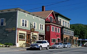
Village of Island Pond in Brighton
|
|

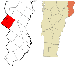
Location in Essex County and the state of Vermont.
|
|

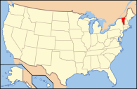
Location of Vermont with the U.S.A.
|
|
| Country | United States |
| State | Vermont |
| County | Essex |
| Chartered | 1781 |
| Settled | 1824 |
| Organized | 1832 |
| Community | Island Pond |
| Government | |
| • Type | New England town |
| Area | |
| • Total | 53.3 sq mi (138.1 km2) |
| • Land | 51.9 sq mi (134.3 km2) |
| • Water | 1.5 sq mi (3.8 km2) |
| Elevation | 1,280 ft (365 m) |
| Population
(2020)
|
|
| • Total | 1,157 |
| • Density | 22/sq mi (8.6/km2) |
| • Households | 529 |
| • Families | 356 |
| Time zone | UTC-5 (EST) |
| • Summer (DST) | UTC-4 (EDT) |
| ZIP code |
05846 (Island Pond)
|
| Area code(s) | 802 |
| FIPS code | 50-08725 |
| GNIS feature ID | 1462052 |
Brighton is a town in Essex County, Vermont, United States. About 1,157 people lived there in 2020.
Brighton has had a few names! It was first called "Gilead" in 1780. Later, it was named "Random" after being sold to soldiers. Finally, in 1832, the name was changed to "Brighton". The main village in Brighton is called Island Pond. Its name comes from the Abenaki word Menanbawk, which means "island pond". Brighton is part of a larger area that includes Berlin, NH.
Contents
Geography of Brighton
Brighton is located in western Essex County. It shares borders with several other towns and areas. The main community, Island Pond, is found at the northern end of a lake with the same name. This lake is right in the middle of the town.
Land and Water Areas
The town of Brighton covers a total area of about 138.1 square kilometers (53.3 square miles). Most of this is land (134.3 square kilometers or 51.9 square miles). About 3.8 square kilometers (1.5 square miles) is water.
Island Pond is the biggest body of water in Brighton. It was once called "Knowlton Pond" to honor Luke Knowlton, who helped plan the town. The Clyde River flows out of the north end of Island Pond. It then goes northwest towards Charleston.
Spectacle Pond is another lake nearby. It is quite shallow, only about 8 to 10 feet deep. Most of Brighton's water, including Island Pond and Spectacle Pond, flows into Lake Memphremagog. This means the water eventually reaches the Saint Lawrence River in Quebec, Canada. A smaller part of the town's east side drains into the Connecticut River.
Highest Point and Roads
The highest point in Brighton is the southern peak of Bluff Mountain. It stands about 2,789 feet (850 meters) tall.
Two main roads, Route 114 and Route 105, cross through Brighton. They join together as Derby Street in Island Pond.
- Route 114 goes north about 16 miles to the Canadian border. It also goes south about 24 miles to Lyndonville.
- Route 105 goes east about 16 miles to Bloomfield and northwest about 17 miles to Derby Center.
History of Brighton
In 1957, a very special white spruce tree was chosen from Brighton. This 67-foot-tall tree was displayed as the famous Rockefeller Center Christmas Tree in New York City.
People of Brighton (Demographics)
| Historical population | |||
|---|---|---|---|
| Census | Pop. | %± | |
| 1810 | 144 | — | |
| 1830 | 105 | — | |
| 1840 | 157 | 49.5% | |
| 1850 | 193 | 22.9% | |
| 1860 | 945 | 389.6% | |
| 1870 | 1,535 | 62.4% | |
| 1880 | 1,691 | 10.2% | |
| 1890 | 2,020 | 19.5% | |
| 1900 | 2,023 | 0.1% | |
| 1910 | 2,013 | −0.5% | |
| 1920 | 2,280 | 13.3% | |
| 1930 | 2,002 | −12.2% | |
| 1940 | 1,754 | −12.4% | |
| 1950 | 1,671 | −4.7% | |
| 1960 | 1,545 | −7.5% | |
| 1970 | 1,365 | −11.7% | |
| 1980 | 1,557 | 14.1% | |
| 1990 | 1,562 | 0.3% | |
| 2000 | 1,260 | −19.3% | |
| 2010 | 1,222 | −3.0% | |
| 2020 | 1,157 | −5.3% | |
| U.S. Decennial Census | |||
Most people in Brighton are White (about 95.4%). About 1.2% are Asian, and 3.1% are from two or more races.
In 2000, there were 1,260 people living in Brighton. There were 529 households, and 356 of these were families. About 30.2% of households had children under 18 living there. The average household had 2.38 people, and the average family had 2.88 people.
The population's age groups were spread out:
- 25.0% were under 18 years old.
- 7.8% were from 18 to 24 years old.
- 23.8% were from 25 to 44 years old.
- 25.2% were from 45 to 64 years old.
- 18.2% were 65 years or older.
The average age in Brighton was 41 years.
Economy and Activities
The average income for a household in Brighton was about $26,932 in 2000. For families, the average income was about $31,316.
Tourism and Recreation
Tourism is an important part of Brighton's economy. The Brighton Snowmobile Club takes care of about 130 miles of trails. These trails are very popular for snowmobiling during the winter months.
Media
WVTI 106.9 is a radio station that broadcasts from Island Pond.
See also
 In Spanish: Brighton (Vermont) para niños
 | Leon Lynch |
 | Milton P. Webster |
 | Ferdinand Smith |

