Lake Memphremagog facts for kids
Quick facts for kids Lake Memphremagog |
|
|---|---|
| Lac Memphrémagog | |
Lake Memphremagog
|
|
| Location | Memphrémagog Regional County Municipality, Quebec, Canada; Orleans County, Vermont, United States |
| Coordinates | 45°0′18″N 72°13′53″W / 45.00500°N 72.23139°W |
| Primary inflows | (clockwise from the mouth) Discharge from a small lake, discharge from a small lake, discharge from three small lakes, stream, Taylor stream, Fitch stream (via Fitch bay), Bunker stream (via Fitch bay), stream (via Fitch bay), Tompkin stream (via Harvey Bay), stream, Arnold stream, Johns River (Vermont) (Canada-United States), 3 streams (United States), Clyde River (Vermont), Barton River (Vermont), Black River (Lake Memphremagog), Perkins Creek, Glen Creek, West Creek, Powell Creek, Scott Creek, Patterson Creek, Benoit Creek, Castle Creek, Cherry River (Quebec) |
| Primary outflows | Magog River |
| Catchment area | 686 sq mi (1,777 km2) |
| Basin countries | Canada / United States |
| Max. length | 32 mi (51 km) |
| Surface area | 41 sq mi (110 km2) |
| Average depth | 15.5 m (51 ft) |
| Max. depth | 107 m (351 ft) |
| Surface elevation | 208 m (682 ft) |
| Islands | 21 |
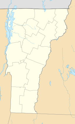
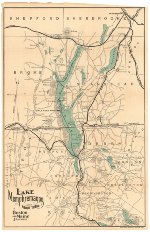
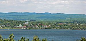
Lake Memphremagog (called Lac Memphrémagog in French) is a large fresh water lake. It was formed by glaciers. The lake stretches between Newport, Vermont, in the United States, and Magog, Quebec, in Canada. Most of the lake is in Quebec.
Even though most of the lake is in Canada, most of the land that drains water into the lake (called its watershed) is in Vermont. This land can sometimes bring pollution like phosphorus and sediments into the lake. Since the late 1980s, people have worked hard to clean up the lake, and its water quality has gotten much better. This lake provides drinking water for 200,000 people!
Contents
About the Lake's Shape and Size
Lake Memphremagog is about 31 miles (50 km) long. About 73 percent of the lake's surface is in Quebec. From there, its water flows into the Magog River.
However, three-quarters of the land that drains into the lake is in Vermont. This area is about 489 square miles (1,270 km2). The total area that drains into the lake is 687 square miles (1,780 km2), with 198 square miles (510 km2) in Quebec.
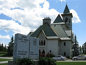
In Vermont, the lake is in parts of Derby, Newport, and the City of Newport. These are all in Orleans County. In Quebec, the lake is in parts of Austin, Magog, Ogden, Potton, Saint-Benoît-du-Lac, and Stanstead Township. These are all in the Memphrémagog Regional County Municipality.
The lake is about 682 feet (208 m) above sea level. Both ends of the lake are quite shallow, usually 20 feet (6.1 m) to 30 feet (9.1 m) deep. The lake gets much deeper in Canada, reaching a maximum depth of 351 feet (107 m). This makes it the third deepest lake in Vermont.
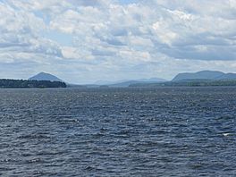
The lake has an uneven shape, with many interesting curves and bays along its shores. Some parts of the shore are low, while others are high and rocky. Along the western side of the lake, you can see several mountains, including Owl's Head and Elephantis.
Islands in the Lake
Lake Memphremagog has twenty-one islands. Five of these islands are in the United States, one is shared between both countries, and fifteen are in Canada. Many islands have had different names over time.
Islands in the United States
- Horseneck Island is the island furthest south on the lake, close to the eastern shore.
- Bell Island is one of the "Twin Sister" islands.
- Gull Rocks is a small group of rocks north of Bell Island.
- Black Island is the other "Twin Sister" island.
- Cove Island is located east of Black Island.
International Island
- Province Island is unique because the international border runs right through it! About one-tenth of the southern part of the island is in the United States, and the rest is in Canada.
Islands in Canada
- Tea Table Island is north of Province Island.
- Round Island is close to the western shore.
- Whetstone Island is at the entrance to Fitch Bay. It was named because a type of stone used for sharpening tools was found there.
- Gull Island is north of Whetstone Island.
- Loon Island is located in Fitch Bay.
- Minnow Island is east of Skinner's Island.
- Skinner's Island is west of Minnow Island.
- Long Island is north of Skinner's Island.
- Molson's Island is on the eastern shore.
- Lord's Island is further north in the lake.
- Eagle Island is north of Hermitage Point.
- Three Sisters are a group of three small islands close together.
- Charest Island is the island furthest north on the lake, located in Magog, Quebec.
How Water Flows In and Out
Four rivers in Vermont flow directly into Lake Memphremagog: the Clyde, the Barton, the Black, and the Johns River.
In the middle of winter, the ice on the lake can get very thick, up to 3 feet (0.9 m) deep.
The Magog River in Quebec is where the lake's water flows out towards the northeast. A dam on the Magog River, called the Memphremagog Dam, helps control the lake's water level. The water level is managed by an agreement between the United States and Canada that was signed in 1935.
The Lake's History in Earth
During the ice age, Lake Memphremagog was part of a much larger ancient lake. This huge lake also covered areas like Lake Magog and Lake Brompton.
Protecting the Lake's Environment
Like many other lakes, Memphremagog has faced challenges with pollution, such as too much phosphorus and sediments. These often come from farms and other sources. There's also a concern about invasive species, like the Eurasian water milfoil, which is already in the lake, and the potential for zebra mussels to arrive.
Since the 1970s, a lot of effort has gone into stopping pollution from directly entering the lake and its rivers. Because of these efforts, the lake's water quality has gotten better.
In 1994, the Lake Memphremagog Watershed Association was created. This group focuses on solving problems related to the lake and its rivers. Studies have shown that farms, even though they make up only 16% of the land in the area, contribute about 44% of the runoff that can carry nutrients into the lake. The goal for a healthy lake is to have about 14 micrograms of phosphorus per liter of water. The lake was measured at 17 micrograms, which is a bit higher than the healthy standard.
Where the Name Comes From
The lake is in the traditional territory of the Abenaki tribe. The name Memphremagog comes from the Algonkian language.
- It comes from the word Memrahabegek, which means "where there is a big expanse of water."
- Another way it was pronounced was "Mamphremagog." This came from the Abenakis' Mamlawbagak, meaning "a long and large sheet of water." The first part, mamlaw, means large or abundant. The middle part, baga, means water. And "k" shows that it's a local name.
In English, people usually say the name as "mem fra MAY gog."
Lake History
In 1753, the Abenakis brought a famous person named John Stark down the lake. They landed where the city of Newport is today.
In 1759, a group called Rogers' Rangers had to retreat south after an attack. To confuse those chasing them, they split up on the east shore of the lake.
The first accurate map of the lake was made in 1776. This map helped more settlers become interested in the area.
Boats have been important on the lake for a long time. The Mountain Maid paddlewheeler operated from 1850 to 1870. The Lady of the Lake steamship started in 1867 and offered fun trips and ferry services. It stopped running in 1917. Another steamer, the Anthemis, was built in 1909 and could carry 300 people. It stopped operating after 1945.
In 2010, the U.S. Fish and Wildlife Service received a gift of 420 acres (170 ha) of undeveloped land on the lake's shores near the Canadian border.
Memphre: The Lake Monster?
Lake Memphremagog is said to be home to a mysterious creature called Memphre (or Memphré). People have reported seeing this creature since the 1700s, and stories about it are still part of the local folklore. A sighting of Memphre was even reported in the year 2000!
Lighthouses of Lake Memphremagog
Lake Memphremagog once had at least three lighthouses on the Vermont side and seven on the Quebec side. These lighthouses helped boaters find their way safely across the large lake.
Vermont Lighthouses
All three of the original lighthouses in Vermont have been taken down.
Maxfield Point Light
The Maxfield Point Light was a small lighthouse built in 1879. It was a round, cast iron tower, 25 feet (7.6 m) tall. It showed a steady white light that could be seen for 10 miles (16 km). We don't know exactly when it was taken down.
Newport Wharf Light
The Newport Wharf Light was a tower built in 1879 in the Newport area of the lake. It was a red steel tower on a concrete base. This tower showed a steady red light that could be seen for up to 12 mi (19 km). Like the Maxfield Point Lighthouse, the date it was taken down is unknown.
Whipple Point Light
Whipple Point Light was a wooden tower built in 1879 at the end of a pier. It was shaped like a hexagon and stood 13 feet (4.0 m) tall. Its light was steady white and could be seen from up to 10 mi (16 km) away. This lighthouse was stopped around 1906 and later taken down.
Quebec Lighthouses
Most of the lighthouses in Quebec were first built in 1878. None of the original lighthouse buildings are still standing today, but some have been replaced by simple navigation lights. Here are some of them, listed from north to south:
Magog Lighthouse
The Magog Lighthouse was located on a freight shed and had a steady red light that could be seen for 8 miles (13 km). It was built in 1910 near Magog and was later taken down.
Witch Shoal Lighthouse
Witch Shoal Lighthouse was about 0.5 miles (0.80 km) southwest of Magog. The first lighthouse here was a 21 feet (6.4 m) white wooden tower built in 1878. It had a steady white light that could be seen for 9 miles (14 km). It was rebuilt in 1900. In 1933, ice destroyed it. It was rebuilt again in 1960 as a small metal tower, but that too was swept away by ice in 1978. Since 1980, a simple mast with a light is put in place only from May to October each year.
Black Point Lighthouse
Black Point Lighthouse was on the western side of the lake, about 3 miles (4.8 km) southwest from Witch Shoal lighthouse. It was also known as Green Point Lighthouse. It was a 22-foot (6.7 m) white wooden tower built in 1878. It had a steady white light that could be seen for 8 miles (13 km). It was rebuilt in 1914.
Wadleigh's Point Lighthouse
Wadleigh's Point Lighthouse was on the western side of the lake, about 4 miles (6.4 km) southwest of Black Point lighthouse, near Austin. The first lighthouse was a 22 feet (6.7 m) white wooden tower built in 1878 with a steady white light that could be seen for 8 miles (13 km). It was replaced several times, and today, a modern 22 feet (6.7 m) steel tower with a steady white light is still used from May to October each year.
Chateau de Silva Lighthouse
Chateau de Silva Lighthouse was on the western side of the lake, near a hotel. It was a 22 feet (6.7 m) white wooden tower built in 1878 with a steady white light that could be seen for 8 miles (13 km). It was later taken down.
Molson's Island Lighthouse
Molson's Island Lighthouse was on the southwest point of Molson's Island, near Georgeville. It was a 22 feet (6.7 m) white wooden tower built in 1878 with a steady white light that could be seen for 8 miles (13 km). It was rebuilt in 1914 and later taken down. A lighted buoy now marks the spot.
Lead Mines Lighthouse
Lead Mines Lighthouse was on the western side of the lake, near Leadville. It was a 22 feet (6.7 m) white wooden tower built in 1878 with a steady white light that could be seen for 8 miles (13 km). It was rebuilt in 1914 and later taken down.
Economy Around the Lake
The land around the lake in Vermont is mostly farms and forests. However, more homes are being built in both Vermont and Quebec.
As mentioned, the lake provides drinking water for 200,000 people, which is very important.
In 2011, a day cruise ship started offering summer tours on the Canadian side of the lake, which is a fun way for people to enjoy the water.
Sargent's Bay Yacht Club
Sargent's Bay Yacht Club is a small sailing club for children located in Sargent's Bay. It runs for eight weeks in the summer, teaching up to 40 campers each week. The club was started in 1935 by several families who wanted to teach their children how to sail. The Fisher family has kindly allowed the club to use their property since 1935.
 | Georgia Louise Harris Brown |
 | Julian Abele |
 | Norma Merrick Sklarek |
 | William Sidney Pittman |


