Cherry River (Quebec) facts for kids
Quick facts for kids Cherry River |
|
|---|---|

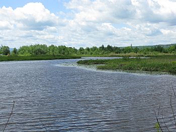
A riverbend in the Cherry River
|
|
| Native name | Rivière aux Cerises (in French) |
| Country | Canada |
| Province | Quebec |
| Administrative region | Estrie |
| Physical characteristics | |
| Main source | Orford (secteur Saint-Élie d'Orford), Étang de la source |
| River mouth | Sherbrooke (secteur Deauville), Lake Memphremagog 204 m 45°16′13″N 72°10′16″W / 45.27028°N 72.17111°W |
| Length | 11.9 km |
| Basin features | |
| Tributaries |
|
The Cherry River (or Rivière aux Cerises in French) is a beautiful river in Quebec, Canada. It flows through the towns of Orford and Magog. This river is an important part of the Lake Memphremagog area.
Long ago, in the late 1800s, dams were built on the river. This caused the area around it to flood. Now, it's a permanent wetland, which is a special watery habitat.
Contents
Where Does the Cherry River Flow?
The Cherry River is part of a larger water system. It connects to many other streams and lakes.
Nearby Waterways
Here are some of the main water areas near the Cherry River:
- To the north: Key Creek.
- To the east: Magog River, Red Creek, Dorman Creek, Meadow Creek, and the Saint-François River.
- To the south: Lake Memphremagog.
- To the west: Gagné stream and Montjoie Lake.
The River's Journey
The Cherry River starts at a place called "Etang aux Cerises" (Cherry Pond). This pond is near Lake Stukely and Mount Orford. The pond gets its water from several smaller streams, including:
- Grand Crescent Creek and Billot Creek, coming from Mount Orford.
- Streams from the "Hill of Pines."
- Mai Creek (which also gets water from Perdu Creek).
From Cherry Pond, the Cherry River flows for about 11.9 kilometers (about 7.4 miles). Here's how its journey goes:
- It flows southeast through Sayat-Nova Pond.
- It meets Cuvette Creek, which comes from Lac de la Cuvette.
- It passes the "Grand Rocher Creek."
- It flows past the small villages of Cherry River and Chéribourg.
- It joins with Castle Creek and then the "Branche de l'Est" creek.
- Finally, it flows into a small bay on the north shore of Lake Memphremagog. This is near Cabana Point in the Deauville area.
The Route 112 crosses the Cherry River right where it meets Lake Memphremagog.
Why is it Called Cherry River?
The name "Cherry River" comes from the fruit of the cherry tree. Cherries grow in this region and are ripe in the middle of summer. Many places in this area are named "Cherry," like the pond, a small village, and the marsh.
The official name "rivière aux Cerises" was recorded on December 5, 1968, by the Commission de toponymie du Québec.
 | Stephanie Wilson |
 | Charles Bolden |
 | Ronald McNair |
 | Frederick D. Gregory |

