
Orleans County, Vermont facts for kids
Quick facts for kids
Orleans County
|
|
|---|---|

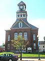
Orleans County Courthouse in Newport (city)
|
|

Location within the U.S. state of Vermont
|
|
 Vermont's location within the U.S. |
|
| Country | |
| State | |
| Founded | 1799 |
| Named for | Orléans, France |
| Shire Town | Newport |
| Largest city | Derby |
| Area | |
| • Total | 721 sq mi (1,870 km2) |
| • Land | 693 sq mi (1,790 km2) |
| • Water | 28 sq mi (70 km2) 3.9%% |
| Population
(2020)
|
|
| • Total | 27,393 |
| • Density | 37.993/sq mi (14.669/km2) |
| Time zone | UTC−5 (Eastern) |
| • Summer (DST) | UTC−4 (EDT) |
| Congressional district | At-large |
Orleans County is a county located in the northeastern part of the U.S. state of Vermont. In 2020, about 27,393 people lived here. Its main town, also called the county seat, is Newport. The county was created in 1792 and officially started in 1799. Like other parts of New England, the county government doesn't have many powers. It mostly helps organize and deliver state services.
Contents
History
Orleans County shares its early history with the rest of the Northeast Kingdom.
In 1753, the Abenaki people brought a person named John Stark down Lake Memphremagog. They landed where Newport is today before traveling to his home in New Hampshire.
Rogers' Rangers had to retreat through the county in 1759 after attacking a place called Saint-Francis, Quebec. To confuse those chasing them, they split up on the east side of Lake Memphremagog. Some followed the Clyde River, while others went south along the Barton River.
In 1774, British surveyors tried to mark the border between Canada and America. They aimed for the 45th parallel north, but the line ended up being a bit crooked. This crooked line was officially accepted in 1842, which meant places like Derby Line stayed in the U.S.
Around 1779, General Moses Hazen built the Bayley-Hazen Military Road. This road was meant for an invasion of Canada, but it was never used for that. Instead, it helped people settle this area.
Vermont was first divided into two counties in 1778. In 1781, the northern part became Orange County. On November 5, 1792, Orleans County was created from parts of Chittenden and Orange counties. We don't know why it was named after Orléans, France.
In 1810, a natural disaster happened when Runaway Pond suddenly flooded the Barton River Valley with a huge amount of water. Amazingly, no one died.
During the War of 1812, British soldiers from Quebec invaded the county in 1813. They destroyed an army barracks and looked for supplies in Derby. No one was hurt. Before this, many local people didn't support the war. After the invasion, their feelings changed.
June 1816 brought a foot of snow to the county, which ruined many crops. This year became known as the Year without a summer.
Orleans County lost some land when Lamoille County was formed in 1835. Later, in 1858, it gained a small piece of land from Sheffield, including May Pond.
During the American Civil War, many men from Orleans County joined the Union Army. In 1864, 54 soldiers from Orleans County were captured at the Battle of the Weldon Railroad and sent to Andersonville prison, which was known for its harsh conditions. Many of them died there.
After the Civil War, many farms in Vermont, especially in the northern part, became available for sale. This led to many French-Canadians moving to the county.
The county's population grew until 1900, then it decreased until 1960. Since then, the population has been growing again.
In 1903, the county bought a jail through a mail order catalog! It closed in 1995 and is now a historic site.
In 2004, the famous band Phish held what was supposed to be their last concert in Coventry. About 70,000 people attended, making it one of the largest gatherings in Vermont's history.
The county has twenty-three places listed on the National Register of Historic Places, which are important historical sites.
In 2008, a health study looked at people living near a former asbestos mine. A revised study in 2009 found that deaths related to the mine were from people who worked there, not just living nearby. However, the site still needs to be cleaned up.
Geography
Orleans County covers about 721 square miles. Most of this is land (693 square miles), and 28 square miles (3.9%) is water. It's the largest of the three counties in the Northeast Kingdom.
The county is located between the eastern and western parts of the Green Mountains.
The highest point in the county is Jay Peak, which is 3,858 feet tall. The lowest point is the surface of Lake Memphremagog, at 682 feet.
Most of the county's water flows north into the St. Lawrence River basin through four main river systems: the Barton, the Black, the Clyde, and the Missisquoi River. The southern part of the county drains south and west into the Lamoille River.
The Barton River flows north from Crystal Lake through several towns and into Lake Memphremagog. The Black River also flows north to Lake Memphremagog. The Clyde River has four dams before it reaches Lake Memphremagog.
Orleans County has more ponds than any other county in Vermont.
The county is home to three state forests: Hazen's Notch, Jay, and Willoughby.
Animals and Birds
Orleans County is a great place for songbirds because of its northern location, boreal forests, mountains, and many bodies of water. You can find many different kinds of birds here, including ovenbirds, American robins, bald eagles, and common loons.
Climate
The average growing season in the Newport area is about 130 days without frost. Higher places in the county usually have shorter growing seasons.
Tornadoes have hit the county four times between 1950 and 1995, but they were all mild.
On February 5, 1995, Jay Peak received 42 inches of snow, which is the most daily snowfall ever recorded in Vermont.
Climate Change
In the 20th century, the county was in a "Hardiness Zone Three," meaning certain plants could grow there. By 2014, many plants that usually grow in warmer "Zone Four" or even "Zone Five" areas were doing well here. This shows that the growing seasons have been getting longer, increasing by about 3.7 days every ten years since 1974.
Neighboring Areas
- Essex County - east
- Caledonia County - south
- Lamoille County - southwest
- Franklin County - west
- Brome-Missisquoi Regional County Municipality, Quebec - northwest
- Memphrémagog Regional County Municipality, Quebec - north
- Coaticook Regional County Municipality, Quebec - northeast
Population
| Historical population | |||
|---|---|---|---|
| Census | Pop. | %± | |
| 1800 | 1,439 | — | |
| 1810 | 5,838 | 305.7% | |
| 1820 | 6,976 | 19.5% | |
| 1830 | 13,980 | 100.4% | |
| 1840 | 13,634 | −2.5% | |
| 1850 | 15,707 | 15.2% | |
| 1860 | 18,981 | 20.8% | |
| 1870 | 21,035 | 10.8% | |
| 1880 | 22,083 | 5.0% | |
| 1890 | 22,101 | 0.1% | |
| 1900 | 22,024 | −0.3% | |
| 1910 | 23,337 | 6.0% | |
| 1920 | 23,913 | 2.5% | |
| 1930 | 23,036 | −3.7% | |
| 1940 | 21,718 | −5.7% | |
| 1950 | 21,190 | −2.4% | |
| 1960 | 20,143 | −4.9% | |
| 1970 | 20,153 | 0.0% | |
| 1980 | 23,440 | 16.3% | |
| 1990 | 24,053 | 2.6% | |
| 2000 | 26,277 | 9.2% | |
| 2010 | 27,231 | 3.6% | |
| 2020 | 27,393 | 0.6% | |
| U.S. Decennial Census 1790–1960 1900–1990 1990–2000 2010–2018 |
|||
In 2010, there were 27,231 people living in Orleans County. The average age was 43.7 years old.
Economy
In 2008, about one-third of the homes in Orleans County were used as second homes.
In 2011, about 23.1% of residents received food stamps.
Businesses and Jobs
There were 838 private businesses in the county, employing 7,392 people. In 2002, retail sales in the county were $240 million. About 24% of businesses were owned by women.
In 2003, there were 194 dairy farms in the county, which was the third largest number in Vermont. By 2010, the number of dairy farms had decreased to 139.
The county has seen a big increase in jobs related to forest products.
Shopping
Many stores are found in downtown Newport and along the Newport-Derby Road. The villages of Barton and Orleans also have shops.
There are seven pharmacies in the county, most of which are part of larger chains. There are also two regional chain supermarkets and many local grocery stores. Many smaller towns still have a general store in the center.
Tourism
Orleans County is tied for first place in Vermont for having the highest percentage of second homes, meaning many people visit and own vacation homes here.
Education
About 78.2% of residents have at least a high school education, and 16.1% have a college degree.
There are three public high schools in the county: North Country Union High School, Lake Region Union High School, and Craftsbury Academy. Wheeler Mountain Academy helps students with emotional or learning challenges. United Christian Academy is a private religious school.
The Northeast Kingdom Learning Services helps people find learning programs. The Central Orleans Family Education Center offers childcare, pre-kindergarten, and after-school programs.
College Education
Craftsbury Common is home to Sterling College, a four-year college with almost 100 students.
The city of Newport has a branch of the Community College of Vermont, where nearly 300 students can earn an Associate's Degree.
Culture
There are thirteen libraries in the county. Two are full-time: the famous Haskell Free Library in Derby Line and the one in Newport. Most other libraries rely on volunteers and local support.
When French immigrants came to the county, they brought their Catholic religion, which is now the most common religion here.
Media
Newspapers
- The Orleans County Record - published Monday through Saturday
- the Chronicle - published weekly in Barton
- The Newport Daily Express - published weekdays in Newport
- Newport Dispatch - an online news source updated daily
Radio
- W243AE - 96.5 FM; Orleans (repeats WGLY-FM Burlington)
- WIKE - 1490 AM; Newport
- WMOO - 92.1 FM; Derby Center
Television
- W14CK - Channel 14; Newport.
- NEK-TV - Channels 14 and 15; Northeast Kingdom Television, Newport.
Comcast provides cable TV service to Newport and most of Orleans County.
Utilities and Communication
Communication
Fairpoint Communications provides landline phone service throughout the county.
Cell Phones
In 2007, AT&T took over Unicel in Orleans County. Verizon Wireless covers Newport city and the Derby-I-91 area.
Internet
As of 2006, about 86% of the county had broadband internet access. This included cable (52%), DSL (44%), and wireless internet (69%).
Transportation
Main Roads
The opening of Interstate 91 in 1972 (north from Barton) and 1978 (south from the county) had a big impact on Orleans County, similar to how the railway changed things a century earlier. The county saw its first population growth in a century after the interstate opened.
Interstate 91 has its five northernmost exits in Orleans County. Two are in Barton, and three are in Derby.
The county has 1,041 miles of state and local roads. About 606 miles are dirt roads. The county government does not build or maintain any roads.
Derby has the most road mileage (102 miles), and Westfield has the least (31 miles).
The county has ten traffic lights, with six in Newport city and four in Derby. Most are along U.S. Route 5 and Vermont Route 105.
 Interstate 91 - Barton to Derby
 U.S. Route 5 - Barton to Derby
 VT 5A - Westmore to Derby
 VT Route 14 - Irasburg to Coventry and Newport
 Vermont Route 16 - Greensboro to Westmore
 Vermont Route 58 - Lowell to Westmore
 VT Route 100 - Newport through Eden.
 Vermont Route 101 - Connects North Troy and Route 105 with Troy Village
 VT Route 105 - Troy to Charleston.
 Vermont Route 111 - Derby to Morgan
 VT Route 114 - Goes through Morgan
 VT 122 - Glover southeast to Sheffield
 Vermont Route 191 - "Access Road", connects I-91, Exit 27, to Newport city
 Vermont Route 242 - connects route 101 in Jay, with Jay Peak Village
 Vermont Route 243 - Connects North Troy to Mansonville, Quebec
Public Transportation
The RCT (Rural Community Transportation) is a non-profit group that provides bus services in Orleans and nearby counties. Buses run north and south from Newport city to Derby Center during the week and on Saturdays. The fare is 25 cents.
Railroads
The Washington County Railroad operates a freight train line that runs from White River Junction north through St. Johnsbury and Newport. There are no passenger stops in the county.
Airport
The county is served by the Newport State Airport. It has two runways, each 4,000 feet long.
Nature Protection
The Nature Conservancy works to protect natural areas in Orleans County from development. Some of these protected places include May Pond, Wheeler Mountain, the north beach at Willoughby Lake, and the Willoughby Falls Wildlife Management Area.
Communities
City
- Newport (city) (main town)
Towns
Most towns in Orleans County hire the County Sheriff for police services.
Villages
These villages are part of the larger towns around them.
- Albany
- Barton
- Beebe Plain (unincorporated village of Derby)
- Derby Center
- Derby Line
- North Troy
- Orleans
Census-Designated Places
These are specific areas recognized by the census.
Other Places
- Lindsay Beach
- North Derby
Notable People
- John Gunther, an author who lived part-time in Greensboro.
- Henry M. Leland, an inventor and engineer who created the original Cadillac and Lincoln cars. He was born in Barton.
- Gilbert C. Lucier, the last surviving Civil War veteran in Vermont, who died in Jay in 1944.
- Howard Frank Mosher, an author who wrote many books set in the Northeast Kingdom. He lived in Irasburg.
- William Hubbs Rehnquist, a Chief Justice of the U.S. Supreme Court who lived part-time in Greensboro.
- Theodore Robinson, an impressionist painter born in Irasburg.
- Wallace Stegner, a Pulitzer prize-winning author who lived part-time in Greensboro.
- William Barstow Strong, who was president of the Atchison, Topeka and Santa Fe Railway. He was born in Brownington.
- Alexander Twilight, the first African American to serve in a state legislature and the first to get a degree from an American University. He lived in Brownington.
Images for kids
-
Orleans County Courthouse in Newport (city)
See also
 In Spanish: Condado de Orleans (Vermont) para niños
