Westmore, Vermont facts for kids
Quick facts for kids
Westmore, Vermont
|
|
|---|---|
|
Town
|
|

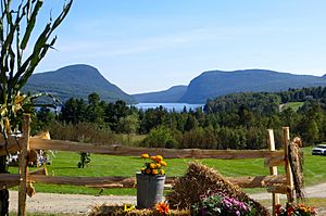
Westmore, Vermont (Mount Pisgah, Lake Willoughby, Mount Hor)
|
|

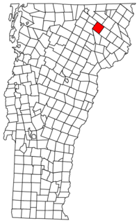
Located in Orleans County, Vermont
|
|

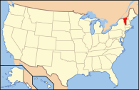
Location of Vermont with the U.S.A.
|
|
| Country | United States |
| State | Vermont |
| County | Orleans |
| Chartered | August 17, 1781 |
| Area | |
| • Total | 37.5 sq mi (97.0 km2) |
| • Land | 34.5 sq mi (89.4 km2) |
| • Water | 2.9 sq mi (7.6 km2) |
| Elevation | 1,170 ft (554 m) |
| Population
(2020)
|
|
| • Total | 357 |
| • Density | 10/sq mi (4.0/km2) |
| • Households | 136 |
| • Families | 85 |
| Time zone | UTC-5 (EST) |
| • Summer (DST) | UTC-4 (EDT) |
| ZIP Codes | |
| Area code(s) | 802 |
| FIPS code | 50-81700 |
| GNIS feature ID | 1462254 |
Westmore is a small town in Orleans County, Vermont, United States. In 2020, about 357 people lived there. This makes Westmore the town with the fewest people in its county. The town has a small village area located near Lake Willoughby.
Contents
History of Westmore
How Westmore Got Its Name
Westmore was first called Westford. It officially became a town on August 17, 1781. There was already another town named Westford in Chittenden County. So, in 1787, the name was changed to Westmore to avoid confusion.
Early Days and Growth
The first vacation house near the lake was built in 1860. It is known as the Cheney House. Westmore never had a very large population. The most people who ever lived there at one time was 485 in 1880.
Famous Visitors and Developments
The famous poet Robert Frost camped in Westmore with his family in 1909. This was before he became well-known. A summer camp for girls, called Songadeewin Camp, was located here from the 1920s to the 1940s. Electricity first came to the south end of Lake Willoughby around 1934.
Protecting Natural Beauty
In 1970, the state of Vermont bought 7,600 acres of land. This land became part of the Willoughby State Forest. The Cheney House was included in this purchase.
Westmore's Role in Elections
Westmore has sometimes been called a "bellwether" town. This means its voting results often match the overall state results. For example, in 2004 and 2006, Westmore's votes for president and governor were very similar to Vermont's statewide votes.
Geography and Nature
Size and Water Features
Westmore covers about 37.5 square miles (97.0 square kilometers). Most of this area, about 34.5 square miles (89.4 square kilometers), is land. The rest, about 2.9 square miles (7.6 square kilometers), is water.
Lake Willoughby: A Deep Wonder
One of the most important natural features in Westmore is Lake Willoughby. This lake is very deep, reaching 312 feet (95 meters). It is the deepest lake completely within Vermont. It is also one of the deepest lakes in all of New England.
Mountains and Wildlife
The mountains around Lake Willoughby have tall rock cliffs. These cliffs are part of the Willoughby State Forest. They have been named a National Natural Landmark because they are so special. In recent years, peregrine falcons have been seen living there. These birds are known for being very fast flyers.
Other local mountains include:
- Goodwin Mountain, which is 2,936 feet (895 meters) tall.
- Bald Mountain, which is 3,316 feet (1,011 meters) tall.
- Hedgehog Mountain, which is 2,201 feet (671 meters) tall.
- Haystack Mountain, which is 2,713 feet (827 meters) tall.
- Bartlett Mountain, which is 2,047 feet (624 meters) tall.
Westmore also has its own weather station. This station records and reports local weather conditions.
Population and People
| Historical population | |||
|---|---|---|---|
| Census | Pop. | %± | |
| 1810 | 126 | — | |
| 1830 | 132 | — | |
| 1840 | 122 | −7.6% | |
| 1850 | 152 | 24.6% | |
| 1860 | 324 | 113.2% | |
| 1870 | 412 | 27.2% | |
| 1880 | 480 | 16.5% | |
| 1890 | 395 | −17.7% | |
| 1900 | 390 | −1.3% | |
| 1910 | 331 | −15.1% | |
| 1920 | 287 | −13.3% | |
| 1930 | 224 | −22.0% | |
| 1940 | 224 | 0.0% | |
| 1950 | 210 | −6.2% | |
| 1960 | 179 | −14.8% | |
| 1970 | 195 | 8.9% | |
| 1980 | 257 | 31.8% | |
| 1990 | 305 | 18.7% | |
| 2000 | 306 | 0.3% | |
| 2010 | 350 | 14.4% | |
| 2020 | 357 | 2.0% | |
| U.S. Decennial Census | |||
In 2000, there were 306 people living in Westmore. There were 133 households, which are groups of people living together. About 90 of these households were families. The population density was about 8.9 people per square mile.
About 20% of the households had children under 18 years old. Most households (58.6%) were married couples living together. The average household had 2.30 people. The average family had 2.74 people.
The people in Westmore were of different ages. About 16.7% were under 18 years old. About 36.3% were between 45 and 64 years old. And 16.7% were 65 years or older. The average age was 46 years old.
Economy and Tourism
Tourism in Westmore
Westmore is a popular place for people to own second homes. It has one of the highest percentages of second home ownership in its county.
Most of the tourism in Westmore centers around Lake Willoughby and the nearby mountains. These areas offer many outdoor activities.
- Hiking and Biking: There are many trails for hiking and biking. Some of these trails are connected to the Kingdom Trails network.
- Water Activities: Visitors can enjoy fishing, ice fishing, canoeing, and other forms of boating. Parasailing is also popular on the lake.
- Climbing: The cliffs offer opportunities for rock climbing and ice climbing.
- Camping: There are campgrounds available for visitors who want to stay overnight.
- Diving: Some visitors enjoy diving from Devils Rock, which is on the east shore of the lake.
Notable People
- Galen Hunter (1802–1872), a pharmacist.
See also
 In Spanish: Westmore para niños
 | Precious Adams |
 | Lauren Anderson |
 | Janet Collins |

