Jay, Vermont facts for kids
Quick facts for kids
Jay, Vermont
|
|
|---|---|
|
Town
|
|

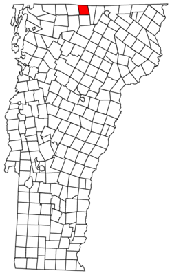
Located in Orleans County, Vermont
|
|

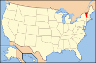
Location of Vermont with the U.S.A.
|
|
| Country | United States |
| State | Vermont |
| County | Orleans |
| Chartered | November 7, 1792 |
| Organized | March 29, 1828 |
| Area | |
| • Total | 34.0 sq mi (88.0 km2) |
| • Land | 33.9 sq mi (87.9 km2) |
| • Water | 0.1 sq mi (0.1 km2) |
| Elevation | 922 ft (469 m) |
| Population
(2020)
|
|
| • Total | 551 |
| • Density | 16/sq mi (6.3/km2) |
| • Households | 261 |
| • Families | 163 |
| Time zone | UTC-5 (EST) |
| • Summer (DST) | UTC-4 (EDT) |
| ZIP code |
05859
|
| Area code(s) | 802 |
| FIPS code | 50-36325 |
| GNIS feature ID | 1462127 |
Jay is a small town in Orleans County, Vermont, United States. It is located very close to the border with Canada. In 2020, about 551 people lived there.
The town of Jay is named after John Jay, who was one of the important people known as the Founding Fathers of the United States. Between 2000 and 2005, the number of people living in Jay grew quite a bit. This was one of the fastest population growths in Vermont at that time. Jay also hosts a fun event called the Jay Challenge, which is a three-part race usually held in July.
Contents
History of Jay, Vermont
On November 10, 1943, a training plane from the Royal Canadian Air Force crashed near the top of a mountain in Jay. This happened during a heavy snowfall. Sadly, one person on the plane died in the crash.
Geography and Landscape
Jay is a town with a total area of about 34 square miles (88 square kilometers). Most of this area is land, with only a very small part being water.
The highest point in the town is a place called North Jay Peak. It stands about 3,438 feet (1,048 meters) above sea level. Even though they have "Jay" in their names, other famous peaks like Jay Peak and the Jay Peak Resort are mostly located in the nearby town of Westfield.
A local stream called Jay Branch Brook flows into the Missisquoi River.
Weather in Jay
| Climate data for Jay Peak, Vermont, 1991–2020 normals, 1988–2014 extremes: 1840ft (561m) | |||||||||||||
|---|---|---|---|---|---|---|---|---|---|---|---|---|---|
| Month | Jan | Feb | Mar | Apr | May | Jun | Jul | Aug | Sep | Oct | Nov | Dec | Year |
| Record high °F (°C) | 59 (15) |
60 (16) |
73 (23) |
83 (28) |
85 (29) |
89 (32) |
89 (32) |
88 (31) |
87 (31) |
76 (24) |
67 (19) |
64 (18) |
89 (32) |
| Mean daily maximum °F (°C) | 23.6 (−4.7) |
25.5 (−3.6) |
33.5 (0.8) |
46.0 (7.8) |
60.9 (16.1) |
69.5 (20.8) |
73.7 (23.2) |
72.2 (22.3) |
65.7 (18.7) |
52.2 (11.2) |
39.5 (4.2) |
29.4 (−1.4) |
49.3 (9.6) |
| Daily mean °F (°C) | 13.9 (−10.1) |
15.6 (−9.1) |
24.1 (−4.4) |
36.8 (2.7) |
51.0 (10.6) |
60.2 (15.7) |
64.7 (18.2) |
63.2 (17.3) |
55.9 (13.3) |
43.4 (6.3) |
31.7 (−0.2) |
21.0 (−6.1) |
40.1 (4.5) |
| Mean daily minimum °F (°C) | 4.2 (−15.4) |
5.7 (−14.6) |
14.7 (−9.6) |
27.7 (−2.4) |
41.1 (5.1) |
50.9 (10.5) |
55.7 (13.2) |
54.1 (12.3) |
46.1 (7.8) |
34.6 (1.4) |
23.8 (−4.6) |
12.7 (−10.7) |
30.9 (−0.6) |
| Record low °F (°C) | −32 (−36) |
−33 (−36) |
−22 (−30) |
−2 (−19) |
23 (−5) |
32 (0) |
34 (1) |
31 (−1) |
16 (−9) |
12 (−11) |
−10 (−23) |
−28 (−33) |
−33 (−36) |
| Average precipitation inches (mm) | 5.07 (129) |
4.26 (108) |
3.67 (93) |
4.27 (108) |
5.91 (150) |
5.83 (148) |
6.09 (155) |
6.12 (155) |
5.29 (134) |
6.64 (169) |
5.49 (139) |
6.18 (157) |
64.82 (1,645) |
| Source: NOAA (precip 1981–2010) | |||||||||||||
People of Jay: Demographics
| Historical population | |||
|---|---|---|---|
| Census | Pop. | %± | |
| 1810 | 28 | — | |
| 1820 | 52 | 85.7% | |
| 1830 | 196 | 276.9% | |
| 1840 | 306 | 56.1% | |
| 1850 | 371 | 21.2% | |
| 1860 | 474 | 27.8% | |
| 1870 | 553 | 16.7% | |
| 1880 | 696 | 25.9% | |
| 1890 | 641 | −7.9% | |
| 1900 | 530 | −17.3% | |
| 1910 | 513 | −3.2% | |
| 1920 | 368 | −28.3% | |
| 1930 | 274 | −25.5% | |
| 1940 | 230 | −16.1% | |
| 1950 | 243 | 5.7% | |
| 1960 | 197 | −18.9% | |
| 1970 | 182 | −7.6% | |
| 1980 | 302 | 65.9% | |
| 1990 | 381 | 26.2% | |
| 2000 | 426 | 11.8% | |
| 2010 | 521 | 22.3% | |
| 2020 | 551 | 5.8% | |
| U.S. Decennial Census | |||
In 2010, there were 595 people living in Jay. These people lived in 276 households, and 215 of these were families. The town had about 15.4 people per square mile. Most of the people living in Jay were White (96.9%). A small number were Native American (0.8%), Asian (0.6%), or from two or more races (1.7%). About 0.6% of the population was Hispanic or Latino.
Out of the 276 households, 43% had children under 18 living there. Most households (63.7%) were married couples living together. About 9.9% had a female head of the household living alone. About 25.6% of all households were made up of single individuals. On average, there were 2.34 people in each household and 2.80 people in each family.
The population in Jay was spread out by age. About 22.5% were under 18 years old. About 28.9% were between 25 and 44 years old. And 12.5% were 65 years or older. The average age in town was 41.3 years. For every 100 females, there were about 104.8 males.
The average income for a household in Jay was $43,958. For families, the average income was $48,594. The average income per person in the town was $20,058. About 7.4% of families and 12.2% of the total population lived below the poverty line. This included 14% of those under 18 and 10.4% of those aged 65 or older.
See also
 In Spanish: Jay (Vermont) para niños
 | George Robert Carruthers |
 | Patricia Bath |
 | Jan Ernst Matzeliger |
 | Alexander Miles |

