Barton (village), Vermont facts for kids
Quick facts for kids
Barton, Vermont
|
|
|---|---|
|
Village
|
|
 |
|
| Country | United States |
| State | Vermont |
| County | Orleans |
| Area | |
| • Total | 1.14 sq mi (2.96 km2) |
| • Land | 1.13 sq mi (2.93 km2) |
| • Water | 0.01 sq mi (0.03 km2) |
| Elevation | 958 ft (292 m) |
| Population
(2020)
|
|
| • Total | 690 |
| • Density | 610/sq mi (235.5/km2) |
| Time zone | UTC-5 (Eastern (EST)) |
| • Summer (DST) | UTC-4 (EDT) |
| ZIP codes |
05822
|
| Area code(s) | 802 |
| FIPS code | 50-03475 |
| GNIS feature ID | 1456281 |
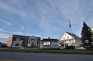
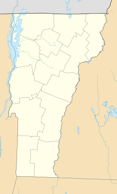
Barton is a small village located in Orleans County, Vermont, United States. It sits near the center of the larger town of Barton. In 2020, about 690 people lived in the village.
Contents
History of Barton Village
In the 1800s, Barton Village was a very important place for business in the county. Before it officially became a village, people called it "Barton Mills." Tourists from big cities like Boston and New York would travel here by train. They could stay in one of the village's three large hotels. Barton Village officially became a village on November 21, 1874.
Fires and Rebuilding in Barton
Fires have changed Barton Village many times over the years. A big fire in 1883 destroyed a building where the Pierce Building now stands. The village's hotels were also destroyed by fires in 1967 and 1971. The Pierce Block, built in 1885, is one of the few business buildings that survived many fires and is still used today.
To help fight fires, the village built a water system in 1889 using water from May Pond. This system replaced old water tanks with fire hydrants. In 1895, Barton Village also built a power plant on the Clyde River to make electricity.
Important Discoveries and Events
In 1907, during digging for the new Barton Academy, an old Native American burial ground was found. Sadly, there are no records of what happened to the items found there.
Also in 1907, a ballpark with 200 seats was built. A professional baseball team from Barton played there and won the state championship in 1908!
In 1927, heavy floods caused a lot of damage to the village. Another fire on August 11, 1938, destroyed three business areas. This fire made it hard for the village to bring back its industries.
Over the years, other fires destroyed important buildings like a butter tub factory, the Opera House (in 1929), a cheese factory (in 1954), and the local newspaper building (in 1968).
Modern Improvements in Barton
In the late 1970s, the village built a new water treatment plant. This stopped untreated wastewater from going into the Barton River. The plant cost a lot of money, but most of it was paid for by the state and federal governments.
Historic Places in Barton
Barton Village has three places listed on the National Register of Historic Places. These are special places recognized for their history:
- Crystal Lake Falls Historic District (added August 7, 1994)
- Crystal Lake State Park (added August 30, 2005)
- King Block at 117 High Street (added July 20, 2002)
Geography of Barton Village
Barton Village covers about 1.4 square miles (3.7 square kilometers). Most of this area is land, and a small part is water.
The village owns Pageant Park, which is located on Crystal Lake. This park was briefly closed in 2007 but reopened later that year.
Population of Barton Village
| Report looks at wells for Barton | ||
|---|---|---|
| Year | Pop. | ±% p.a. |
| 1880 | 742 | — |
| 1890 | 778 | +0.47% |
| 1900 | 1,050 | +3.04% |
| 1910 | 1,330 | +2.39% |
| 1920 | 1,187 | −1.13% |
| 1930 | 1,363 | +1.39% |
| 1940 | 1,262 | −0.77% |
| 1950 | 1,267 | +0.04% |
| 1960 | 1,169 | −0.80% |
| 1970 | 1,057 | −1.00% |
| 1980 | 1,062 | +0.05% |
| 1990 | 908 | −1.55% |
| 2000 | 742 | −2.00% |
| 2005 | 756 | +0.37% |
| 2010 | 737 | −0.51% |
| 2020 | 690 | −0.66% |
| Source:
|
||
Barton Village has seen its population decrease over time. Since 1930, the number of people living here has gone down by almost half. In 1930, it was the largest village in Orleans County, but now it is the second largest.
As of 2020, there were 690 people living in Barton Village. There were 311 households. The village has about 595 people per square mile (229 people per square kilometer).
Economy and Life in Barton
Fun Activities and Tourism
There is a golf course near Barton Village that a golfing magazine called one of the "30 best deals" in the country. It's an 18-hole course.
Utilities and Communication
Cellphone Service
In Barton Village, you can get cellphone service from Verizon and AT&T Mobility.
Electricity for Homes and Businesses
Barton Village owns its own electric company called Barton Electric. This company makes some of its own power using hydroelectricity (power from water). It provides electricity to the village and many surrounding areas, serving about 2,100 customers. Barton Electric owns two power-generating turbines on the Clyde River.
Culture and Community
Annual Sugar on Snow Party
Every year, on the fourth Saturday in July, Barton Village holds a "sugar on snow" party on the Village Green. This is a fun tradition where maple syrup is poured over snow to make a sweet treat!
Barton Public Library
Barton has a library that is open four days a week for a total of 19 hours. It is a non-profit organization, meaning it uses its money to help the community rather than make a profit. The library has about 18,000 books and many magazines. It has one paid librarian, and many helpful volunteers also work there.
See also
 In Spanish: Barton (condado de Orleans, Vermont) para niños
 | Aurelia Browder |
 | Nannie Helen Burroughs |
 | Michelle Alexander |


