Derby, Vermont facts for kids
Quick facts for kids
Derby, Vermont
|
|
|---|---|
|
Town
|
|
 |
|

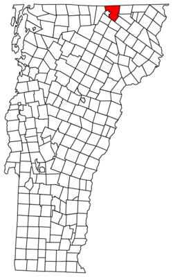
Located in Orleans County, Vermont
|
|

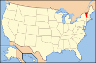
Location of Vermont with the U.S.A.
|
|
| Country | United States |
| State | Vermont |
| County | Orleans |
| Organized | October 29, 1779 |
| Communities |
|
| Area | |
| • Total | 57.6 sq mi (149.2 km2) |
| • Land | 49.6 sq mi (128.6 km2) |
| • Water | 8.0 sq mi (20.7 km2) |
| Elevation | 1,011 ft (307 m) |
| Population
(2020)
|
|
| • Total | 4,579 |
| • Density | 92/sq mi (35.6/km2) |
| • Households | 1,832 |
| • Families | 1,319 |
| Time zone | UTC-5 (EST) |
| • Summer (DST) | UTC-4 (EDT) |
| ZIP Codes | |
| Area code(s) | 802 |
| FIPS code | 50-17350 |
| GNIS feature ID | 1462081 |
Derby is a town in Orleans County, Vermont, United States. It's the most populated community in Orleans County, with 4,579 people counted in the 2020 census.
The town includes several small communities: Beebe Plain, Clyde Pond, Lake Salem, and North Derby. It also has two official villages: Derby Center and Derby Line.
Derby is the northernmost town along Interstate 91 and covers the largest area in Orleans County.
| Top - 0-9 A B C D E F G H I J K L M N O P Q R S T U V W X Y Z |
Exploring Derby's Location
Derby is located in the northern part of Orleans County. It shares a border with the Canadian Province of Quebec.
Derby's Size and Water Bodies
The town covers about 57.6 square miles (149.2 square kilometers) in total. Most of this is land (49.6 square miles or 128.5 square kilometers). The rest is water (8.0 square miles or 20.7 square kilometers).
Derby is bordered by several other towns. To the east, you'll find Holland. To the southeast are Morgan and Charleston. To the southwest, it borders Coventry and Brownington. To the west, it's next to Newport and Lake Memphremagog.
Inside Derby, you'll find Lake Salem. There's also Clyde Pond, which was created by building a dam on the Clyde River.
A Look Back at Derby's History
Derby was officially created on October 29, 1779. The state of Vermont gave the land to Timothy Andrus and 59 other people. It was named after the city of Derby, in England.
Key Moments in Derby's Past
During the War of 1812, a group of volunteers from Quebec destroyed a military building in Derby. Luckily, no one was hurt.
Before the Civil War, two important people from Derby, Portus Baxter and David Camp, helped people escape slavery. They were part of the Underground Railroad.
On October 31, 1866, a special monument was put up in Derby Center. This granite monument honors the soldiers from Derby who died in the Civil War. It lists the names of 53 men. This is the oldest community memorial for the Civil War in the United States.
In 1881, the nearby town of Salem joined Derby. This made Derby the largest town in Orleans County.
Like many towns in the area, Derby's population grew until 1890. After that, a period of economic difficulty in 1893 affected the local farms and businesses. The population went up and down for a while, reaching its lowest point in 1940. Since then, the town has been growing steadily.
In 1917, parts of Derby and the town of Newport combined to create the city of Newport.
An airport called Canadian Gateway Airport opened in Derby in 1928. It was the third airport built in Vermont. However, it closed in 1933 because a larger airport in Burlington was chosen as the main entry point from Canada.
A drive-in theater opened in Derby in 1950 and closed in 1985.
Derby's Population Over Time
Derby has seen its population change quite a bit over the years. Here's a quick look:
| Historical population | |||
|---|---|---|---|
| Census | Pop. | %± | |
| 1800 | 178 | — | |
| 1810 | 714 | 301.1% | |
| 1820 | 925 | 29.6% | |
| 1830 | 1,469 | 58.8% | |
| 1840 | 1,681 | 14.4% | |
| 1850 | 1,750 | 4.1% | |
| 1860 | 1,906 | 8.9% | |
| 1870 | 2,039 | 7.0% | |
| 1880 | 1,967 | −3.5% | |
| 1890 | 2,900 | 47.4% | |
| 1900 | 3,274 | 12.9% | |
| 1910 | 2,530 | −22.7% | |
| 1920 | 2,201 | −13.0% | |
| 1930 | 2,165 | −1.6% | |
| 1940 | 2,118 | −2.2% | |
| 1950 | 2,245 | 6.0% | |
| 1960 | 2,506 | 11.6% | |
| 1970 | 3,252 | 29.8% | |
| 1980 | 4,222 | 29.8% | |
| 1990 | 4,479 | 6.1% | |
| 2000 | 4,604 | 2.8% | |
| 2010 | 4,621 | 0.4% | |
| 2020 | 4,579 | −0.9% | |
| U.S. Decennial Census | |||
In 2000, there were 4,604 people living in Derby. The town had 1,832 households, and 1,319 of those were families.
The population was spread out in terms of age. About 27% of the people were under 18 years old. The median age was 39 years, meaning half the population was younger than 39 and half was older.
Derby's Economy and Development
Derby has a mix of businesses and services.
Local Businesses and Growth
New buildings and stores are expanding from the city of Newport onto the Newport-Derby Road (US Route 5). You can find large stores, restaurants, and other businesses along this road.
The main office for Community National Bank, which has 12 branches across Vermont, is located in Derby.
In 2004, a sports center called Indoor Recreation of Orleans County (IROC) was built. It had a sports arena, a swimming center, and a gym for sports like basketball and volleyball. However, it closed in 2013 and is now a hardware store called Sticks N Stuff.
Media in Derby
Derby has its own radio station.
Radio Station
- WMOO – 92.1 FM; located in Derby Center.
Famous People from Derby
Many notable individuals have connections to Derby, Vermont.
- Charles Kendall Adams: An educator and historian.
- Portus Baxter: A United States Representative who served in Congress.
- David M. Camp: Served as Lieutenant Governor of Vermont from 1836 to 1841.
- Enoch Chase: A state senator in Wisconsin.
- Horace Chase: A former mayor of Milwaukee, Wisconsin.
- Aaron H. Grout: Son of Josiah Grout and a former Vermont Secretary of State.
- Josiah Grout: The 46th governor of Vermont.
- Willie Johnston: A Medal of Honor recipient from the Civil War, known as the "Little Drummer Boy."
- Benjamin H. Steele: An Associate Justice of the Vermont Supreme Court.
- William Tyler: The first Catholic bishop of the Diocese of Hartford.
Getting Around Derby
Derby has the most miles of roads of any town or city in Orleans County, totaling about 103 miles. Many of these are dirt roads.
Major Roads and Public Transport
Both Interstate 91 and U.S. Route 5 end in Derby. These two major roads run side-by-side for their entire length. Interstate 91 has its last three exits in Derby. Several Vermont state routes, including Vermont Route 105, Vermont Route 111, and Vermont Route 191, also pass through the town.
Rural Community Transportation offers bus services in Derby. During the week, there are four buses traveling north and south from west Newport city to Derby Center. On Saturdays, there are two buses in each direction. There is no cost to ride these buses. They also offer special services for people with disabilities and older adults if requested.
Important Buildings in Derby
One of the most famous buildings in Derby is unique.
- Haskell Free Library and Opera House: This special building sits right on the border between the United States and Canada. You can walk into the library in the U.S. and then step into the opera house in Canada!
See also
 In Spanish: Derby (Vermont) para niños
 | William M. Jackson |
 | Juan E. Gilbert |
 | Neil deGrasse Tyson |

